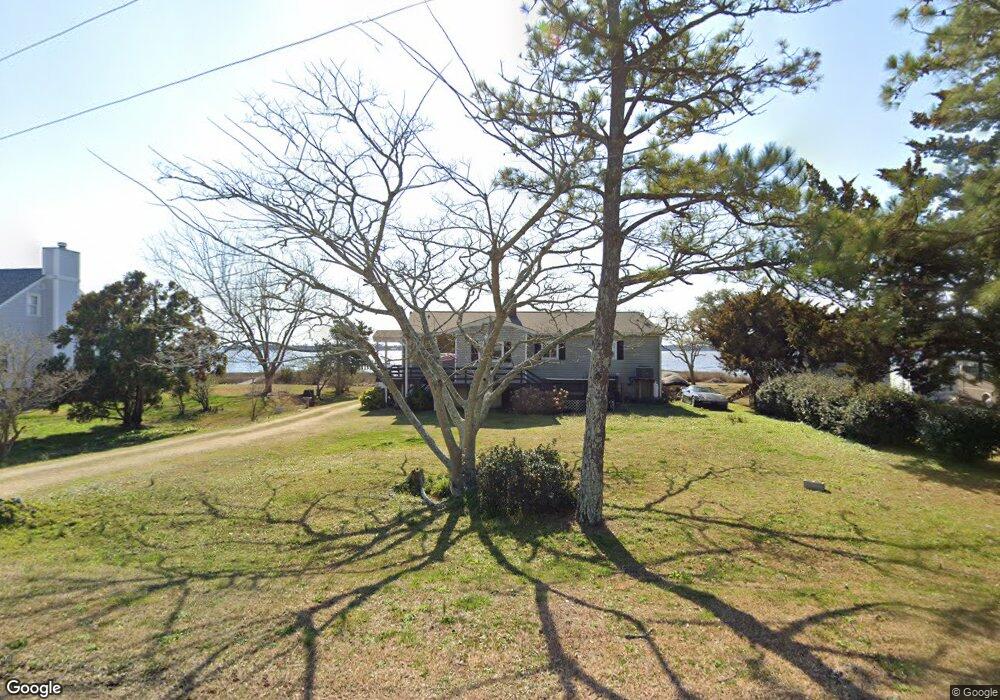
238 Shore Rd Newport, NC 28570
Estimated Value: $415,000 - $717,000
3
Beds
2
Baths
1,485
Sq Ft
$345/Sq Ft
Est. Value
About This Home
This home is located at 238 Shore Rd, Newport, NC 28570 and is currently estimated at $511,939, approximately $344 per square foot. 238 Shore Rd is a home located in Carteret County with nearby schools including Newport Elementary School, Newport Middle School, and West Carteret High School.
Ownership History
Date
Name
Owned For
Owner Type
Purchase Details
Closed on
Jul 5, 2011
Sold by
The Bank Of New York Mellon
Bought by
Lewis Carl and Lewis Margaret
Current Estimated Value
Purchase Details
Closed on
Oct 26, 2010
Sold by
Daniels Stephen F and Frost Miraluna
Bought by
The Bank Of New York Mellon and The Bank Of New York
Purchase Details
Closed on
Dec 19, 2003
Purchase Details
Closed on
Dec 20, 2000
Create a Home Valuation Report for This Property
The Home Valuation Report is an in-depth analysis detailing your home's value as well as a comparison with similar homes in the area
Home Values in the Area
Average Home Value in this Area
Purchase History
| Date | Buyer | Sale Price | Title Company |
|---|---|---|---|
| Lewis Carl | $120,000 | None Available | |
| The Bank Of New York Mellon | $235,000 | None Available | |
| -- | $193,000 | -- | |
| -- | $135,000 | -- |
Source: Public Records
Tax History Compared to Growth
Tax History
| Year | Tax Paid | Tax Assessment Tax Assessment Total Assessment is a certain percentage of the fair market value that is determined by local assessors to be the total taxable value of land and additions on the property. | Land | Improvement |
|---|---|---|---|---|
| 2025 | $2,209 | $541,353 | $178,401 | $362,952 |
| 2024 | $1,452 | $268,168 | $90,545 | $177,623 |
| 2023 | $1,526 | $268,168 | $90,545 | $177,623 |
| 2022 | $1,499 | $268,168 | $90,545 | $177,623 |
| 2021 | $1,419 | $268,168 | $90,545 | $177,623 |
| 2020 | $1,574 | $268,168 | $90,545 | $177,623 |
| 2019 | $1,323 | $228,655 | $57,633 | $171,022 |
| 2017 | $1,255 | $228,655 | $57,633 | $171,022 |
| 2016 | $1,220 | $228,655 | $57,633 | $171,022 |
| 2015 | $1,198 | $228,655 | $57,633 | $171,022 |
| 2014 | $1,159 | $219,899 | $73,881 | $146,018 |
Source: Public Records
Map
Nearby Homes
- 209 Shore Rd
- 295 Old Winberry Rd
- 2944 Mill Creek Rd
- 3032 Mill Creek Rd
- 3115 Mill Creek Rd
- 2312 Crab Point Loop Rd
- 1726 River Dr
- 212 Settlement Ln
- 1603 Sanderling Dr
- 1512 Scotts
- 303 Mayflower Dr
- 1630 N 20th St
- 1812 Widgeon Dr
- 1209 Woods Ct
- 1801 Clubhouse Dr
- 3302 Hogan Ct Unit A
- 1206 Strange Ct
- 3303 Hogan Ct Unit B
- 1805 Ivory Gull Dr
- 3208 Country Club Rd
- 228 Shore Rd
- 248 Shore Rd
- 235 Shore Rd
- 241 Shore Rd
- 210 Shore Rd
- 261 Shore Rd
- 213 Shore Rd
- 133 Mc Seafood Ln
- 189 Shore Rd
- 138 Joans Haven
- 140 Joan's Haven Dr
- 140 Joans Haven
- 134 Joan's Haven Dr
- 134 Joans Haven
- 109 Mc Seafood Ln
- 117 Mc Seafood Ln
- 130 Joan's Haven Dr
- 130 Joans Haven
- 190 Hammocks Landing Rd
- 132 Mc Seafood Ln