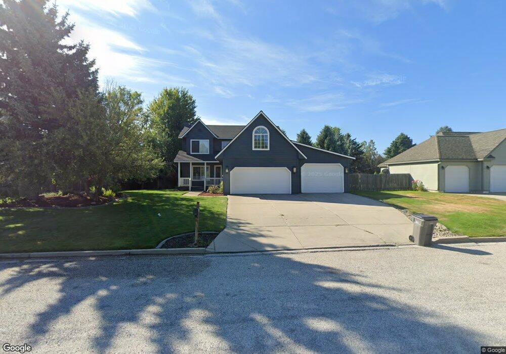
238 Upper Humbird Dr Sandpoint, ID 83864
Estimated Value: $694,000 - $727,000
About This Home
This home is located at 238 Upper Humbird Dr, Sandpoint, ID 83864 and is currently estimated at $707,226, approximately $305 per square foot. 238 Upper Humbird Dr is a home with nearby schools including Kootenai Elementary School, Sandpoint Middle School, and Sandpoint High School.
Ownership History
We collect this data history from publicly available records. To have your information removed, we recommend requesting removal directly through your county’s website.
Purchase Details
Purchase Details
Home Financials for this Owner
Home Financials are based on the most recent Mortgage that was taken out on this home.Home Values in the Area
Average Home Value in this Area
Purchase History
We collect this data history from publicly available records. To have your information removed, we recommend requesting removal directly through your county’s website.
| Date | Buyer | Sale Price | Title Company |
|---|---|---|---|
| -- | None Listed On Document | ||
| -- | Sandpoint Title Insurance |
Mortgage History
We collect this data history from publicly available records. To have your information removed, we recommend requesting removal directly through your county’s website.
| Date | Status | Borrower | Loan Amount |
|---|---|---|---|
| Previous Owner | $353,400 |
Tax History
We collect this data history from publicly available records. To have your information removed, we recommend requesting removal directly through your county’s website.
| Year | Tax Paid | Tax Assessment Tax Assessment Total Assessment is a certain percentage of the fair market value that is determined by local assessors to be the total taxable value of land and additions on the property. | Land | Improvement |
|---|---|---|---|---|
| 2025 | $1,989 | $668,466 | $254,176 | $414,290 |
| 2024 | $2,415 | $622,621 | $211,141 | $411,480 |
| 2023 | $1,996 | $687,770 | $211,141 | $476,629 |
| 2022 | $2,225 | $602,150 | $204,268 | $397,882 |
| 2021 | $1,877 | $392,539 | $108,634 | $283,905 |
| 2020 | $2,148 | $390,695 | $99,940 | $290,755 |
| 2019 | $2,459 | $354,982 | $85,450 | $269,532 |
| 2018 | $2,318 | $320,065 | $76,000 | $244,065 |
| 2017 | $2,318 | $288,230 | $0 | $0 |
| 2016 | $2,416 | $292,720 | $0 | $0 |
| 2015 | -- | $292,720 | $0 | $0 |
| 2014 | -- | $300,690 | $0 | $0 |
Map
- 128 Spur Dr
- 0 Idaho 200
- 32056 Idaho 200
- 540 Ponder Point Dr
- 101 Sprague St
- 311 N Main St
- 61 Whiskey Jack Rd
- 95 Whiskey Jack Rd
- 87 Rock Rd
- 127 Backtrack
- 140 Backtrack Rd
- 147 Backtrack Rd
- 105 Backtrack
- 113 Crooked Ear Dr
- 159 Backtrack
- 200 Brittany Loop
- 126 Backtrack Rd
- 171 Backtrack Rd
- 1 Crooked Ear Dr
- 185 Backtrack Rd
- 252 Upper Humbird Dr
- 0 Upper Humbird Dr
- 1345 Upper Humbird Dr
- 245 Upper Humbird Dr
- 31 Spur Dr
- 271 Upper Humbird Dr
- 49 Spur Dr
- 38 Roundhouse Dr
- 294 Upper Humbird Dr
- 329 Up Humbird Dr
- 233 Upper Humbird Dr
- NNA Upper Humbird Dr
- Lot 10 Upper Humbird Dr
- Lot 8 Upper Humbird Dr
- Lot 7 Upper Humbird Dr
- 21 Spur Dr
- 281 Upper Humbird Dr
- 67 Spur Dr
- 16 Roundhouse Dr
- 205 Upper Humbird Dr
Ask me questions while you tour the home.