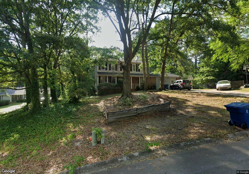
2382 Shadowood Dr SW Conyers, GA 30094
Estimated Value: $267,000 - $307,000
3
Beds
3
Baths
2,160
Sq Ft
$132/Sq Ft
Est. Value
About This Home
This home is located at 2382 Shadowood Dr SW, Conyers, GA 30094 and is currently estimated at $284,681, approximately $131 per square foot. 2382 Shadowood Dr SW is a home located in Rockdale County with nearby schools including Shoal Creek Elementary School, Edwards Middle School, and Heritage High School.
Ownership History
Date
Name
Owned For
Owner Type
Purchase Details
Closed on
Jul 11, 2006
Sold by
Williams Kenneth
Bought by
Williams Kenneth and Williams Rochelle J
Current Estimated Value
Home Financials for this Owner
Home Financials are based on the most recent Mortgage that was taken out on this home.
Original Mortgage
$115,976
Interest Rate
7.75%
Mortgage Type
New Conventional
Purchase Details
Closed on
May 15, 2003
Sold by
Herrington Al and Herrington Joan
Bought by
Friendship Ciu
Purchase Details
Closed on
Aug 31, 1995
Sold by
Mclain Kenneth Robin
Bought by
Herrington Al Joan
Purchase Details
Closed on
May 5, 1994
Sold by
Currie Ralph
Bought by
Mclain Kenneth Robin
Create a Home Valuation Report for This Property
The Home Valuation Report is an in-depth analysis detailing your home's value as well as a comparison with similar homes in the area
Home Values in the Area
Average Home Value in this Area
Purchase History
| Date | Buyer | Sale Price | Title Company |
|---|---|---|---|
| Williams Kenneth | -- | -- | |
| Williams Kenneth | $154,700 | -- | |
| Friendship Ciu | -- | -- | |
| Herrington Al Joan | $92,000 | -- | |
| Mclain Kenneth Robin | $90,000 | -- |
Source: Public Records
Mortgage History
| Date | Status | Borrower | Loan Amount |
|---|---|---|---|
| Previous Owner | Williams Kenneth | $115,976 | |
| Previous Owner | Williams Kenneth | $38,658 | |
| Closed | Mclain Kenneth Robin | -- | |
| Closed | Herrington Al Joan | $0 |
Source: Public Records
Tax History Compared to Growth
Tax History
| Year | Tax Paid | Tax Assessment Tax Assessment Total Assessment is a certain percentage of the fair market value that is determined by local assessors to be the total taxable value of land and additions on the property. | Land | Improvement |
|---|---|---|---|---|
| 2024 | $2,288 | $96,800 | $20,040 | $76,760 |
| 2023 | $2,154 | $94,480 | $22,400 | $72,080 |
| 2022 | $1,566 | $71,560 | $15,360 | $56,200 |
| 2021 | $1,294 | $58,000 | $11,120 | $46,880 |
| 2020 | $1,131 | $52,680 | $11,120 | $41,560 |
| 2019 | $1,032 | $48,560 | $7,000 | $41,560 |
| 2018 | $986 | $46,840 | $7,000 | $39,840 |
| 2017 | $788 | $40,120 | $7,000 | $33,120 |
| 2016 | $727 | $40,120 | $7,000 | $33,120 |
| 2015 | $583 | $35,080 | $5,520 | $29,560 |
| 2014 | $384 | $29,640 | $4,520 | $25,120 |
| 2013 | -- | $41,760 | $9,200 | $32,560 |
Source: Public Records
Map
Nearby Homes
- 2477 Laurel Ridge Place SW
- 2289 Amberbrook Dr SW
- 2505 Laurel Ridge Place SW
- 1993 Old Smyrna Rd SW
- 2055 Smyrna Rd SW
- 2956 Loch Lomond Dr
- 1509 Shoal Creek Dr SW
- 2856 Flat Shoals Rd SW
- 2150 Smyrna Ridge Ct SW
- 2318 Hedgeview Rd
- 1700 Carissa Dr
- 2900 Waterford Dr SW
- 3009 Inverness Ct
- 2989 Waterford Dr SW
- 3055 SW Reserve Ct
- 3059 SW Reserve Ct
- 0 Granade Rd SW Unit 10430605
- 0 Granade Rd SW Unit 10430608
- 0 Granade Rd SW Unit 23687414
- 2380 Shadowood Dr SW
- 2400 Amberbrook Dr SW
- 2414 Amberbrook Dr SW
- 2378 Shadowood Dr SW
- 2381 Shadowood Dr SW
- 2376 Shadowood Dr SW
- 2386 Shadowood Dr SW
- 2385 Shadowood Dr SW
- 2380 Amberbrookdr
- 2380 Amberbrook Dr SW
- 2357 Shadowood Dr SW
- 2370 Shadowood Dr SW
- 2430 Amberbrook Dr SW
- 2430 Amberbrook Dr SW
- 2430 Amberbrook Dr SW Unit Acres
- 2411 Amberbrook Dr SW
- 2397 Amberbrook Dr SW
- 2370 Amberbrook Dr SW
- 2334 Cedar Mill Dr SW
- 2338 Cedar Mill Dr SW