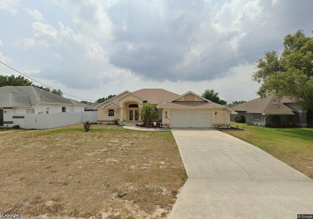
2383 Holston Ave Spring Hill, FL 34608
Estimated Value: $309,000 - $329,829
3
Beds
2
Baths
1,729
Sq Ft
$186/Sq Ft
Est. Value
About This Home
This home is located at 2383 Holston Ave, Spring Hill, FL 34608 and is currently estimated at $321,957, approximately $186 per square foot. 2383 Holston Ave is a home located in Hernando County with nearby schools including Explorer K-8, Frank W. Springstead High School, and Gulf Coast Elementary School.
Ownership History
Date
Name
Owned For
Owner Type
Purchase Details
Closed on
Mar 29, 2007
Sold by
Lennon Gregory F
Bought by
Urban Adam and Urban Rose
Current Estimated Value
Home Financials for this Owner
Home Financials are based on the most recent Mortgage that was taken out on this home.
Original Mortgage
$160,000
Outstanding Balance
$95,029
Interest Rate
6.1%
Mortgage Type
Purchase Money Mortgage
Estimated Equity
$226,928
Purchase Details
Closed on
Jul 27, 2005
Sold by
Lennon Gregory F
Bought by
Lennon Gregory F and Lennon Lorraine
Purchase Details
Closed on
Jan 10, 1996
Sold by
Gapske David L and Gapske Eliza J
Bought by
Lennon Gregory F
Create a Home Valuation Report for This Property
The Home Valuation Report is an in-depth analysis detailing your home's value as well as a comparison with similar homes in the area
Home Values in the Area
Average Home Value in this Area
Purchase History
| Date | Buyer | Sale Price | Title Company |
|---|---|---|---|
| Urban Adam | $210,000 | Alamo Title Company | |
| Lennon Gregory F | $34,500 | -- | |
| Lennon Gregory F | $12,500 | -- |
Source: Public Records
Mortgage History
| Date | Status | Borrower | Loan Amount |
|---|---|---|---|
| Open | Urban Adam | $160,000 |
Source: Public Records
Tax History
| Year | Tax Paid | Tax Assessment Tax Assessment Total Assessment is a certain percentage of the fair market value that is determined by local assessors to be the total taxable value of land and additions on the property. | Land | Improvement |
|---|---|---|---|---|
| 2025 | $1,813 | $117,961 | -- | -- |
| 2024 | $1,714 | $114,637 | -- | -- |
| 2023 | $1,714 | $111,298 | $0 | $0 |
| 2022 | $1,621 | $108,056 | $0 | $0 |
| 2021 | $1,071 | $104,909 | $0 | $0 |
| 2020 | $1,498 | $103,461 | $0 | $0 |
| 2019 | $1,491 | $101,135 | $0 | $0 |
| 2018 | $915 | $99,249 | $0 | $0 |
| 2017 | $1,187 | $97,208 | $0 | $0 |
| 2016 | $1,146 | $95,209 | $0 | $0 |
| 2015 | $1,151 | $94,547 | $0 | $0 |
| 2014 | $1,112 | $93,797 | $0 | $0 |
Source: Public Records
Map
Nearby Homes
- 10244 Hoover St
- 12018 Linden Dr
- 2419 Appian Ave
- 10177 Deer St
- 2321 Evangelina Ave
- 2293 Marietta Ave
- 0 Linden Dr Unit MFRTB8413730
- 10331 Dunkirk Rd
- 10364 Bedford Rd
- 2469 Anchor Ave
- 2462 Stephanie Dr
- 10440 Laval St
- 00 Bedford Rd
- 10563 Marysville St
- 10415 Laval St
- 2359 Gimlet Ave
- 2367 Gimlet Ave
- 2163 Linwood Ave
- 2463 Stephanie Dr
- Lot 16 Bedford Rd
- 2391 Holston Ave
- 2375 Holston Ave
- 2332 Sparkleberry Ct
- 2399 Holston Ave
- 2367 Holston Ave
- 2407 Holston Ave
- 0 Holston Ave
- 2384 Holston Ave
- 2326 Sparkleberry Ct
- 2338 Sparkleberry Ct
- 2359 Holston Ave
- 2368 Holston Ave
- 2400 Holston Ave
- 10269 Hoover St
- 2408 Holston Ave
- 2360 Holston Ave
- 12075 Linden Dr
- 2320 Sparkleberry Ct
- 12091 Linden Dr
- 12059 Linden Dr
Your Personal Tour Guide
Ask me questions while you tour the home.