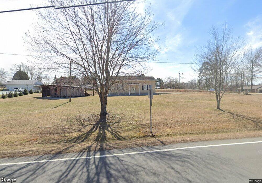
2383 Leasburg Rd Roxboro, NC 27574
Estimated Value: $256,000 - $322,000
3
Beds
2
Baths
1,709
Sq Ft
$169/Sq Ft
Est. Value
About This Home
This home is located at 2383 Leasburg Rd, Roxboro, NC 27574 and is currently estimated at $289,141, approximately $169 per square foot. 2383 Leasburg Rd is a home located in Person County with nearby schools including Person High School, Roxboro Community School, and Roxboro Christian Academy.
Ownership History
Date
Name
Owned For
Owner Type
Purchase Details
Closed on
Jan 20, 2021
Sold by
Westbrooks Jackie M and Westbrooks Alvin G
Bought by
Crumpton Rodney B
Current Estimated Value
Purchase Details
Closed on
Feb 12, 2014
Sold by
Jordan Yvonne Gail
Bought by
Crumpton Rodney B
Home Financials for this Owner
Home Financials are based on the most recent Mortgage that was taken out on this home.
Original Mortgage
$129,081
Interest Rate
4.56%
Mortgage Type
New Conventional
Create a Home Valuation Report for This Property
The Home Valuation Report is an in-depth analysis detailing your home's value as well as a comparison with similar homes in the area
Home Values in the Area
Average Home Value in this Area
Purchase History
| Date | Buyer | Sale Price | Title Company |
|---|---|---|---|
| Crumpton Rodney B | $1,000 | None Available | |
| Crumpton Rodney B | $1,000 | King Wells P | |
| Crumpton Rodney B | $126,500 | None Available |
Source: Public Records
Mortgage History
| Date | Status | Borrower | Loan Amount |
|---|---|---|---|
| Previous Owner | Crumpton Rodney B | $129,081 |
Source: Public Records
Tax History Compared to Growth
Tax History
| Year | Tax Paid | Tax Assessment Tax Assessment Total Assessment is a certain percentage of the fair market value that is determined by local assessors to be the total taxable value of land and additions on the property. | Land | Improvement |
|---|---|---|---|---|
| 2025 | $1,735 | $258,062 | $0 | $0 |
| 2024 | $1,389 | $178,985 | $0 | $0 |
| 2023 | $1,389 | $178,985 | $0 | $0 |
| 2022 | $1,384 | $178,985 | $0 | $0 |
| 2021 | $1,120 | $149,091 | $0 | $0 |
| 2020 | $948 | $125,996 | $0 | $0 |
| 2019 | $960 | $125,996 | $0 | $0 |
| 2018 | $901 | $125,996 | $0 | $0 |
| 2017 | $888 | $125,996 | $0 | $0 |
| 2016 | $888 | $125,996 | $0 | $0 |
| 2015 | $888 | $125,996 | $0 | $0 |
| 2014 | $810 | $114,844 | $0 | $0 |
Source: Public Records
Map
Nearby Homes
- 7710 Leasburg Rd
- 131 Rosewood Dr
- 41 Lakewood Dr
- 814 Frank St
- 140 Smith Hill Ln
- 2 Semora Rd
- 811 Jones Lester Rd
- 167.10 Leasburg Rd
- 305 Lochridge Dr
- 102 Scotland Place
- 421 S Morgan St
- 305 W Barden St
- 204 Kiser Hicks Rd
- 135 Hill St
- 209 Reade Dr
- 133 Hill St
- 240 Crestwood Dr
- 531 Booth St
- 156 Southern Middle School Rd
- 50 Southern Village Dr
- 2477 Leasburg Rd
- 46 Dee Long Rd
- 66 Dee Long Rd
- 2333 Leasburg Rd
- 84 Dee Long Rd
- 102 Dee Long Rd
- 88 Robert Norris Rd
- 130 Dee Long Rd
- 2241 Leasburg Rd
- 2543 Leasburg Rd
- 187 Dee Long Rd
- 121 Robert Norris Rd
- 155 Robert Norris Rd
- 2174 Leasburg Rd
- 2597 Leasburg Rd
- 201 Robert Norris Rd
- 246 Dee Long Rd
- 282 Dee Long Rd
- 2087 Leasburg Rd
- 2686 Leasburg Rd