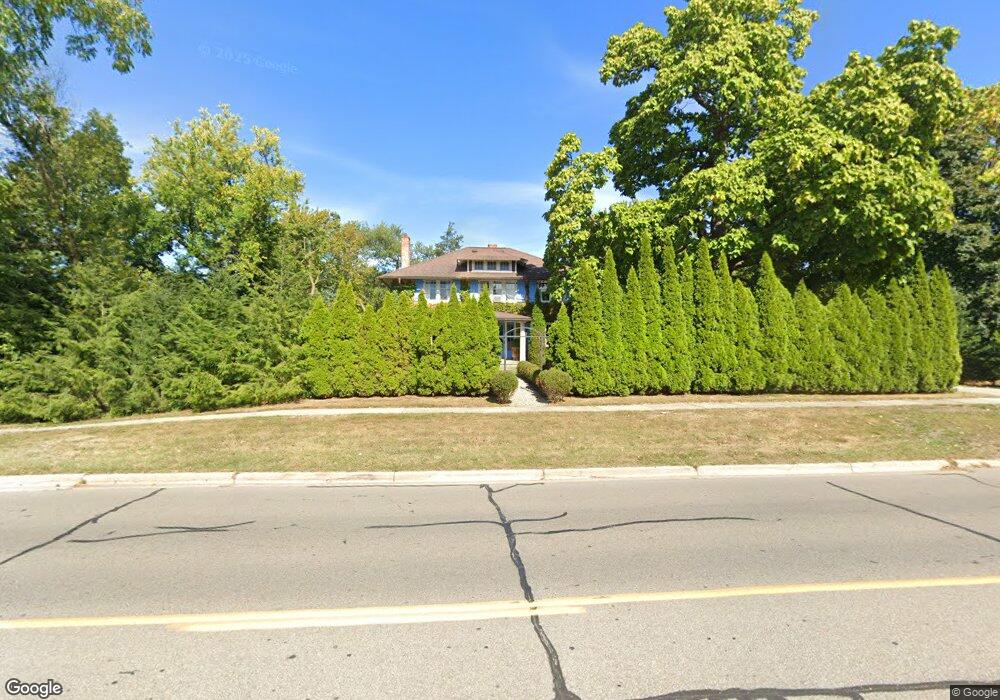
2384 W Maple Rd Bloomfield Hills, MI 48301
Estimated Value: $595,460 - $811,000
4
Beds
2
Baths
2,146
Sq Ft
$333/Sq Ft
Est. Value
About This Home
This home is located at 2384 W Maple Rd, Bloomfield Hills, MI 48301 and is currently estimated at $714,615, approximately $332 per square foot. 2384 W Maple Rd is a home located in Oakland County with nearby schools including Quarton Elementary, Derby Middle School, and Ernest W. Seaholm High School.
Ownership History
Date
Name
Owned For
Owner Type
Purchase Details
Closed on
Oct 28, 2016
Sold by
Ayoub Patrick R and Ayoub Amy J
Bought by
Ayoub Patrick and Ayoub Amy
Current Estimated Value
Purchase Details
Closed on
Nov 23, 2010
Sold by
Ayoub Patrick R
Bought by
Ayoub Patrick R and Ayoub Amy J
Purchase Details
Closed on
Jan 19, 2001
Sold by
Southern Gary C
Bought by
Ayoub Patrick R
Home Financials for this Owner
Home Financials are based on the most recent Mortgage that was taken out on this home.
Original Mortgage
$274,000
Outstanding Balance
$96,470
Interest Rate
6.91%
Estimated Equity
$618,145
Create a Home Valuation Report for This Property
The Home Valuation Report is an in-depth analysis detailing your home's value as well as a comparison with similar homes in the area
Home Values in the Area
Average Home Value in this Area
Purchase History
| Date | Buyer | Sale Price | Title Company |
|---|---|---|---|
| Ayoub Patrick | -- | None Available | |
| Ayoub Patrick R | -- | None Available | |
| Ayoub Patrick R | $345,000 | -- |
Source: Public Records
Mortgage History
| Date | Status | Borrower | Loan Amount |
|---|---|---|---|
| Open | Ayoub Patrick R | $274,000 |
Source: Public Records
Tax History Compared to Growth
Tax History
| Year | Tax Paid | Tax Assessment Tax Assessment Total Assessment is a certain percentage of the fair market value that is determined by local assessors to be the total taxable value of land and additions on the property. | Land | Improvement |
|---|---|---|---|---|
| 2024 | $4,003 | $231,840 | $0 | $0 |
| 2023 | $3,841 | $209,270 | $0 | $0 |
| 2022 | $6,773 | $201,010 | $0 | $0 |
| 2021 | $6,829 | $202,890 | $0 | $0 |
| 2020 | $3,690 | $199,280 | $0 | $0 |
| 2019 | $6,809 | $196,620 | $0 | $0 |
| 2018 | $6,736 | $197,220 | $0 | $0 |
| 2017 | $6,737 | $194,210 | $0 | $0 |
| 2016 | $6,775 | $191,070 | $0 | $0 |
| 2015 | -- | $186,500 | $0 | $0 |
| 2014 | -- | $162,610 | $0 | $0 |
| 2011 | -- | $142,470 | $0 | $0 |
Source: Public Records
Map
Nearby Homes
- 120 Westchester Way
- 397 S Cranbrook Rd
- 394 S Glenhurst Dr
- 345 Kimberly St
- 1834 Fairview St
- 2579 Amberly Rd
- 1882 Melbourne St
- 695 Westchester Way
- 520 Pleasant St
- 1019 N Cranbrook Rd
- 586 Fairfax St
- 956 Westwood Dr
- 222 Arlington St
- 2802 Heathfield Rd
- 100 Overhill Rd
- 786 S Cranbrook Rd
- 2721 Heathfield Rd
- 1120 Lyonhurst St
- 999 Pleasant Ave
- 2330 Fairway Dr
- 2400 Bradway Blvd
- 2412 Bradway Blvd
- 2300 W Maple Rd
- 2375 Tilbury Place
- 2363 Tilbury Place
- 2368 Radnor St
- 2347 W Maple Rd
- 2325 W Maple Rd
- 2327 Tilbury Place
- 2299 W Maple Rd
- 283 Tilbury Rd
- 2425 Bradway Blvd
- 2311 Tilbury Place
- 2250 W Maple Rd
- 237 Tilbury Rd
- 2338 Radnor St
- 2283 W Maple Rd
- 185 Tilbury Rd
- 2300 Avon Ln
- 2261 W Maple Rd