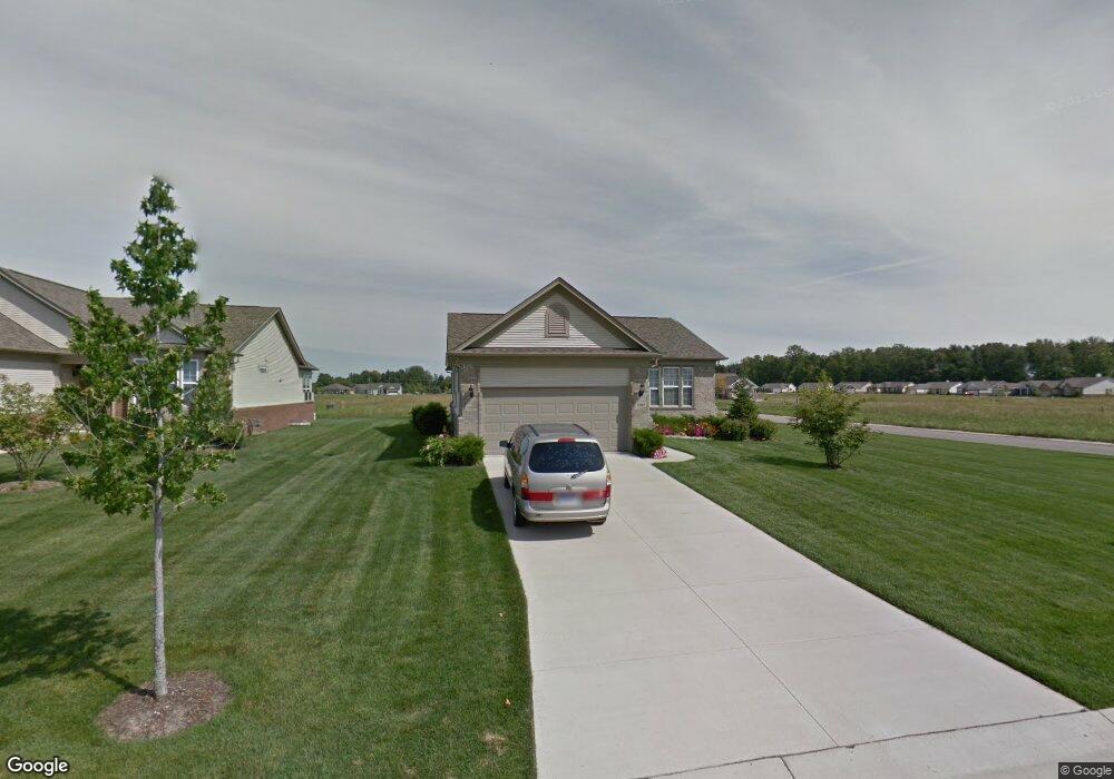
23857 Manistee Ln Unit 254 Flat Rock, MI 48134
Estimated Value: $371,801 - $403,000
2
Beds
2
Baths
1,695
Sq Ft
$227/Sq Ft
Est. Value
About This Home
This home is located at 23857 Manistee Ln Unit 254, Flat Rock, MI 48134 and is currently estimated at $384,450, approximately $226 per square foot. 23857 Manistee Ln Unit 254 is a home located in Wayne County with nearby schools including Wegienka Elementary School, Brownstown Middle School, and Patrick Henry Middle School.
Ownership History
Date
Name
Owned For
Owner Type
Purchase Details
Closed on
Jun 19, 2020
Sold by
Peterson Lyndon L and Peterson Belva J
Bought by
Peterson Lyndon L and Peterson Belva J
Current Estimated Value
Purchase Details
Closed on
Dec 19, 2007
Sold by
Pulte Land Co Llc
Bought by
Peterson Lyndon L
Create a Home Valuation Report for This Property
The Home Valuation Report is an in-depth analysis detailing your home's value as well as a comparison with similar homes in the area
Home Values in the Area
Average Home Value in this Area
Purchase History
| Date | Buyer | Sale Price | Title Company |
|---|---|---|---|
| Peterson Lyndon L | -- | None Available | |
| Peterson Lyndon L | $85,625 | Fidelity National Title |
Source: Public Records
Tax History Compared to Growth
Tax History
| Year | Tax Paid | Tax Assessment Tax Assessment Total Assessment is a certain percentage of the fair market value that is determined by local assessors to be the total taxable value of land and additions on the property. | Land | Improvement |
|---|---|---|---|---|
| 2025 | $3,617 | $183,100 | $0 | $0 |
| 2024 | $3,617 | $184,600 | $0 | $0 |
| 2023 | $3,450 | $163,500 | $0 | $0 |
| 2022 | $6,140 | $144,700 | $0 | $0 |
| 2021 | $5,694 | $139,500 | $0 | $0 |
| 2020 | $5,607 | $126,700 | $0 | $0 |
| 2019 | $5,567 | $128,000 | $0 | $0 |
| 2018 | $3,016 | $117,000 | $0 | $0 |
| 2017 | $4,916 | $151,700 | $0 | $0 |
| 2016 | $5,375 | $112,600 | $0 | $0 |
| 2015 | $11,928 | $120,000 | $0 | $0 |
| 2013 | $11,740 | $122,000 | $0 | $0 |
| 2012 | -- | $116,800 | $42,800 | $74,000 |
Source: Public Records
Map
Nearby Homes
- 26530 Higgins Way
- 27142 Newberry Blvd
- 00 West Rd
- 27176 Walloon Way
- 27900 Paradise Ln Unit 1
- 24576 Arsenal Rd
- 24338 Walloon Way
- Oakmont Plan at Timber Creek
- Birch Plan at Timber Creek
- Hickory Plan at Timber Creek
- Pineridge II Plan at Timber Creek
- Edgewood Plan at Timber Creek
- Arlington Plan at Timber Creek
- Oakcrest Plan at Timber Creek
- 24611 Rock Lake Ct
- 27520 West Rd
- 25860 Brighton Ln
- 22213 Inkster Rd
- 27299 Jessica Ln
- 27236 Ritter Blvd
- 23849 Manistee Ln Unit 253
- 23831 Manistee Ln Unit 252
- 26391 Higgins Way Unit 251
- 23865 Manistee Ln
- 23830 Montague Dr
- 26421 Higgins Way Unit 377
- 26428 St Clair Dr Unit 354
- 23881 Manistee Ln
- 23860 Manistee Ln Unit 330
- 26427 Higgins Way Unit 376
- 23836 Montague Dr
- 26436 St Clair Dr Unit 355
- 23882 Manistee Ln
- 26435 Higgins Way Unit Bldg-Unit
- 26435 Higgins Way
- 23842 Montague Dr
- 23829 Montague Dr Unit 277
- 23861 St Clair Dr
- 26340 Higgins Way
- 26442 St Clair Dr Unit 356