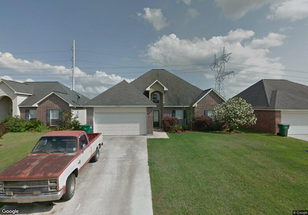
23862 Southpoint Dr Denham Springs, LA 70726
Estimated Value: $228,000 - $240,000
3
Beds
2
Baths
1,908
Sq Ft
$123/Sq Ft
Est. Value
About This Home
This home is located at 23862 Southpoint Dr, Denham Springs, LA 70726 and is currently estimated at $234,052, approximately $122 per square foot. 23862 Southpoint Dr is a home located in Livingston Parish with nearby schools including Seventh Ward Elementary School, Juban Parc Junior High School, and Denham Springs Freshman High School.
Ownership History
Date
Name
Owned For
Owner Type
Purchase Details
Closed on
Apr 15, 2005
Sold by
Pcc Home Builders Inc
Bought by
Phillips Gloria Ann
Current Estimated Value
Home Financials for this Owner
Home Financials are based on the most recent Mortgage that was taken out on this home.
Original Mortgage
$129,800
Outstanding Balance
$67,633
Interest Rate
5.93%
Mortgage Type
New Conventional
Estimated Equity
$166,419
Create a Home Valuation Report for This Property
The Home Valuation Report is an in-depth analysis detailing your home's value as well as a comparison with similar homes in the area
Home Values in the Area
Average Home Value in this Area
Purchase History
| Date | Buyer | Sale Price | Title Company |
|---|---|---|---|
| Phillips Gloria Ann | $129,800 | Provident Title Company Inc |
Source: Public Records
Mortgage History
| Date | Status | Borrower | Loan Amount |
|---|---|---|---|
| Open | Phillips Gloria Ann | $129,800 |
Source: Public Records
Tax History Compared to Growth
Tax History
| Year | Tax Paid | Tax Assessment Tax Assessment Total Assessment is a certain percentage of the fair market value that is determined by local assessors to be the total taxable value of land and additions on the property. | Land | Improvement |
|---|---|---|---|---|
| 2024 | $2,122 | $20,737 | $1,890 | $18,847 |
| 2023 | $1,688 | $14,940 | $1,890 | $13,050 |
| 2022 | $1,700 | $14,940 | $1,890 | $13,050 |
| 2021 | $1,482 | $14,940 | $1,890 | $13,050 |
| 2020 | $1,473 | $14,940 | $1,890 | $13,050 |
| 2019 | $1,596 | $15,820 | $1,890 | $13,930 |
| 2018 | $1,620 | $15,820 | $1,890 | $13,930 |
| 2017 | $1,612 | $15,820 | $1,890 | $13,930 |
| 2015 | $762 | $14,860 | $1,890 | $12,970 |
| 2014 | $774 | $14,860 | $1,890 | $12,970 |
Source: Public Records
Map
Nearby Homes
- 23937 S Park Ln
- 11277 Westwood Ave
- 23581 Wellington Ave
- 23529 Country Manor Ave
- 23532 Wellington Ave
- 23938 Teakwood Dr
- 23679 Sweetbriar Ct
- TBD Woodlore Ave Unit Tracts B & D
- 11656 Brown Rd
- 23904 Springhill Dr
- 23644 Southpoint Dr
- 23621 S Point Dr
- 23597 S Point Dr
- 25699 Tarver St
- 25716 Tarver St
- 25705 Tarver St
- 25669 Tarver St
- 24210 Steller's Sea Dr
- 24184 Sharp Shinned Dr
- 12624 Bald Eagle Dr
- 23856 Southpoint Dr
- 23856 S Point Dr
- 23868 Southpoint Dr
- 23868 Southpoint Dr
- 23874 S Point Dr
- 23874 Southpoint Dr
- 23852 Southpoint Dr
- 23861 Southpoint Dr
- 23880 Southpoint Dr
- 23880 S Point Dr
- 23867 S Point Dr
- 23855 S Point Dr
- 23855 Southpoint Dr
- 168 Springhill Dr
- 172 Springhill Dr
- 422 Springhill Dr
- 0 Springhill Dr
- 000 Springhill Dr
- 23849 S Point Dr
- 23873 Southpoint Dr