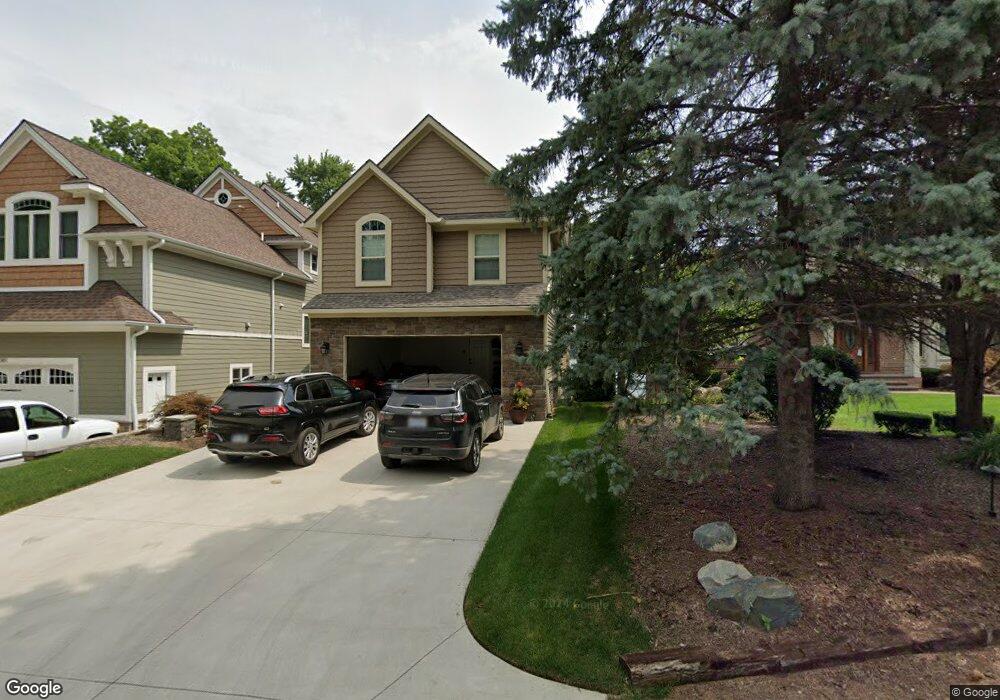
2387 Circle Dr West Bloomfield, MI 48324
Estimated Value: $567,000 - $1,846,000
3
Beds
4
Baths
2,620
Sq Ft
$521/Sq Ft
Est. Value
About This Home
This home is located at 2387 Circle Dr, West Bloomfield, MI 48324 and is currently estimated at $1,365,737, approximately $521 per square foot. 2387 Circle Dr is a home located in Oakland County with nearby schools including Clifford H. Smart Middle School, Walled Lake Northern High School, and Our Lady Of Refuge School.
Create a Home Valuation Report for This Property
The Home Valuation Report is an in-depth analysis detailing your home's value as well as a comparison with similar homes in the area
Home Values in the Area
Average Home Value in this Area
Tax History
| Year | Tax Paid | Tax Assessment Tax Assessment Total Assessment is a certain percentage of the fair market value that is determined by local assessors to be the total taxable value of land and additions on the property. | Land | Improvement |
|---|---|---|---|---|
| 2025 | $24,446 | $601,110 | $162,740 | $438,370 |
| 2024 | $17,230 | $589,680 | $0 | $0 |
| 2022 | $16,321 | $545,630 | $147,940 | $397,690 |
| 2021 | $20,879 | $519,250 | $0 | $0 |
| 2020 | $8,626 | $490,210 | $147,940 | $342,270 |
| 2018 | $14,019 | $447,830 | $123,290 | $324,540 |
| 2015 | -- | $77,930 | $0 | $0 |
| 2014 | -- | $104,090 | $0 | $0 |
| 2011 | -- | $97,830 | $0 | $0 |
Source: Public Records
Map
Nearby Homes
- 7240 Aaronway Dr
- 7145 Henry Dr
- 7110 Commerce Rd
- 6620 Red Cedar Ln Unit 37
- 1701 Marylestone Dr
- 1630 Weymouth St
- VAC Mercedes Ave
- VAC Massena Ave
- 7377 Cooley Lake Rd
- 9999 Cooley Lake Rd
- 6313 Kiev St
- 6707 Heatherwood Dr
- 6835 High Ridge Rd
- 1990 Union Lake Rd
- 3195 Green Oaks Dr
- 8541 Joseph St
- 8511 Joseph St
- 8491 Joseph St
- 7648 Woodview Dr Unit 8
- 7369 Sweetbriar
Your Personal Tour Guide
Ask me questions while you tour the home.