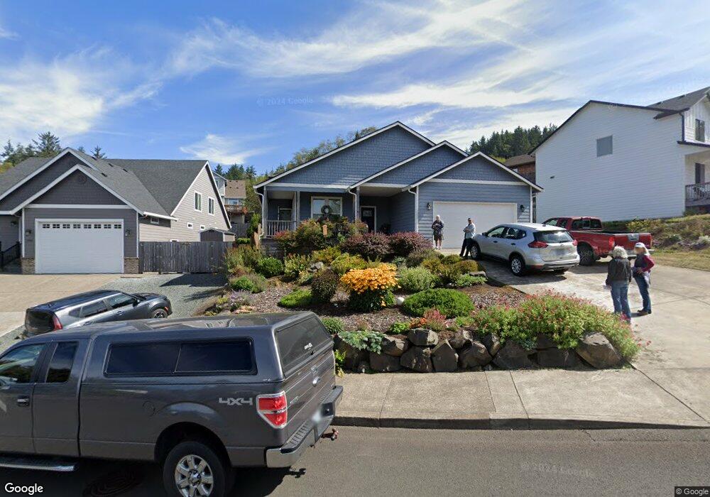
2387 N Fork Rd Seaside, OR 97138
Estimated Value: $568,203 - $692,000
3
Beds
2
Baths
2,036
Sq Ft
$318/Sq Ft
Est. Value
About This Home
This home is located at 2387 N Fork Rd, Seaside, OR 97138 and is currently estimated at $647,801, approximately $318 per square foot. 2387 N Fork Rd is a home located in Clatsop County with nearby schools including Seaside High School.
Ownership History
Date
Name
Owned For
Owner Type
Purchase Details
Closed on
Mar 17, 2017
Sold by
Hta Properties Llc
Bought by
Bjornstad Robert and Bjornstad Linda
Current Estimated Value
Home Financials for this Owner
Home Financials are based on the most recent Mortgage that was taken out on this home.
Original Mortgage
$201,000
Outstanding Balance
$166,373
Interest Rate
4.19%
Mortgage Type
New Conventional
Estimated Equity
$481,428
Purchase Details
Closed on
Oct 2, 2015
Sold by
Lhc Inc Profit Sharing Plan #2
Bought by
Hta Properties Llc
Home Financials for this Owner
Home Financials are based on the most recent Mortgage that was taken out on this home.
Original Mortgage
$420,000
Interest Rate
3.78%
Mortgage Type
Purchase Money Mortgage
Purchase Details
Closed on
Jul 7, 2014
Sold by
Olstedt Construction Inc
Bought by
Lhc Inc Profit Sharing Plan #2
Create a Home Valuation Report for This Property
The Home Valuation Report is an in-depth analysis detailing your home's value as well as a comparison with similar homes in the area
Home Values in the Area
Average Home Value in this Area
Purchase History
| Date | Buyer | Sale Price | Title Company |
|---|---|---|---|
| Bjornstad Robert | $351,000 | Pacific Title Company | |
| Hta Properties Llc | -- | Pacific Title Company | |
| Hta Properties Llc | $110,000 | Accommodation | |
| Lhc Inc Profit Sharing Plan #2 | $660,000 | Pacific Title Company |
Source: Public Records
Mortgage History
| Date | Status | Borrower | Loan Amount |
|---|---|---|---|
| Open | Bjornstad Robert | $201,000 | |
| Previous Owner | Hta Properties Llc | $420,000 |
Source: Public Records
Tax History Compared to Growth
Tax History
| Year | Tax Paid | Tax Assessment Tax Assessment Total Assessment is a certain percentage of the fair market value that is determined by local assessors to be the total taxable value of land and additions on the property. | Land | Improvement |
|---|---|---|---|---|
| 2025 | $4,541 | $315,999 | -- | -- |
| 2024 | $4,407 | $306,796 | -- | -- |
| 2023 | $4,277 | $297,861 | $0 | $0 |
| 2022 | $4,160 | $289,186 | $0 | $0 |
| 2021 | $4,072 | $280,764 | $0 | $0 |
| 2020 | $3,977 | $272,587 | $0 | $0 |
| 2019 | $3,868 | $264,648 | $0 | $0 |
| 2018 | $3,715 | $256,941 | $0 | $0 |
| 2017 | $3,545 | $249,459 | $0 | $0 |
| 2016 | $481 | $39,999 | $39,999 | $0 |
| 2015 | $561 | $46,511 | $46,511 | $0 |
| 2014 | $625 | $48,958 | $0 | $0 |
| 2013 | -- | $47,927 | $0 | $0 |
Source: Public Records
Map
Nearby Homes
- 2344 Royal View Dr
- 2657 N Hwy 101 Unit 6
- 802 25th Ave
- 000 Neawanna St
- 481 Hillside Loop
- 1350 13th Ave
- 0 Vacant Land Unit 159249124
- 2624 Neawanna St
- 790 17th Ave
- 782 Woodland Ct
- 3389 U S 101
- 820 12th Ave
- 3387-3389 U S 101
- 1299 6th Ave
- 1265 D St
- 1116 6th Ave
- 1110 6th Ave
- 717 12th Ave
- 739 11th Ave
- 731 11th Ave
- 2367 N Fork Rd
- 2203 North Fork Rd
- 2351 N Fork Dr
- 1915 N Fork Rd
- 0 N Fork Rd Unit 51
- -1 N Fork Rd
- 2215 N Fork Rd
- 2209 N Fork Rd
- 2225 N Fork Rd
- 2392 N Fork Rd
- 2382 N Fork Dr
- 2235 1weuoquzdxbz Fork
- 2235 N Fork
- 2382 N Fork Rd
- 2235 N Fork Rd
- 2372 N Fork Dr
- 2372 N Fork Rd
- 2362 N Fork Rd
- 2348 N Fork Dr
- 2348 N Fork Rd