Estimated Value: $870,809 - $1,168,000
3
Beds
3
Baths
3,766
Sq Ft
$266/Sq Ft
Est. Value
About This Home
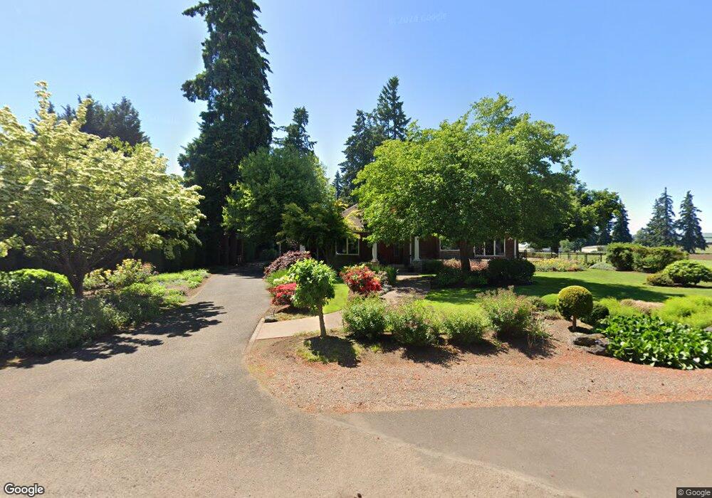
This home is located at 2389 N Maple St, Canby, OR 97013 and is currently estimated at $1,002,452, approximately $266 per square foot. 2389 N Maple St is a home located in Clackamas County with nearby schools including Howard Eccles Elementary School, Baker Prairie Middle School, and Canby High School.
Ownership History
Date
Name
Owned For
Owner Type
Purchase Details
Closed on
Oct 30, 2023
Sold by
Albrich Rita J
Bought by
Jerald And Rita Albrich Revocable Trust and Albrich
Current Estimated Value
Purchase Details
Closed on
Jun 21, 2017
Sold by
Albrich Rita J
Bought by
Albrich Rita J and Rita Albrich Revocable Trust
Purchase Details
Closed on
Nov 10, 2005
Sold by
Albrich Jerald E and Albrich Rita J
Bought by
Albrich Jerald E and Albrich Rita J
Create a Home Valuation Report for This Property
The Home Valuation Report is an in-depth analysis detailing your home's value as well as a comparison with similar homes in the area
Home Values in the Area
Average Home Value in this Area
Purchase History
| Date | Buyer | Sale Price | Title Company |
|---|---|---|---|
| Jerald And Rita Albrich Revocable Trust | -- | None Listed On Document | |
| Jerald And Rita Albrich Revocable Trust | -- | None Listed On Document | |
| Albrich Rita J | -- | None Available | |
| Albrich Jerald E | -- | None Available | |
| Albrich Jerald E | -- | -- |
Source: Public Records
Tax History
| Year | Tax Paid | Tax Assessment Tax Assessment Total Assessment is a certain percentage of the fair market value that is determined by local assessors to be the total taxable value of land and additions on the property. | Land | Improvement |
|---|---|---|---|---|
| 2025 | $10,234 | $746,726 | -- | -- |
| 2024 | $9,950 | $724,977 | -- | -- |
| 2023 | $9,950 | $703,862 | $0 | $0 |
| 2022 | $9,499 | $683,362 | $0 | $0 |
| 2021 | $9,129 | $663,459 | $0 | $0 |
| 2020 | $8,991 | $644,135 | $0 | $0 |
| 2019 | $8,521 | $625,374 | $0 | $0 |
| 2018 | $8,346 | $607,159 | $0 | $0 |
| 2017 | $8,142 | $589,475 | $0 | $0 |
| 2016 | $7,862 | $572,306 | $0 | $0 |
Source: Public Records
Map
Nearby Homes
- 660 NE 20th Ave
- 2040 N Country Club Dr
- 1753 N Oak St
- 844 NE 17th Ave
- 1762 N Oak St
- 116 NE 19th Ave
- 1004 NE 17th Ave
- 853 NE 17th Ave
- 1009 NE 17th Ave
- 1566 NE Laurelwood Cir
- 1422 NE 18th Place
- 1947 NE 21st Ave
- 1020 N Juniper St
- 32088 SW Peach Cove Rd
- 2125 NE Spitz Rd
- 2123 NE Spitz Rd
- 1390 NE 11th Ave
- 615 NW Territorial Rd
- 364 NE 9th Ave
- 1275 N Fir St
- 2327 N Maple St
- 2341 N Maple St
- 2319 N Maple St
- 2307 N Maple St
- 609 NE 22nd Ave
- 625 NE 22nd Ave
- 720 NE 23rd Ave
- 2247 N Maple St
- 760 NE 23rd Ave
- 2217 N Maple St
- 2550 N Maple Ct
- 715 NE 23rd Ave
- 810 NE 23rd Ave
- 690 NE 22nd Ave
- 575 NE 22nd Ave
- 2560 N Maple Ct
- 785 NE 23rd Ave
- 750 NE 22nd Ave
- 2555 N Maple Ct
- 830 NE 23rd Ave
Your Personal Tour Guide
Ask me questions while you tour the home.