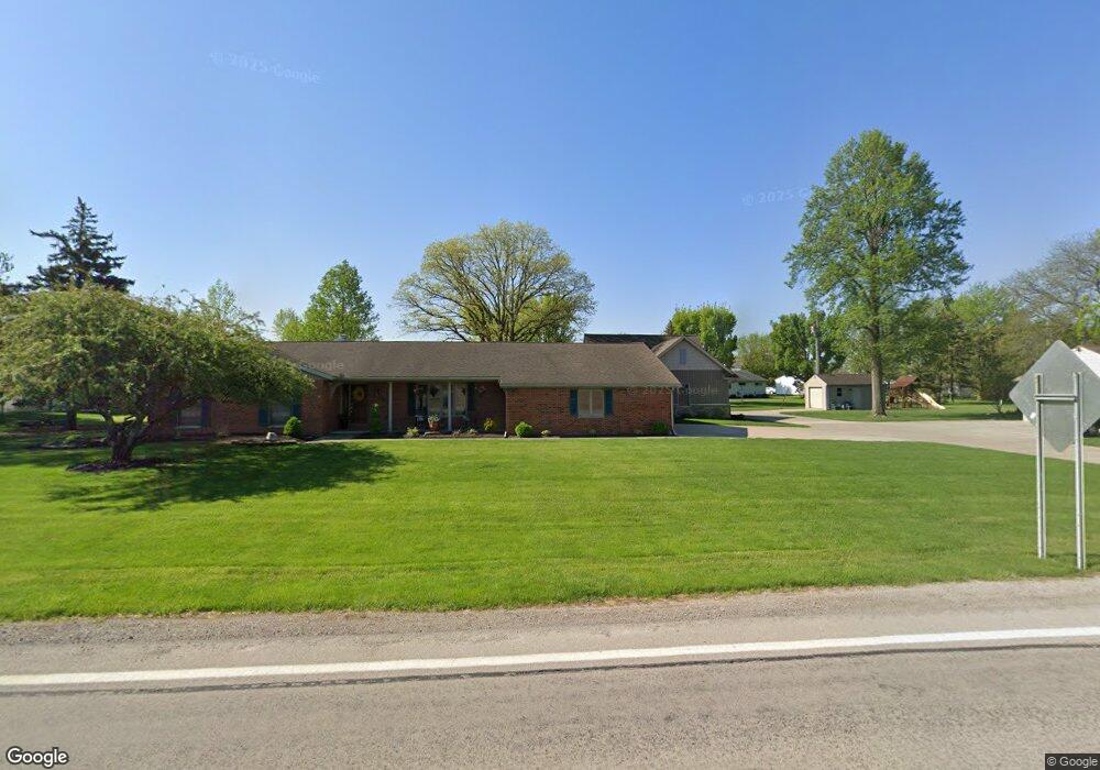
23890 State Route 697 Delphos, OH 45833
Estimated Value: $265,000 - $291,307
3
Beds
3
Baths
1,977
Sq Ft
$138/Sq Ft
Est. Value
About This Home
This home is located at 23890 State Route 697, Delphos, OH 45833 and is currently estimated at $273,327, approximately $138 per square foot. 23890 State Route 697 is a home located in Van Wert County with nearby schools including Delphos St. John's High School and Delphos St. John's Elementary School.
Ownership History
Date
Name
Owned For
Owner Type
Purchase Details
Closed on
Dec 27, 2023
Sold by
Grothouse Catherine A
Bought by
Grote 697 Llc
Current Estimated Value
Purchase Details
Closed on
Feb 23, 2007
Sold by
Gerdeman James C and Gerdeman Darrin J
Bought by
Grothouse James T and Grothouse Catherine A
Purchase Details
Closed on
Oct 12, 1995
Bought by
Grothouse James T and Grothouse Cath
Create a Home Valuation Report for This Property
The Home Valuation Report is an in-depth analysis detailing your home's value as well as a comparison with similar homes in the area
Home Values in the Area
Average Home Value in this Area
Purchase History
| Date | Buyer | Sale Price | Title Company |
|---|---|---|---|
| Grote 697 Llc | -- | None Listed On Document | |
| Grothouse Catherine A | -- | None Listed On Document | |
| Grothouse James T | -- | None Listed On Document | |
| Grothouse James T | -- | None Available | |
| Grothouse James T | $126,500 | -- | |
| Grothouse James T | $126,500 | -- |
Source: Public Records
Tax History Compared to Growth
Tax History
| Year | Tax Paid | Tax Assessment Tax Assessment Total Assessment is a certain percentage of the fair market value that is determined by local assessors to be the total taxable value of land and additions on the property. | Land | Improvement |
|---|---|---|---|---|
| 2024 | $3,453 | $118,890 | $5,810 | $113,080 |
| 2023 | $3,453 | $118,890 | $5,810 | $113,080 |
| 2022 | $2,980 | $93,120 | $4,970 | $88,150 |
| 2021 | $2,990 | $93,120 | $4,970 | $88,150 |
| 2020 | $3,042 | $93,120 | $4,970 | $88,150 |
| 2019 | $2,352 | $81,120 | $4,470 | $76,650 |
| 2018 | $2,349 | $81,120 | $4,470 | $76,650 |
| 2017 | $1,893 | $76,010 | $4,470 | $71,540 |
| 2016 | $1,719 | $61,780 | $4,470 | $57,310 |
| 2015 | $1,529 | $55,120 | $4,470 | $50,650 |
| 2014 | $1,625 | $55,800 | $4,470 | $51,330 |
| 2013 | $1,751 | $55,800 | $4,470 | $51,330 |
Source: Public Records
Map
Nearby Homes
- 11630 Clearview Dr
- 606 S Cass St
- 634 S Clay St
- 409 N Bredeick St
- 616 W 5th St
- 424 S Canal St
- 604 W 6th St
- 503 W 6th St
- 221 S Main St
- 516 S Main St
- 827 S Washington St
- 508 S Washington St
- 210 E 3rd St
- 405 N Franklin St
- 610 N Washington St
- 1001 S Adams St
- 704 N Franklin St
- 628 N Pierce St
- 810 N Franklin St
- 633 E 2nd St
- 23876 State Route 697
- 23925 Jennings Delphos Rd
- 23901 Jennings Delphos Rd
- 23889 Jennings Delphos Rd
- 23850 State Route 697
- 23826 State Route 697
- 23861 Jennings Delphos Rd
- 23850 Jennings Delphos Rd
- 23843 Jennings Delphos Rd
- 23796 State Route 697
- 11536 Mox Rd
- 2112 St Marys Rd N
- S Erie
- 23840 Jennings Delphos Rd
- 23774 State Route 697
- 23811 Jennings Delphos Rd