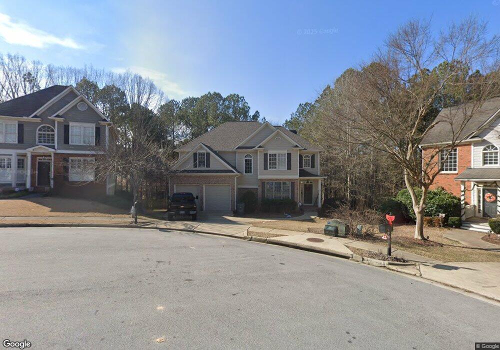
239 239 McEver Branch Landing Acworth, GA 30101
Cedarcrest NeighborhoodEstimated Value: $504,463 - $554,000
3
Beds
6
Baths
2,306
Sq Ft
$228/Sq Ft
Est. Value
About This Home
This home is located at 239 239 McEver Branch Landing, Acworth, GA 30101 and is currently estimated at $524,866, approximately $227 per square foot. 239 239 McEver Branch Landing is a home located in Paulding County with nearby schools including Burnt Hickory Elementary School, Sammy Mcclure Sr. Middle School, and North Paulding High School.
Ownership History
Date
Name
Owned For
Owner Type
Purchase Details
Closed on
Feb 19, 2019
Sold by
Noah Emil J
Bought by
Brooks Clay
Current Estimated Value
Home Financials for this Owner
Home Financials are based on the most recent Mortgage that was taken out on this home.
Original Mortgage
$255,000
Outstanding Balance
$223,733
Interest Rate
4.4%
Mortgage Type
New Conventional
Estimated Equity
$301,133
Purchase Details
Closed on
Dec 12, 2005
Sold by
Thomason Bradford L
Bought by
Noah Emil J and Noah Julie A
Home Financials for this Owner
Home Financials are based on the most recent Mortgage that was taken out on this home.
Original Mortgage
$234,400
Interest Rate
7%
Mortgage Type
New Conventional
Create a Home Valuation Report for This Property
The Home Valuation Report is an in-depth analysis detailing your home's value as well as a comparison with similar homes in the area
Home Values in the Area
Average Home Value in this Area
Purchase History
| Date | Buyer | Sale Price | Title Company |
|---|---|---|---|
| Brooks Clay | $300,000 | -- | |
| Noah Emil J | $293,000 | -- |
Source: Public Records
Mortgage History
| Date | Status | Borrower | Loan Amount |
|---|---|---|---|
| Open | Brooks Clay | $255,000 | |
| Previous Owner | Noah Emil J | $234,400 |
Source: Public Records
Tax History Compared to Growth
Tax History
| Year | Tax Paid | Tax Assessment Tax Assessment Total Assessment is a certain percentage of the fair market value that is determined by local assessors to be the total taxable value of land and additions on the property. | Land | Improvement |
|---|---|---|---|---|
| 2024 | $4,615 | $188,784 | $26,000 | $162,784 |
| 2023 | $4,838 | $188,120 | $26,000 | $162,120 |
| 2022 | $4,305 | $167,028 | $26,000 | $141,028 |
| 2021 | $3,897 | $135,972 | $26,000 | $109,972 |
| 2020 | $3,470 | $116,824 | $26,000 | $90,824 |
| 2019 | $3,539 | $117,464 | $26,000 | $91,464 |
| 2018 | $3,691 | $122,508 | $26,000 | $96,508 |
| 2017 | $3,343 | $109,428 | $24,000 | $85,428 |
| 2016 | $3,401 | $112,480 | $24,000 | $88,480 |
| 2015 | $2,892 | $93,960 | $24,000 | $69,960 |
| 2014 | $3,071 | $97,280 | $24,000 | $73,280 |
| 2013 | -- | $85,520 | $24,000 | $61,520 |
Source: Public Records
Map
Nearby Homes
- 103 Brier Bend Ct Unit D
- 102 Silverdale Ln
- 385 Graves Rd
- 280 Graves Rd
- 365 Hunt Creek Dr
- 139 Thunder Ridge Ln
- 174 Timber Creek #176 Ln SW
- 51 Water Oak Dr
- 88 Water Oak Dr
- 303 Eagle Rock Dr
- 1039 Lost Creek Pkwy
- 197 Hickory Pointe Dr
- 1029 Lost Creek Pkwy
- 283 Hickory Pointe Dr
- 1019 Lost Creek Pkwy
- 1009 Lost Creek Pkwy
- 407 Estates View Dr
- 1648 Harmony Grove Church Rd
- 991 Lost Creek Pkwy
- 994 Lost Creek Pkwy
- 239 McEvers Branch Landing
- 247 McEvers Branch Landing Unit D
- 231 McEvers Branch Landing
- 960 Bentwater Dr
- 242 McEvers Branch Landing
- 229 McEvers Branch Landing
- 938 Bentwater Dr
- 224 McEvers Branch Landing
- 201 McEvers Branch Landing
- 210 McEvers Branch Landing
- 959 Bentwater Dr
- 918 Bentwater Dr
- 185 McEvers Branch Landing
- 196 McEvers Branch Landing
- 931 Bentwater Dr
- 134 Brier Bend Ct Unit 41
- 134 Brier Bend Ct
- 163 McEvers Branch Landing
- 900 Bentwater Dr
- 909 Bentwater Dr