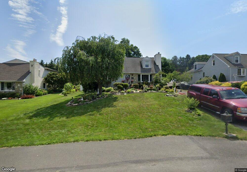
239 Aspen Ave Langhorne, PA 19047
Estimated Value: $495,000 - $543,000
3
Beds
2
Baths
2,408
Sq Ft
$217/Sq Ft
Est. Value
About This Home
This home is located at 239 Aspen Ave, Langhorne, PA 19047 and is currently estimated at $523,130, approximately $217 per square foot. 239 Aspen Ave is a home located in Bucks County with nearby schools including Tawanka Elementary School, Maple Point Middle School, and Neshaminy High School.
Ownership History
Date
Name
Owned For
Owner Type
Purchase Details
Closed on
Oct 5, 1982
Sold by
Pintozzi Jr Andrew J and Pintozzi Zina
Bought by
Mccolgan Michael J and Mccolgan Cynthia C
Current Estimated Value
Create a Home Valuation Report for This Property
The Home Valuation Report is an in-depth analysis detailing your home's value as well as a comparison with similar homes in the area
Home Values in the Area
Average Home Value in this Area
Purchase History
| Date | Buyer | Sale Price | Title Company |
|---|---|---|---|
| Mccolgan Michael J | $60,500 | -- |
Source: Public Records
Tax History Compared to Growth
Tax History
| Year | Tax Paid | Tax Assessment Tax Assessment Total Assessment is a certain percentage of the fair market value that is determined by local assessors to be the total taxable value of land and additions on the property. | Land | Improvement |
|---|---|---|---|---|
| 2025 | $5,591 | $25,680 | $4,880 | $20,800 |
| 2024 | $5,591 | $25,680 | $4,880 | $20,800 |
| 2023 | $5,502 | $25,680 | $4,880 | $20,800 |
| 2022 | $5,357 | $25,680 | $4,880 | $20,800 |
| 2021 | $5,357 | $25,680 | $4,880 | $20,800 |
| 2020 | $5,293 | $25,680 | $4,880 | $20,800 |
| 2019 | $5,175 | $25,680 | $4,880 | $20,800 |
| 2018 | $5,080 | $25,680 | $4,880 | $20,800 |
| 2017 | $4,950 | $25,680 | $4,880 | $20,800 |
| 2016 | $4,950 | $25,680 | $4,880 | $20,800 |
| 2015 | $5,140 | $25,680 | $4,880 | $20,800 |
| 2014 | $5,140 | $25,680 | $4,880 | $20,800 |
Source: Public Records
Map
Nearby Homes
- 1021 W Maple Ave
- 166 N Hawthorne Ave
- 1210 Brownsville Rd
- 13 Golf Club Dr
- 308 W Richardson Ave
- 225 Playwicki St
- 565 Hulmeville Rd
- 257 Wisteria Ave
- 230 Playwicki St
- 710 Fox Ct
- 1605 Old Lincoln Hwy
- 523 Turtle Ln
- 1420 Super Hwy
- 2816 Avenue E
- 2823 Avenue E
- 1516 Fairview Ave
- 147 Watergate Dr
- 239 N Pine St
- 0 Prospect Ave
- 2623 Sunnyside Ave