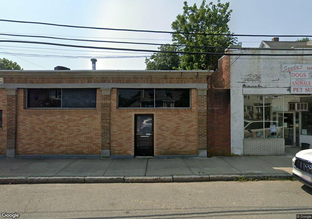
239 Atlantic St Unit 235-239 Quincy, MA 02171
North Quincy Neighborhood
--
Bed
2
Baths
6,021
Sq Ft
10,019
Sq Ft Lot
About This Home
This home is located at 239 Atlantic St Unit 235-239, Quincy, MA 02171. 239 Atlantic St Unit 235-239 is a home located in Norfolk County with nearby schools including Squantum Elementary School, Atlantic Middle School, and North Quincy High School.
Ownership History
Date
Name
Owned For
Owner Type
Purchase Details
Closed on
Dec 13, 2002
Sold by
Amerias Real Estate Co
Bought by
Greenwood David
Home Financials for this Owner
Home Financials are based on the most recent Mortgage that was taken out on this home.
Original Mortgage
$161,250
Outstanding Balance
$68,916
Interest Rate
6.17%
Mortgage Type
Purchase Money Mortgage
Purchase Details
Closed on
Dec 6, 1994
Sold by
Allied Communication
Bought by
Americas Real Est Corp
Home Financials for this Owner
Home Financials are based on the most recent Mortgage that was taken out on this home.
Original Mortgage
$100,000
Interest Rate
8.81%
Mortgage Type
Commercial
Create a Home Valuation Report for This Property
The Home Valuation Report is an in-depth analysis detailing your home's value as well as a comparison with similar homes in the area
Home Values in the Area
Average Home Value in this Area
Purchase History
| Date | Buyer | Sale Price | Title Company |
|---|---|---|---|
| Greenwood David | $215,000 | -- | |
| Americas Real Est Corp | $85,000 | -- |
Source: Public Records
Mortgage History
| Date | Status | Borrower | Loan Amount |
|---|---|---|---|
| Open | Greenwood David | $161,250 | |
| Previous Owner | Americas Real Est Corp | $100,000 |
Source: Public Records
Tax History Compared to Growth
Tax History
| Year | Tax Paid | Tax Assessment Tax Assessment Total Assessment is a certain percentage of the fair market value that is determined by local assessors to be the total taxable value of land and additions on the property. | Land | Improvement |
|---|---|---|---|---|
| 2025 | $16,602 | $721,500 | $174,100 | $547,400 |
| 2024 | $14,725 | $655,900 | $172,300 | $483,600 |
| 2023 | $13,131 | $592,000 | $170,700 | $421,300 |
| 2022 | $13,247 | $555,200 | $162,500 | $392,700 |
| 2021 | $12,948 | $534,600 | $160,900 | $373,700 |
| 2020 | $12,897 | $519,200 | $159,400 | $359,800 |
| 2019 | $12,819 | $509,100 | $157,700 | $351,400 |
| 2018 | $13,634 | $504,200 | $166,600 | $337,600 |
| 2017 | $14,045 | $489,200 | $161,700 | $327,500 |
| 2016 | $13,924 | $474,100 | $161,700 | $312,400 |
| 2015 | $13,920 | $460,000 | $161,700 | $298,300 |
| 2014 | $13,863 | $443,900 | $161,700 | $282,200 |
Source: Public Records
Map
Nearby Homes
- 201 Billings St
- 38 Walker St
- 25 Hummock Rd
- 297 Billings St
- 175 Quincy Shore Dr Unit B24
- 212 Quincy Shore Dr
- 58 Bayfield Rd S
- 148 Quincy Shore Dr Unit 43
- 138 Quincy Shore Dr Unit 170
- 91 Atlantic St
- 85 E Squantum St Unit 10
- 166 Quincy Shore Dr Unit 108
- 90 Shore Ave
- 68 Atlantic St
- 90 Quincy Shore Dr Unit 701
- 90 Quincy Shore Dr Unit 501
- 133 Commander Shea Blvd Unit 315
- 133 Commander Shea Blvd Unit 609
- 133 Commander Shea Blvd Unit 620
- 133 Commander Shea Blvd Unit 204
- 235 Atlantic St Unit 1
- 233 Atlantic St Unit 4
- 233 Atlantic St Unit 1-L
- 0 Confidential St Unit 70711602
- 9999 Somewhere
- 0 Confidential St Unit 70232445
- 0 Confidential St Unit 70151547
- 0 Confidential St Unit 70151526
- 243 Atlantic St
- 238 Atlantic St
- 244 Atlantic St
- 234 Atlantic St
- 246 Atlantic St
- 208 Billings St
- 228 Atlantic St
- 204 Billings St
- 214 Billings St
- 214 Billings St Unit 2
- 214 Billings St Unit 3
- 214 Billings St Unit 1