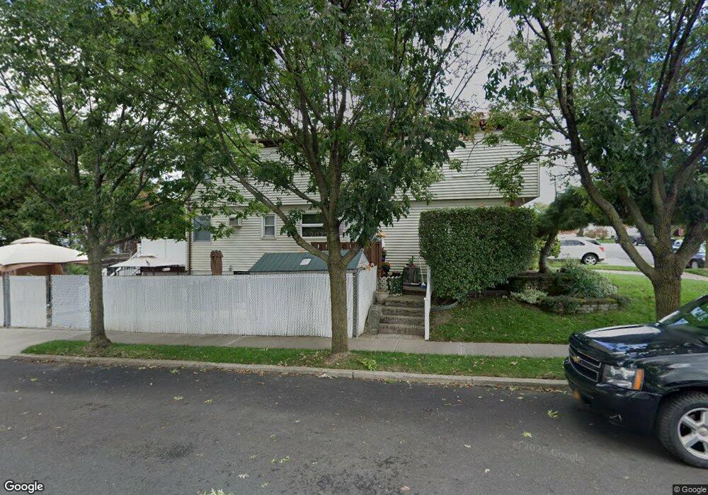
239 Barlow Ave Staten Island, NY 10308
Great Kills NeighborhoodEstimated Value: $930,705 - $965,000
4
Beds
1
Bath
2,288
Sq Ft
$413/Sq Ft
Est. Value
About This Home
This home is located at 239 Barlow Ave, Staten Island, NY 10308 and is currently estimated at $944,676, approximately $412 per square foot. 239 Barlow Ave is a home located in Richmond County with nearby schools including P.S. 32 The Gifford School, I.S. 075 Frank D. Paulo, and Susan E Wagner High School.
Ownership History
Date
Name
Owned For
Owner Type
Purchase Details
Closed on
Dec 1, 2000
Sold by
Cangiarella Frank V and Cangiarella Heidi M
Bought by
Stiles Raymond J and Stiles Joanne
Current Estimated Value
Home Financials for this Owner
Home Financials are based on the most recent Mortgage that was taken out on this home.
Original Mortgage
$278,000
Outstanding Balance
$102,520
Interest Rate
7.71%
Estimated Equity
$842,156
Create a Home Valuation Report for This Property
The Home Valuation Report is an in-depth analysis detailing your home's value as well as a comparison with similar homes in the area
Home Values in the Area
Average Home Value in this Area
Purchase History
| Date | Buyer | Sale Price | Title Company |
|---|---|---|---|
| Stiles Raymond J | $348,000 | Fidelity National Title Ins |
Source: Public Records
Mortgage History
| Date | Status | Borrower | Loan Amount |
|---|---|---|---|
| Open | Stiles Raymond J | $278,000 |
Source: Public Records
Tax History Compared to Growth
Tax History
| Year | Tax Paid | Tax Assessment Tax Assessment Total Assessment is a certain percentage of the fair market value that is determined by local assessors to be the total taxable value of land and additions on the property. | Land | Improvement |
|---|---|---|---|---|
| 2025 | $8,193 | $56,220 | $8,529 | $47,691 |
| 2024 | $8,205 | $45,960 | $10,355 | $35,605 |
| 2023 | $7,713 | $39,802 | $8,342 | $31,460 |
| 2022 | $7,209 | $46,920 | $11,280 | $35,640 |
| 2021 | $7,152 | $42,780 | $11,280 | $31,500 |
| 2020 | $7,202 | $38,880 | $11,280 | $27,600 |
| 2019 | $9,058 | $42,060 | $11,280 | $30,780 |
| 2018 | $6,464 | $33,168 | $10,714 | $22,454 |
| 2017 | $6,079 | $31,291 | $10,524 | $20,767 |
| 2016 | $5,591 | $29,520 | $11,280 | $18,240 |
| 2015 | $5,334 | $29,520 | $9,420 | $20,100 |
| 2014 | $5,334 | $29,383 | $9,376 | $20,007 |
Source: Public Records
Map
Nearby Homes
- 414 Elverton Ave
- 12 Lexington Ln
- 259 Brookfield Ave
- 72 Eric Ln
- 271 Doane Ave
- 339 Abingdon Ave
- 307 Abingdon Ave
- 350 Brookfield Ave
- 87 Pemberton Ave
- 466 Doane Ave
- 360 Barlow Ave Unit 32
- 200 Giffords Ln
- 379 Brookfield Ave
- 248 Abingdon Ave
- 223 Abingdon Ave
- 15 Woodland Ave
- 919 Armstrong Ave
- 400 Brookfield Ave
- 132 Elkhart St
- 63 Genesee Ave
- 235 Barlow Ave
- 231 Barlow Ave
- 50 Arkansas Ave
- 48 Arkansas Ave
- 46 Arkansas Ave
- 227 Barlow Ave
- 382 Elverton Ave
- 380 Elverton Ave
- 384 Elverton Ave
- 388 Elverton Ave
- 42 Arkansas Ave
- 390 Elverton Ave
- 221 Barlow Ave
- 394 Elverton Ave
- 370 Elverton Ave
- 38 Arkansas Ave
- 396 Elverton Ave
- 215 Barlow Ave
- 215 Barlow Ave Unit 2
- 366 Elverton Ave