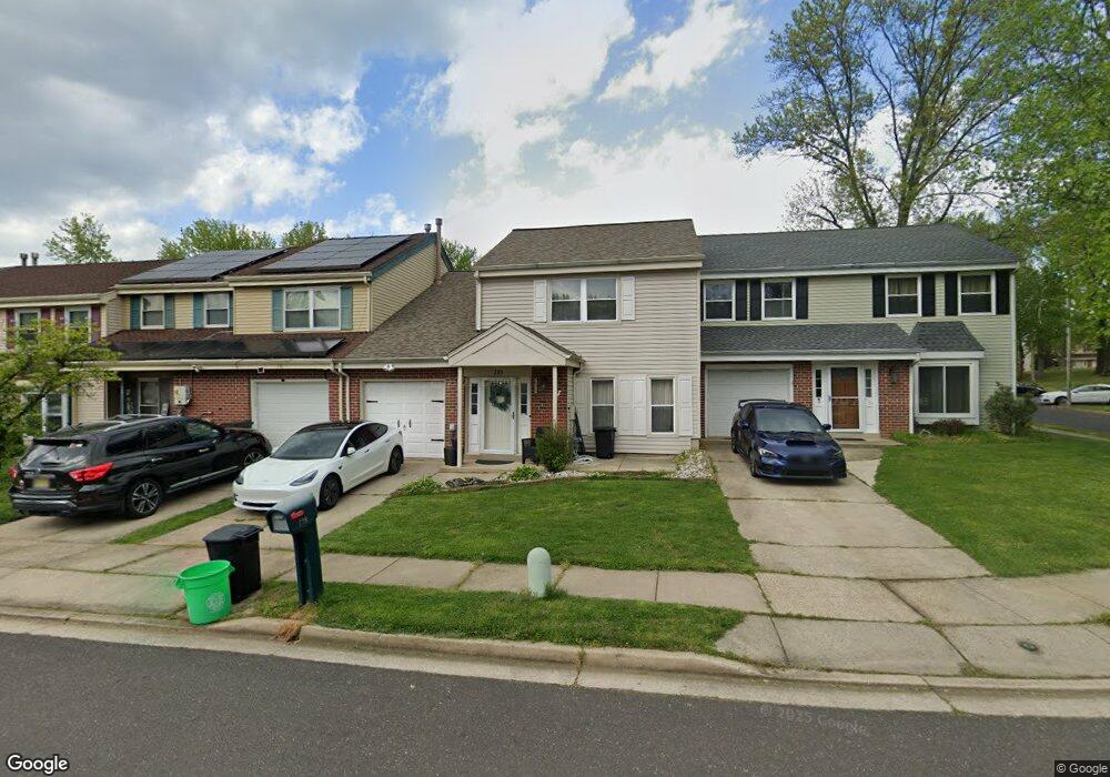
239 Burnamwood Dr Mount Laurel, NJ 08054
Estimated Value: $374,976 - $400,000
--
Bed
--
Bath
1,705
Sq Ft
$227/Sq Ft
Est. Value
About This Home
This home is located at 239 Burnamwood Dr, Mount Laurel, NJ 08054 and is currently estimated at $386,244, approximately $226 per square foot. 239 Burnamwood Dr is a home located in Burlington County with nearby schools including Larchmont Elementary School, Mount Laurel Hartford School, and T.E. Harrington Middle School.
Ownership History
Date
Name
Owned For
Owner Type
Purchase Details
Closed on
Feb 9, 2021
Sold by
Grookett Michael J
Bought by
Sussman Lance and Molina Jessica A
Current Estimated Value
Home Financials for this Owner
Home Financials are based on the most recent Mortgage that was taken out on this home.
Original Mortgage
$224,200
Outstanding Balance
$200,522
Interest Rate
2.7%
Mortgage Type
New Conventional
Estimated Equity
$185,722
Purchase Details
Closed on
Apr 10, 2007
Sold by
Grookett Geraldine
Bought by
Grookett Geraldine and Grookett Michael J
Purchase Details
Closed on
Jun 22, 2000
Sold by
Way Todd and Way Elizabeth A
Bought by
Minutella Anna and Grookett Geraldine
Purchase Details
Closed on
Jul 28, 1995
Sold by
Gehman Paul L
Bought by
Way Todd
Create a Home Valuation Report for This Property
The Home Valuation Report is an in-depth analysis detailing your home's value as well as a comparison with similar homes in the area
Home Values in the Area
Average Home Value in this Area
Purchase History
| Date | Buyer | Sale Price | Title Company |
|---|---|---|---|
| Sussman Lance | $236,000 | Vintage Title Services Llc | |
| Sussman Lance | $236,000 | Vintage Title Services | |
| Grookett Geraldine | -- | None Available | |
| Minutella Anna | $123,000 | -- | |
| Way Todd | $101,800 | -- |
Source: Public Records
Mortgage History
| Date | Status | Borrower | Loan Amount |
|---|---|---|---|
| Open | Sussman Lance | $224,200 | |
| Closed | Sussman Lance | $224,200 |
Source: Public Records
Tax History Compared to Growth
Tax History
| Year | Tax Paid | Tax Assessment Tax Assessment Total Assessment is a certain percentage of the fair market value that is determined by local assessors to be the total taxable value of land and additions on the property. | Land | Improvement |
|---|---|---|---|---|
| 2025 | $5,455 | $172,800 | $54,000 | $118,800 |
| 2024 | $5,250 | $172,800 | $54,000 | $118,800 |
| 2023 | $5,250 | $172,800 | $54,000 | $118,800 |
| 2022 | $5,232 | $172,800 | $54,000 | $118,800 |
| 2021 | $4,757 | $172,800 | $54,000 | $118,800 |
| 2020 | $5,034 | $172,800 | $54,000 | $118,800 |
| 2019 | $4,982 | $172,800 | $54,000 | $118,800 |
| 2018 | $4,944 | $172,800 | $54,000 | $118,800 |
| 2017 | $4,816 | $172,800 | $54,000 | $118,800 |
| 2016 | $4,743 | $172,800 | $54,000 | $118,800 |
| 2015 | $4,688 | $172,800 | $54,000 | $118,800 |
| 2014 | $4,641 | $172,800 | $54,000 | $118,800 |
Source: Public Records
Map
Nearby Homes
- 438B Willow Turn
- 540A Willow Turn Unit A
- 220 Hartford Rd
- 358B Willow Turn Unit 358B
- 36 Whitechapel Dr
- 121A Arden Ct
- 130 Banwell Ln
- 143 Banwell Ln
- 115 Banwell Ln
- 161A Bradford Ct Unit 161
- 210 Stratton Ct
- 216 Martins Way Unit 216
- 5214C Aberdeen Dr Unit C
- 5116C Aberdeen Dr
- 4610B Aberdeen Dr Unit 4610
- 2402B Sedgefield Dr Unit 2402B
- 0 Hartford Rd
- 5 Hampton Ct
- 208B Sedgefield Dr Unit 208B
- 4901A Dunbarton Rd
- 239 Burnam Wood Dr
- 241 Burnamwood Dr
- 237 Burnam Wood Dr
- 237 Burnamwood Dr
- 243 Burnamwood Dr
- 243 Burnam Wood Dr
- 235 Burnamwood Dr
- 245 Burnamwood Dr
- 233 Burnamwood Dr
- 231 Burnamwood Dr
- 234 Burnam Wood Dr
- 236 Burnamwood Dr
- 229 Burnam Wood Dr
- 229 Burnamwood Dr
- 230 Burnam Wood Dr
- 232 Burnamwood Dr
- 230 Burnamwood Dr
- 234 Burnamwood Dr
- 238 Burnamwood Dr
- 227 Burnamwood Dr