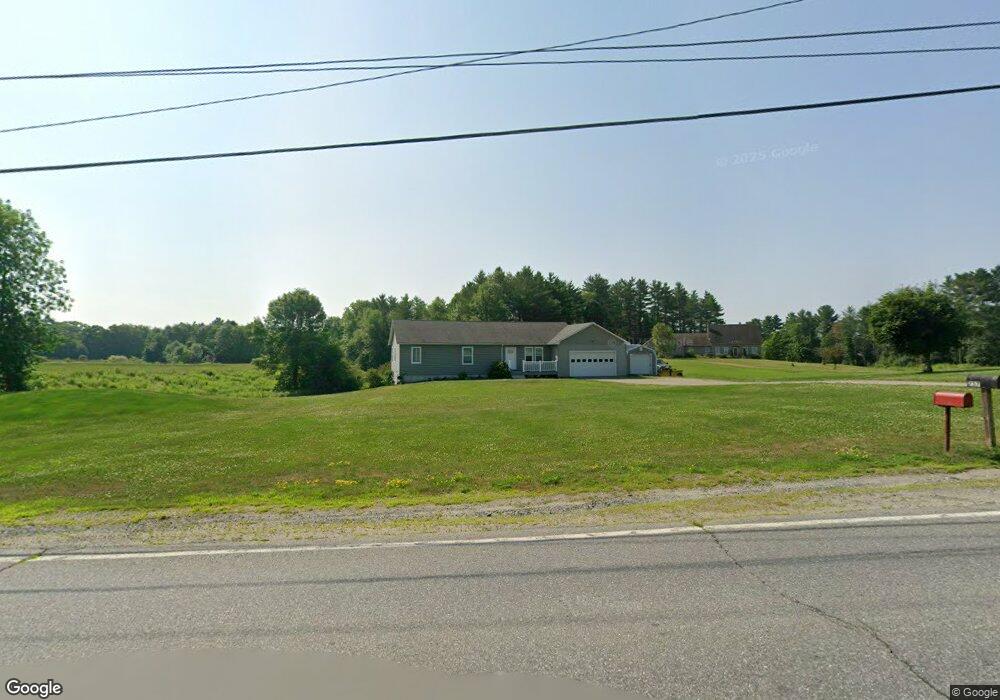
239 Clinton Ave Winslow, ME 04901
Estimated Value: $185,000 - $621,177
1
Bed
1
Bath
544
Sq Ft
$639/Sq Ft
Est. Value
About This Home
This home is located at 239 Clinton Ave, Winslow, ME 04901 and is currently estimated at $347,726, approximately $639 per square foot. 239 Clinton Ave is a home located in Kennebec County with nearby schools including Winslow Elementary School, Winslow Junior High School, and Winslow High School.
Ownership History
Date
Name
Owned For
Owner Type
Purchase Details
Closed on
May 9, 2013
Sold by
Maheu Todd J and Noonan Mindy A
Bought by
Albert Caleb
Current Estimated Value
Purchase Details
Closed on
Sep 14, 2012
Sold by
Roy Michael A and Roy Wendy
Bought by
Albert Caleb
Purchase Details
Closed on
Sep 13, 2011
Sold by
Walters Colonial Ests Llc
Bought by
Maheu Todd J and Noonan Mindy A
Home Financials for this Owner
Home Financials are based on the most recent Mortgage that was taken out on this home.
Original Mortgage
$22,425
Interest Rate
4.58%
Mortgage Type
Purchase Money Mortgage
Purchase Details
Closed on
Jul 11, 2011
Sold by
Dubois Bonnie S
Bought by
Roy Michael
Purchase Details
Closed on
Nov 13, 2007
Sold by
Nadeau Michael and Nadeau Victoria
Bought by
Dubois Bonnie S and Dubois Steven
Create a Home Valuation Report for This Property
The Home Valuation Report is an in-depth analysis detailing your home's value as well as a comparison with similar homes in the area
Home Values in the Area
Average Home Value in this Area
Purchase History
| Date | Buyer | Sale Price | Title Company |
|---|---|---|---|
| Albert Caleb | -- | -- | |
| Albert Caleb | -- | -- | |
| Maheu Todd J | -- | -- | |
| Roy Michael | $49,000 | -- | |
| Dubois Bonnie S | -- | -- |
Source: Public Records
Mortgage History
| Date | Status | Borrower | Loan Amount |
|---|---|---|---|
| Previous Owner | Maheu Todd J | $22,425 |
Source: Public Records
Tax History Compared to Growth
Tax History
| Year | Tax Paid | Tax Assessment Tax Assessment Total Assessment is a certain percentage of the fair market value that is determined by local assessors to be the total taxable value of land and additions on the property. | Land | Improvement |
|---|---|---|---|---|
| 2024 | $9,015 | $601,000 | $44,400 | $556,600 |
| 2023 | $9,015 | $601,000 | $44,400 | $556,600 |
| 2022 | $7,074 | $333,700 | $35,600 | $298,100 |
| 2021 | $6,710 | $332,200 | $35,600 | $296,600 |
| 2020 | $6,252 | $332,200 | $35,600 | $296,600 |
| 2019 | $6,190 | $332,100 | $35,600 | $296,500 |
| 2018 | $5,958 | $332,100 | $35,600 | $296,500 |
| 2017 | $6,418 | $383,400 | $35,600 | $347,800 |
| 2016 | $3,880 | $246,500 | $33,400 | $213,100 |
| 2015 | $2,415 | $155,800 | $38,600 | $117,200 |
| 2014 | $2,415 | $155,800 | $38,600 | $117,200 |
Source: Public Records
Map
Nearby Homes
- 486 Garland Rd
- 158 Clinton Ave
- 5 Mar Val Terrace Unit D7
- 4 Marcoux St
- 144 Clinton Ave
- 14 Fuller Dr
- 11 Poulin St
- 12 Whipple St
- 31 Whipple St
- 85 Halifax St
- 501 Clinton Ave
- 3 Baker St
- 0 Olde Heritage Map 10 Lot 77-3 Place Unit 1628289
- 73 Halifax St
- 75 Halifax St Unit 31
- 23 N Garand St
- Lot 4 Peachtree Ln
- 10 Victor Terrace
- 29 Halifax St
- 29 Bellevue St
- 251 Clinton Ave
- 245 Clinton Ave
- 229 Clinton Ave
- 235 Clinton Ave
- 225 Clinton Ave
- 237 Clinton Ave
- 281 Clinton Ave
- 279 Clinton Ave
- 275 Clinton Ave
- 238 Clinton Ave
- 260 Clinton Ave
- 248 Clinton Ave
- 234 Clinton Ave
- 283 Clinton Ave
- 230 Clinton Ave
- 270 Clinton Ave
- 189 Clinton Ave
- 210 Clinton Ave
- 179 Clinton Ave
- 280 Clinton Ave