Estimated Value: $265,000 - $308,000
2
Beds
1
Bath
1,040
Sq Ft
$274/Sq Ft
Est. Value
About This Home
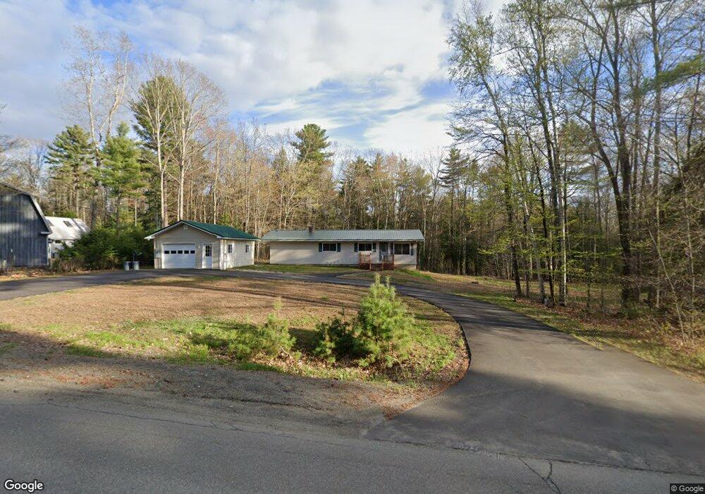
This home is located at 239 Forest Ave, Orono, ME 04473 and is currently estimated at $284,672, approximately $273 per square foot. 239 Forest Ave is a home located in Penobscot County with nearby schools including Orono Middle School and Orono High School.
Ownership History
Date
Name
Owned For
Owner Type
Purchase Details
Closed on
Nov 6, 2007
Sold by
Peters Ruth
Bought by
Soucy Ray P
Current Estimated Value
Home Financials for this Owner
Home Financials are based on the most recent Mortgage that was taken out on this home.
Original Mortgage
$131,580
Outstanding Balance
$80,775
Interest Rate
6.43%
Mortgage Type
FHA
Estimated Equity
$203,897
Create a Home Valuation Report for This Property
The Home Valuation Report is an in-depth analysis detailing your home's value as well as a comparison with similar homes in the area
Home Values in the Area
Average Home Value in this Area
Purchase History
We collect this data history from publicly available records. To have your information removed, we recommend requesting removal directly through your county’s website.
| Date | Buyer | Sale Price | Title Company |
|---|---|---|---|
| Soucy Ray P | -- | -- |
Source: Public Records
Mortgage History
We collect this data history from publicly available records. To have your information removed, we recommend requesting removal directly through your county’s website.
| Date | Status | Borrower | Loan Amount |
|---|---|---|---|
| Open | Soucy Ray P | $131,580 |
Source: Public Records
Tax History
| Year | Tax Paid | Tax Assessment Tax Assessment Total Assessment is a certain percentage of the fair market value that is determined by local assessors to be the total taxable value of land and additions on the property. | Land | Improvement |
|---|---|---|---|---|
| 2025 | $3,956 | $198,800 | $56,400 | $142,400 |
| 2024 | $3,888 | $182,100 | $51,700 | $130,400 |
| 2023 | $3,875 | $165,600 | $47,000 | $118,600 |
| 2022 | $3,941 | $165,600 | $47,000 | $118,600 |
| 2021 | $3,933 | $165,600 | $47,000 | $118,600 |
| 2020 | $2,733 | $97,300 | $39,500 | $57,800 |
| 2019 | $2,574 | $97,300 | $39,500 | $57,800 |
| 2018 | $2,627 | $97,300 | $39,500 | $57,800 |
| 2017 | $2,530 | $97,300 | $39,500 | $57,800 |
| 2016 | $2,418 | $97,300 | $39,500 | $57,800 |
| 2015 | $2,374 | $97,300 | $39,500 | $57,800 |
| 2014 | $2,321 | $97,300 | $39,500 | $57,800 |
| 2013 | $2,004 | $86,400 | $39,500 | $46,900 |
Source: Public Records
Map
Nearby Homes
- 153 Stillwater Ave
- 83 Orono Landing Rd
- 270 Stillwater Ave
- 8 Sylvan Rd
- 16 Godfrey Dr
- 30 Merritt Dr
- 15 Sylvan Rd
- Lot 13 Tripp Dr
- 447 Walden Parke Way
- 374 Walden Parke Way
- 365 Walden Parke Way
- 36 Kelley Rd
- 2 S Spring St
- 76 Spring St
- 18 Sunset Dr
- 12 Sunset Dr
- 11 Spencer St
- 1024 Stillwater Ave
- 37 Hamlin St
- 148 College Ave
- 237 Forest Ave
- 260 Forest Ave
- 235 Forest Ave
- 266 Forest Ave
- 248 Forest Ave
- 252 & 254 Forest Ave
- 243 Forest Ave
- 245 Forest Ave
- 000 Forest Ave
- 278 Forest Ave
- 233 Forest Ave
- 241 Forest Ave
- 59 Taylor Rd
- 0 Taylor
- 63 Taylor Rd
- 9 Maxfield Dr
- Lot#9 Maxfield
- Lot # 9 Maxfield
- Lot# 9 Maxfield Dr
- Lot 9 Maxfield Dr
Your Personal Tour Guide
Ask me questions while you tour the home.