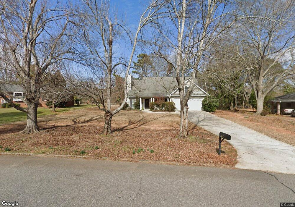
239 Forest Rd Athens, GA 30605
Green - Crestwood NeighborhoodEstimated Value: $313,000 - $349,154
3
Beds
2
Baths
1,561
Sq Ft
$217/Sq Ft
Est. Value
About This Home
This home is located at 239 Forest Rd, Athens, GA 30605 and is currently estimated at $338,289, approximately $216 per square foot. 239 Forest Rd is a home located in Clarke County with nearby schools including Barnett Shoals Elementary School, Hilsman Middle School, and Cedar Shoals High School.
Ownership History
Date
Name
Owned For
Owner Type
Purchase Details
Closed on
Jul 24, 2008
Sold by
Carter Development Corp
Bought by
Larson Colleen P
Current Estimated Value
Home Financials for this Owner
Home Financials are based on the most recent Mortgage that was taken out on this home.
Original Mortgage
$116,000
Outstanding Balance
$75,869
Interest Rate
6.43%
Mortgage Type
New Conventional
Estimated Equity
$262,420
Purchase Details
Closed on
Sep 21, 2006
Sold by
Not Provided
Bought by
Larson Colleen P
Create a Home Valuation Report for This Property
The Home Valuation Report is an in-depth analysis detailing your home's value as well as a comparison with similar homes in the area
Home Values in the Area
Average Home Value in this Area
Purchase History
| Date | Buyer | Sale Price | Title Company |
|---|---|---|---|
| Larson Colleen P | $146,000 | -- | |
| Larson Colleen P | $28,000 | -- |
Source: Public Records
Mortgage History
| Date | Status | Borrower | Loan Amount |
|---|---|---|---|
| Open | Larson Colleen P | $116,000 |
Source: Public Records
Tax History
| Year | Tax Paid | Tax Assessment Tax Assessment Total Assessment is a certain percentage of the fair market value that is determined by local assessors to be the total taxable value of land and additions on the property. | Land | Improvement |
|---|---|---|---|---|
| 2025 | $3,797 | $140,633 | $14,000 | $126,633 |
| 2024 | $3,797 | $134,457 | $14,000 | $120,457 |
| 2023 | $2,744 | $122,794 | $14,000 | $108,794 |
| 2022 | $3,185 | $109,853 | $14,000 | $95,853 |
| 2021 | $2,742 | $91,370 | $13,000 | $78,370 |
| 2020 | $2,515 | $84,634 | $13,000 | $71,634 |
| 2019 | $2,318 | $78,268 | $12,000 | $66,268 |
| 2018 | $2,057 | $70,602 | $12,000 | $58,602 |
| 2017 | $1,823 | $63,698 | $12,000 | $51,698 |
| 2016 | $1,702 | $60,121 | $12,000 | $48,121 |
| 2015 | $1,689 | $59,658 | $12,000 | $47,658 |
| 2014 | $1,703 | $59,978 | $12,000 | $47,978 |
Source: Public Records
Map
Nearby Homes
- 352 Greencrest Dr
- 331 Greencrest Dr
- 150 Rumson Rd
- 189 Ashbrook Dr
- 2535 Barnett Shoals Rd
- 256 Scandia Cir
- 337 Georgetown Dr
- 140 Ashbrook Dr
- 100 Ansonborough Ln
- 100 Ansonborough Ln Unit 703
- 100 Ansonborough Ln Unit 403
- 100 Ansonborough Ln Unit 601
- 29 N Stratford Dr
- 625 Forest Rd
- 42 N Stratford Dr
- 1305 Cedar Shoals Dr Unit 500
- 431 College Cir
- 345 Research Dr Unit 440
- 345 Research Dr Unit 330
- 345 Research Dr Unit 220
- 235 Forest Rd
- 245 Forest Rd
- 120 Lavista Place
- 130 Lavista Place
- 240 Forest Rd
- 255 Forest Rd
- 225 Forest Rd
- 210 Forest Rd
- 385 Greencrest Dr
- 375 Greencrest Dr
- 260 Forest Rd
- 110 Lavista Place
- 289 Forest Rd
- 395 Greencrest Dr
- 371 Greencrest Dr
- 365 Greencrest Dr
- 270 Forest Rd
- 291 Forest Rd
- 105 Lavista Place
- 145 Lavista Place
Your Personal Tour Guide
Ask me questions while you tour the home.