M
Seller's Agent in 2025
Mitchell McElwee
Levy Realty Group
(570) 636-7160
1 in this area
38 Total Sales


Estimated Value: $203,000 - $238,000
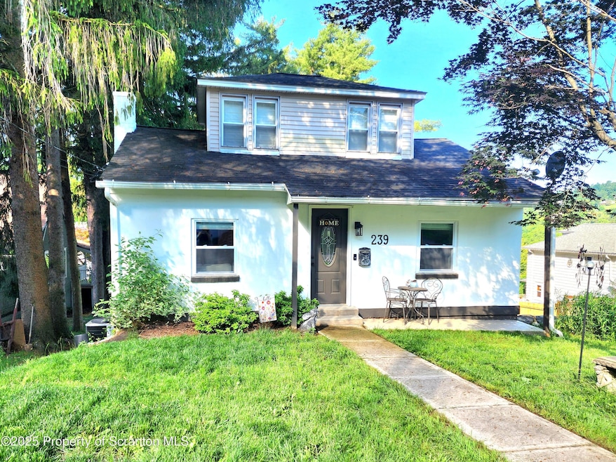
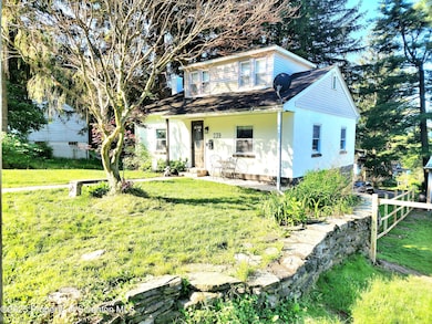
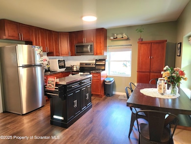
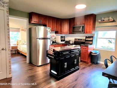
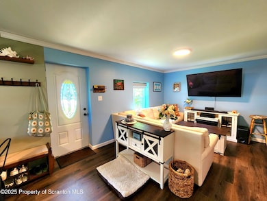
This pristinely kept, fully renovated beauty may be just the home you are looking for. Need a bedroom on the main floor? This home has it! Looking for a private office or bedroom that shares no common walls? This home has an entire second floor with just one bedroom or office space measuring 15 x 11. Still not convinced? The finished lower level has an additional bedroom, bonus room, sitting room, AND a half bath to really spread your wings! Top that off with all new in 2023 windows, electric, plumbing, appliances, gas hot water heater. Last but never least it has central AC and a private driveway for off-street parking! Reach out to your favorite Realtor and schedule your appointment today!
Last Agent to Sell the Property
Levy Realty Group License #RS352777 Listed on: 06/26/2025
Last Buyer's Agent
NON MEMBER
NON MEMBER
| Date | Buyer | Sale Price | Title Company |
|---|---|---|---|
| Zapotek Wyatt Garry | $215,000 | None Listed On Document | |
| Edwards Matthew | $200,000 | None Listed On Document | |
| Asmolot Holdings Llc | $42,000 | -- | |
| Rutkin Edward | $8,300 | -- |
| Date | Status | Borrower | Loan Amount |
|---|---|---|---|
| Open | Zapotek Wyatt Garry | $204,250 | |
| Previous Owner | Edwards Matthew | $202,020 |
| Date | Event | Price | List to Sale | Price per Sq Ft |
|---|---|---|---|---|
| 10/31/2025 10/31/25 | Sold | $215,000 | -4.4% | $173 / Sq Ft |
| 10/02/2025 10/02/25 | Pending | -- | -- | -- |
| 07/18/2025 07/18/25 | Price Changed | $225,000 | -2.2% | $181 / Sq Ft |
| 06/26/2025 06/26/25 | For Sale | $230,000 | -- | $185 / Sq Ft |
| Year | Tax Paid | Tax Assessment Tax Assessment Total Assessment is a certain percentage of the fair market value that is determined by local assessors to be the total taxable value of land and additions on the property. | Land | Improvement |
|---|---|---|---|---|
| 2026 | $1,945 | $84,800 | $17,400 | $67,400 |
| 2025 | $1,836 | $84,800 | $17,400 | $67,400 |
| 2024 | $1,780 | $84,800 | $17,400 | $67,400 |
| 2023 | $1,780 | $84,800 | $17,400 | $67,400 |
| 2022 | $1,764 | $84,800 | $17,400 | $67,400 |
| 2021 | $1,764 | $84,800 | $17,400 | $67,400 |
| 2020 | $1,764 | $84,800 | $17,400 | $67,400 |
| 2019 | $1,748 | $84,800 | $17,400 | $67,400 |
| 2018 | $1,731 | $84,800 | $17,400 | $67,400 |
| 2017 | $1,706 | $84,800 | $17,400 | $67,400 |
| 2016 | -- | $84,800 | $17,400 | $67,400 |
| 2015 | $1,353 | $84,800 | $17,400 | $67,400 |
| 2014 | $1,353 | $84,800 | $17,400 | $67,400 |
M
Seller's Agent in 2025
Mitchell McElwee
Levy Realty Group
(570) 636-7160
1 in this area
38 Total Sales
N
Buyer's Agent in 2025
NON MEMBER
NON MEMBER
Source: Greater Scranton Board of REALTORS®
MLS Number: GSBSC253104
APN: 35-F9S5-003-005-000
Disclaimer: Certain information contained herein is derived from information provided by parties other than Homes.com. All information provided is deemed reliable, but is not guaranteed to be accurate and should be independently verified.
![]() Based on information submitted to the MLS GRID. All data is obtained from various sources and may not have been verified by broker or MLS GRID. Supplied Open House Information is subject to change without notice. All information should be independently reviewed and verified for accuracy. Properties may or may not be listed by the office/agent presenting the information. Some IDX listings have been excluded from this website. Information provided by the Greater Scranton Board of REALTORS® MLS. Information is for consumer’s personal noncommercial use, and may not be used for any purpose other than identifying properties which consumers may be interested in purchasing. Consult the specific municipality for permitted Zoning uses.
Based on information submitted to the MLS GRID. All data is obtained from various sources and may not have been verified by broker or MLS GRID. Supplied Open House Information is subject to change without notice. All information should be independently reviewed and verified for accuracy. Properties may or may not be listed by the office/agent presenting the information. Some IDX listings have been excluded from this website. Information provided by the Greater Scranton Board of REALTORS® MLS. Information is for consumer’s personal noncommercial use, and may not be used for any purpose other than identifying properties which consumers may be interested in purchasing. Consult the specific municipality for permitted Zoning uses.
Based on information submitted to the MLS GRID
Ask me questions while you tour the home.
