C
Seller's Agent in 2025
CAITLYN CODY
RED ROCK REAL ESTATE
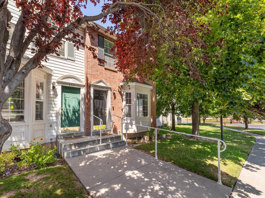
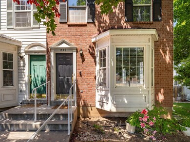
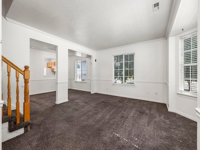
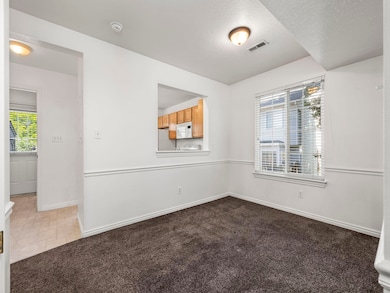
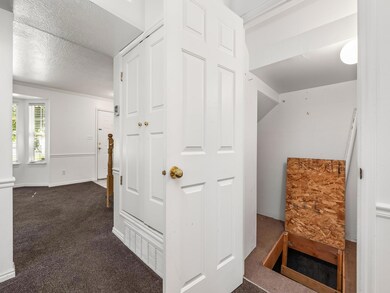
Welcome to this charming end-unit townhome, effortlessly combining location, lifestyle, and value. Ideally situated in a peaceful community, enjoy the convenience of nearby schools, shopping, dining, and parks - all just minutes away. Amenities offered also include gated RV parking, a community playground, and snow removal. Mature trees provide shade and privacy, and a private background patio for entertaining, with an additional open grass space behind - ideal for relaxation and play!
Last Agent to Sell the Property
CAITLYN CODY
RED ROCK REAL ESTATE License #9471107-SA Listed on: 07/02/2025

Last Buyer's Agent
NON BOARD AGENT
NON MLS OFFICE
| Date | Type | Sale Price | Title Company |
|---|---|---|---|
| Warranty Deed | -- | Novation Title | |
| Warranty Deed | -- | Stewart Title | |
| Quit Claim Deed | -- | None Listed On Document | |
| Quit Claim Deed | -- | None Listed On Document | |
| Warranty Deed | -- | First American Title Co | |
| Warranty Deed | -- | None Available | |
| Warranty Deed | -- | Backman Title Services Ltd | |
| Warranty Deed | -- | First American Title Co | |
| Warranty Deed | -- | First American Title Co | |
| Warranty Deed | -- | First American Title Co | |
| Warranty Deed | -- | First American Title Ins Co | |
| Warranty Deed | -- | First American Title |
| Date | Status | Loan Amount | Loan Type |
|---|---|---|---|
| Open | $210,000 | New Conventional | |
| Previous Owner | $10,000 | No Value Available | |
| Previous Owner | $96,000 | No Value Available | |
| Previous Owner | $99,000 | No Value Available | |
| Previous Owner | $98,671 | No Value Available |
| Date | Event | Price | List to Sale | Price per Sq Ft |
|---|---|---|---|---|
| 07/29/2025 07/29/25 | Sold | -- | -- | -- |
| 07/10/2025 07/10/25 | Pending | -- | -- | -- |
| 07/02/2025 07/02/25 | For Sale | $299,900 | -- | $231 / Sq Ft |
| Year | Tax Paid | Tax Assessment Tax Assessment Total Assessment is a certain percentage of the fair market value that is determined by local assessors to be the total taxable value of land and additions on the property. | Land | Improvement |
|---|---|---|---|---|
| 2025 | $1,722 | $173,635 | -- | -- |
| 2024 | $1,629 | $177,540 | $0 | $0 |
| 2023 | $1,629 | $168,080 | $0 | $0 |
| 2022 | $1,625 | $164,450 | $0 | $0 |
| 2021 | $1,388 | $224,800 | $33,700 | $191,100 |
| 2020 | $1,327 | $208,900 | $31,300 | $177,600 |
| 2019 | $1,129 | $187,000 | $24,000 | $163,000 |
| 2018 | $1,062 | $170,000 | $21,000 | $149,000 |
| 2017 | $984 | $84,700 | $0 | $0 |
| 2016 | $0 | $77,000 | $0 | $0 |
| 2015 | -- | $69,300 | $0 | $0 |
| 2014 | -- | $61,710 | $0 | $0 |
C
Seller's Agent in 2025
CAITLYN CODY
RED ROCK REAL ESTATE
N
Buyer's Agent in 2025
NON BOARD AGENT
NON MLS OFFICE
Source: Washington County Board of REALTORS®
MLS Number: 25-262786
APN: 52-672-0085
Disclaimer: Certain information contained herein is derived from information provided by parties other than Homes.com. All information provided is deemed reliable, but is not guaranteed to be accurate and should be independently verified.
![]() All information should be verified by the recipient and none is guaranteed as accurate by ARMLS
All information should be verified by the recipient and none is guaranteed as accurate by ARMLS
Listing Information presented by local MLS brokerage: Ten-X, local REALTOR®- Arlene Richardson - (888)-952-6393
Ask me questions while you tour the home.