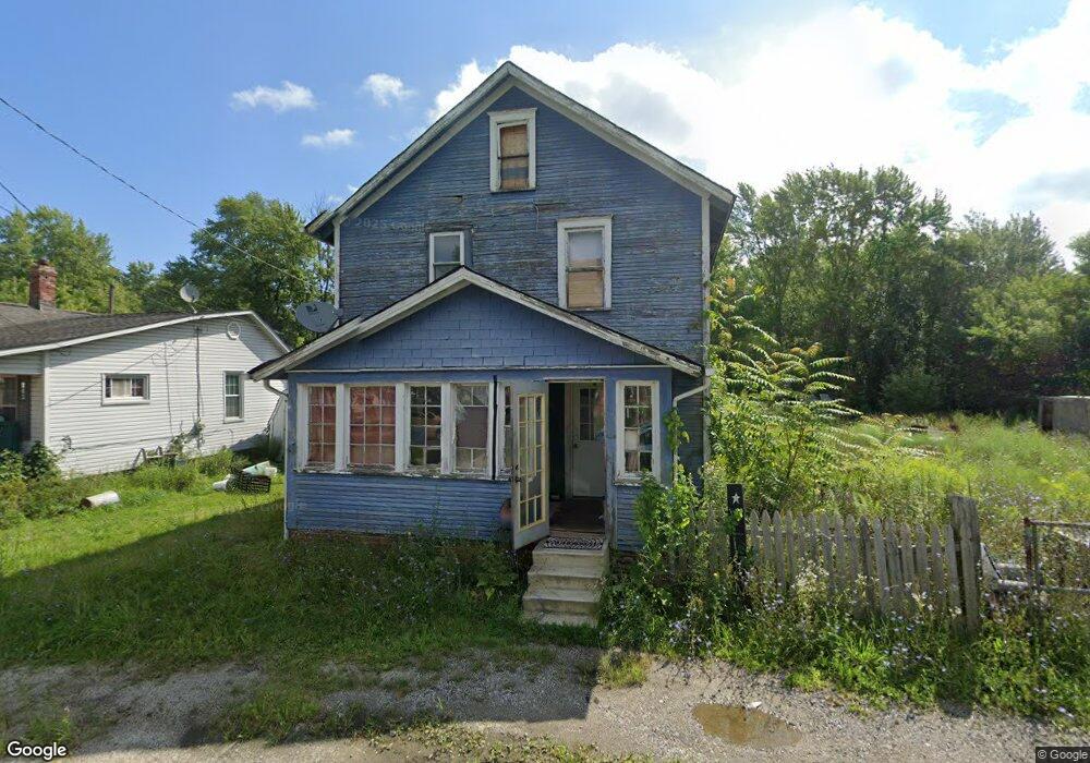
239 N Mahoning Ave Alliance, OH 44601
Alliance AreaEstimated Value: $66,794 - $131,000
About This Home
This home is located at 239 N Mahoning Ave, Alliance, OH 44601 and is currently estimated at $95,949, approximately $59 per square foot. 239 N Mahoning Ave is a home located in Mahoning County with nearby schools including Alliance Early Learning School, Alliance Intermediate School at Northside, and Alliance Middle School.
Ownership History
We collect this data history from publicly available records. To have your information removed, we recommend requesting removal directly through your county’s website.
Purchase Details
Purchase Details
Purchase Details
Purchase Details
Purchase History
We collect this data history from publicly available records. To have your information removed, we recommend requesting removal directly through your county’s website.
| Date | Buyer | Sale Price | Title Company |
|---|---|---|---|
| -- | None Available | ||
| -- | Attorney | ||
| -- | None Available | ||
| -- | -- |
Tax History
We collect this data history from publicly available records. To have your information removed, we recommend requesting removal directly through your county’s website.
| Year | Tax Paid | Tax Assessment Tax Assessment Total Assessment is a certain percentage of the fair market value that is determined by local assessors to be the total taxable value of land and additions on the property. | Land | Improvement |
|---|---|---|---|---|
| 2025 | $149 | $3,620 | $780 | $2,840 |
| 2024 | $149 | $3,620 | $780 | $2,840 |
| 2023 | $155 | $3,620 | $780 | $2,840 |
| 2022 | $132 | $2,950 | $610 | $2,340 |
| 2021 | $132 | $2,950 | $610 | $2,340 |
| 2020 | $137 | $2,950 | $610 | $2,340 |
| 2019 | $126 | $2,580 | $610 | $1,970 |
| 2018 | $159 | $2,580 | $610 | $1,970 |
| 2017 | $129 | $2,580 | $610 | $1,970 |
| 2016 | $124 | $2,360 | $610 | $1,750 |
| 2015 | $128 | $2,360 | $610 | $1,750 |
| 2014 | $3 | $2,360 | $610 | $1,750 |
| 2013 | $3 | $2,360 | $610 | $1,750 |
Map
- 90 N Mahoning Ave
- 445 Oak Ave
- 1031 Pike St
- 847 E Patterson St
- 16251 River St NE
- 000 Lexington Rd
- 442 S Liberty Ave
- 955 E Summit St
- 766 E Summit St
- 440 S Freedom Ave
- 15832 Waverly St NE
- 246 N Mechanic Ave
- 452 E Summit St
- 1033 Walnut Ave
- 244 N Park Ave
- 223 E Oxford St
- 900 S Seneca Ave
- 22177 Alden Ave
- 1035 Auld St
- 1150 Forest Ave
- 263 N Mahoning Ave
- 303 N Mahoning Ave
- 1450 Noble St
- 305 N Mahoning Ave
- 1440 Noble St
- 317 N Mahoning Ave
- 1430 Noble St
- 1420 Noble St
- 1413 Noble St
- 13416 Stanley Ave
- 1416 E Patterson St
- 22850 Alliance Sebring Rd
- 22860 Alliance-Sebring Rd
- 1414 E Patterson St
- 1410 Noble St
- 1404 Noble St
- 1410 E Patterson St
- 1481 Pike St
- 1463 Pike St
- 22840 Alliance Sebring Rd
Ask me questions while you tour the home.