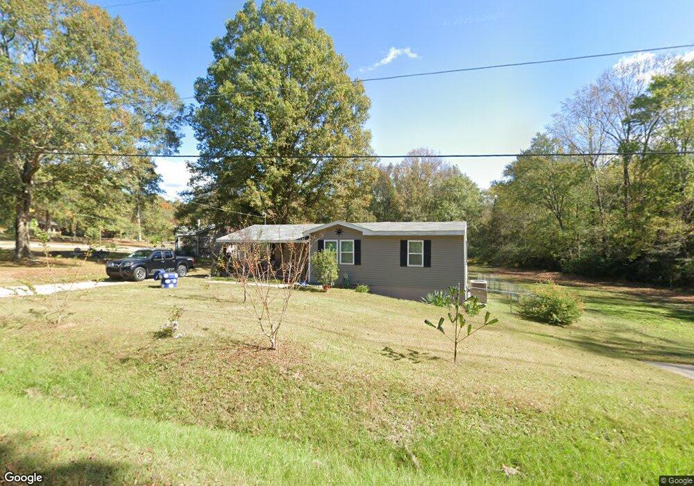
239 Overbrook Dr Lagrange, GA 30240
Estimated Value: $78,000 - $169,000
1
Bed
1
Bath
908
Sq Ft
$145/Sq Ft
Est. Value
About This Home
This home is located at 239 Overbrook Dr, Lagrange, GA 30240 and is currently estimated at $131,564, approximately $144 per square foot. 239 Overbrook Dr is a home located in Troup County with nearby schools including Berta Weathersbee Elementary School, Long Cane Elementary School, and Whitesville Road Elementary School.
Ownership History
Date
Name
Owned For
Owner Type
Purchase Details
Closed on
Apr 10, 2011
Sold by
Meadows James C
Bought by
Lester Richard S
Current Estimated Value
Purchase Details
Closed on
Feb 3, 2003
Sold by
Lisa D Meadows
Bought by
Meadows James C
Purchase Details
Closed on
Mar 9, 1998
Sold by
James C Meadows
Bought by
Lisa D Meadows
Purchase Details
Closed on
Sep 9, 1983
Sold by
Larue Merna Yearwood and Larue Roger L
Bought by
James C Meadows
Purchase Details
Closed on
Sep 1, 1982
Sold by
Yearwood
Bought by
Larue Merna Yearwood and Larue Roger L
Purchase Details
Closed on
Jan 1, 1972
Bought by
Yearwood
Purchase Details
Closed on
Jan 1, 1968
Sold by
Taunton Mack and Taunton Evelyn B
Create a Home Valuation Report for This Property
The Home Valuation Report is an in-depth analysis detailing your home's value as well as a comparison with similar homes in the area
Purchase History
| Date | Buyer | Sale Price | Title Company |
|---|---|---|---|
| Lester Richard S | -- | -- | |
| Meadows James C | -- | -- | |
| Lisa D Meadows | -- | -- | |
| James C Meadows | -- | -- | |
| Larue Merna Yearwood | -- | -- | |
| Yearwood | -- | -- | |
| -- | -- | -- |
Source: Public Records
Tax History
| Year | Tax Paid | Tax Assessment Tax Assessment Total Assessment is a certain percentage of the fair market value that is determined by local assessors to be the total taxable value of land and additions on the property. | Land | Improvement |
|---|---|---|---|---|
| 2025 | $1,079 | $39,560 | $8,000 | $31,560 |
| 2024 | $858 | $31,452 | $8,000 | $23,452 |
| 2023 | $859 | $2,928 | $0 | $2,928 |
| 2022 | $819 | $29,352 | $8,000 | $21,352 |
| 2021 | $881 | $29,204 | $8,000 | $21,204 |
| 2020 | $881 | $29,204 | $8,000 | $21,204 |
| 2019 | $441 | $14,628 | $2,508 | $12,120 |
| 2018 | $456 | $15,132 | $2,508 | $12,624 |
| 2017 | $456 | $15,132 | $2,508 | $12,624 |
| 2016 | $447 | $14,807 | $2,508 | $12,299 |
| 2015 | $447 | $14,807 | $2,508 | $12,299 |
| 2014 | $428 | $14,160 | $2,508 | $11,652 |
| 2013 | -- | $14,905 | $2,508 | $12,397 |
Source: Public Records
Map
Nearby Homes
- 0 Bradfield Dr Unit 10568803
- 8 Horace Carter Rd
- 427 Fling Rd
- 2239 Pegasus Pkwy
- 808 S Fling Rd
- 402 Ginger Cir
- 288 Bradfield Dr
- 509 Connie Dr
- 3 Reed Dr
- 22 Freeman Rd
- 0 Glass Bridge Rd Unit 10679358
- 0 Unit 10514554
- 3009 Old West Point Rd
- 112 Foxdale Dr
- 336 Whitaker Rd
- 105 Redwood Dr
- 98 Hearn Rd
- 266 Glass Bridge Rd
- 117 Brookwood Dr
- 101 Crown St Unit LOT 5
- 12 Morton Dr
- 136 Morton Dr
- 209 Overbrook Dr
- 2688 W Point Rd
- 2654 West Point Rd
- 216 Overbrook Dr
- 29 Morton Dr
- 199 Overbrook Dr
- 0 Bradfield Dr Unit 8348693
- 0 Bradfield Dr Unit 8931502
- 0 Bradfield Dr Unit 7.52 Ac 8506083
- 2636 West Point Rd
- 236 Overbrook Dr
- 200 Overbrook Dr
- 2700 W Point Rd
- 2700 West Point Rd
- 185 Overbrook Dr
- 53 Horace Carter Rd
- 2610 West Point Rd
- 184 Overbrook Dr
Your Personal Tour Guide
Ask me questions while you tour the home.