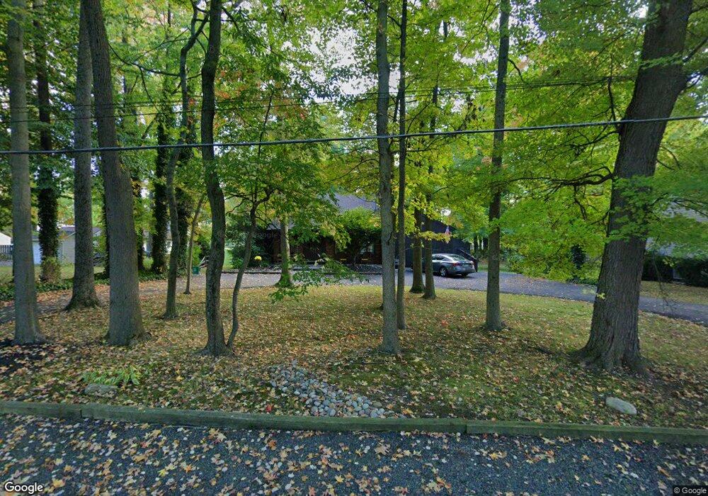
239 Roberts Ave Levittown, PA 19057
Estimated Value: $532,555 - $603,000
4
Beds
4
Baths
2,388
Sq Ft
$240/Sq Ft
Est. Value
About This Home
This home is located at 239 Roberts Ave, Levittown, PA 19057 and is currently estimated at $573,139, approximately $240 per square foot. 239 Roberts Ave is a home located in Bucks County with nearby schools including Albert Schweitzer Elementary School, Sandburg Middle School, and Neshaminy High School.
Ownership History
Date
Name
Owned For
Owner Type
Purchase Details
Closed on
Apr 24, 1998
Sold by
Manzo Maria
Bought by
Manzo C Michael and Manzo Maria
Current Estimated Value
Home Financials for this Owner
Home Financials are based on the most recent Mortgage that was taken out on this home.
Original Mortgage
$109,500
Outstanding Balance
$20,677
Interest Rate
7.04%
Estimated Equity
$552,462
Purchase Details
Closed on
Nov 28, 1983
Bought by
Manzo Maria
Create a Home Valuation Report for This Property
The Home Valuation Report is an in-depth analysis detailing your home's value as well as a comparison with similar homes in the area
Home Values in the Area
Average Home Value in this Area
Purchase History
| Date | Buyer | Sale Price | Title Company |
|---|---|---|---|
| Manzo C Michael | -- | -- | |
| Manzo Maria | -- | -- |
Source: Public Records
Mortgage History
| Date | Status | Borrower | Loan Amount |
|---|---|---|---|
| Open | Manzo C Michael | $109,500 |
Source: Public Records
Tax History Compared to Growth
Tax History
| Year | Tax Paid | Tax Assessment Tax Assessment Total Assessment is a certain percentage of the fair market value that is determined by local assessors to be the total taxable value of land and additions on the property. | Land | Improvement |
|---|---|---|---|---|
| 2025 | $6,559 | $30,130 | $5,560 | $24,570 |
| 2024 | $6,559 | $30,130 | $5,560 | $24,570 |
| 2023 | $6,455 | $30,130 | $5,560 | $24,570 |
| 2022 | $6,286 | $30,130 | $5,560 | $24,570 |
| 2021 | $6,286 | $30,130 | $5,560 | $24,570 |
| 2020 | $6,210 | $30,130 | $5,560 | $24,570 |
| 2019 | $6,072 | $30,130 | $5,560 | $24,570 |
| 2018 | $5,960 | $30,130 | $5,560 | $24,570 |
| 2017 | $5,808 | $30,130 | $5,560 | $24,570 |
| 2016 | $5,808 | $30,130 | $5,560 | $24,570 |
| 2015 | $5,998 | $30,130 | $5,560 | $24,570 |
| 2014 | $5,998 | $30,130 | $5,560 | $24,570 |
Source: Public Records
Map
Nearby Homes
- 212 Apple St
- 114 Nursery Ave
- 75 Flamehill Rd
- 88 Forsythia Dr N
- 65 Candle Rd
- 53 Crestwood Rd
- 23 Crystal Place
- 28 Rust Hill Rd
- 8 Haven Rd
- 6 Handy Rd
- 14 Cleft Rock Rd
- 33 Red Rose Way
- 479 Stanford Rd
- 225 Yorkshire Rd Unit HIII
- 43 Tweed Rd
- 14 Cinnamon Rd
- 14 Harp Rd
- 18 Harvest Rd
- 208 Suffolk Rd
- 283 Snowball Dr
- 249 Roberts Ave
- 215 Roberts Ave
- 1324 Centre St
- 238 Roberts Ave
- 250 Roberts Ave
- 262 Nursery Ave
- 1336 Centre St
- 102 Forsythia Dr E
- 1246 Centre St
- 96 Forsythia Dr E
- 260 Roberts Ave
- 250 Nursery Ave
- 1348 Centre St
- 90 Forsythia Dr E
- 1236 Centre St
- 106 Forsythia Dr E
- 82 Forsythia Dr E
- 237 Apple St
- 179 Forsythia Dr N
- 235 Apple St