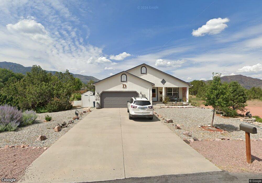
239 Savage Loop Cañon City, CO 81212
Estimated Value: $507,000 - $531,000
4
Beds
3
Baths
3,003
Sq Ft
$173/Sq Ft
Est. Value
About This Home
This home is located at 239 Savage Loop, Cañon City, CO 81212 and is currently estimated at $519,482, approximately $172 per square foot. 239 Savage Loop is a home located in Fremont County with nearby schools including Lincoln School of Science & Technology, Canon City Middle School, and Canon City High School.
Ownership History
Date
Name
Owned For
Owner Type
Purchase Details
Closed on
Nov 15, 2022
Sold by
Dann Dolven
Bought by
Dann Dolven and Pagels Donnell
Current Estimated Value
Purchase Details
Closed on
May 2, 2016
Sold by
Carter Phillip E and Carter Loretta M
Bought by
Dolven Robert D and Dolven D
Purchase Details
Closed on
Aug 12, 2005
Sold by
Letterhos Steven E
Bought by
Carter Phillip E and Carter Loretta M
Purchase Details
Closed on
Jun 2, 2003
Sold by
Abbott Wendi C
Bought by
Letterhos Steven E
Purchase Details
Closed on
May 22, 2000
Sold by
Oakwood Building & Development Co
Bought by
Abbott
Purchase Details
Closed on
Apr 23, 1999
Sold by
Tezak
Bought by
Oakwood Building & Development Co
Create a Home Valuation Report for This Property
The Home Valuation Report is an in-depth analysis detailing your home's value as well as a comparison with similar homes in the area
Home Values in the Area
Average Home Value in this Area
Purchase History
| Date | Buyer | Sale Price | Title Company |
|---|---|---|---|
| Dann Dolven | -- | None Listed On Document | |
| Dolven Robert D | $250,000 | Stewart Title | |
| Carter Phillip E | $200,000 | Stewart Title | |
| Letterhos Steven E | $176,500 | -- | |
| Abbott | $153,000 | -- | |
| Oakwood Building & Development Co | $41,500 | -- |
Source: Public Records
Tax History Compared to Growth
Tax History
| Year | Tax Paid | Tax Assessment Tax Assessment Total Assessment is a certain percentage of the fair market value that is determined by local assessors to be the total taxable value of land and additions on the property. | Land | Improvement |
|---|---|---|---|---|
| 2024 | $2,149 | $27,946 | $0 | $0 |
| 2023 | $2,149 | $24,261 | $0 | $0 |
| 2022 | $2,116 | $24,378 | $0 | $0 |
| 2021 | $2,121 | $25,080 | $0 | $0 |
| 2020 | $1,757 | $20,917 | $0 | $0 |
| 2019 | $1,735 | $20,917 | $0 | $0 |
| 2018 | $1,532 | $18,014 | $0 | $0 |
| 2017 | $1,427 | $18,014 | $0 | $0 |
| 2016 | $1,308 | $17,880 | $0 | $0 |
| 2015 | $1,306 | $17,880 | $0 | $0 |
| 2012 | $1,282 | $18,406 | $3,980 | $14,426 |
Source: Public Records
Map
Nearby Homes
- 207 Savage Loop
- 265 Pelage Ct
- 200 Wolf Cub Trail
- 206 Wolf Cub Trail
- TBD Forge Rd
- 1751 Forge Rd
- 133 Blue Grouse Dr
- 121 Mourning Dove Dr
- 29 Kyndra Ct
- 159 Blue Grouse Dr
- 98 Wild Rose Dr
- TBD Wild Rose Dr
- 58 Wild Rose Dr
- 105 Bobwhite Loop
- 123 Wild Rose Dr
- 147 Mourning Dove Dr
- 46 Wild Rose Dr
- 34 Wild Rose Dr
- 311 Bellows Ct
- 225 Savage Loop
- 245 Wolf Cub Trail
- 251 Pelage Ct
- 207 Savage Loop Unit 73
- 239 Wolf Cub Trail
- 255 Savage Loop
- 193 Savage Loop
- 244 Wolf Cub Trail
- 231 Wolf Cub Trail
- 254 Pelage Ct
- 257 Pelage Ct
- 204 Savage Loop
- 204 Savage Loop Unit 66
- 236 Wolf Cub Trail
- 269 Savage Loop
- 182 Savage Loop
- 179 Savage Loop
- 41 Luna Ct
- 228 Wolf Cub Trail
- 183 Wolf Cub Trail