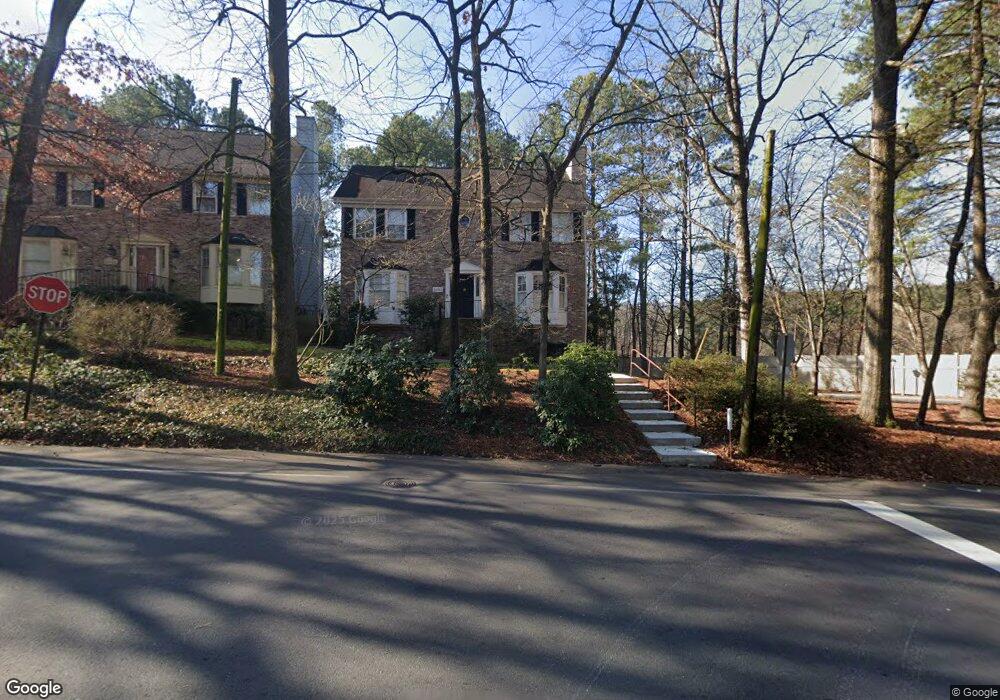
2392 Defoors Ferry Rd NW Atlanta, GA 30318
Underwood Hills NeighborhoodEstimated Value: $635,645 - $922,000
4
Beds
4
Baths
2,150
Sq Ft
$333/Sq Ft
Est. Value
About This Home
This home is located at 2392 Defoors Ferry Rd NW, Atlanta, GA 30318 and is currently estimated at $715,911, approximately $332 per square foot. 2392 Defoors Ferry Rd NW is a home located in Fulton County with nearby schools including Brandon Elementary School, Sutton Middle School, and North Atlanta High School.
Ownership History
Date
Name
Owned For
Owner Type
Purchase Details
Closed on
Mar 19, 2021
Sold by
Loonam Christopher M
Bought by
Loonam Christopher M and Loonam Erin Elizabeth
Current Estimated Value
Home Financials for this Owner
Home Financials are based on the most recent Mortgage that was taken out on this home.
Original Mortgage
$191,130
Outstanding Balance
$139,147
Interest Rate
2.8%
Mortgage Type
New Conventional
Estimated Equity
$576,764
Purchase Details
Closed on
Aug 5, 2008
Sold by
Shannon Penelope B
Bought by
Loonam Christopher M
Home Financials for this Owner
Home Financials are based on the most recent Mortgage that was taken out on this home.
Original Mortgage
$248,000
Interest Rate
6.43%
Mortgage Type
New Conventional
Create a Home Valuation Report for This Property
The Home Valuation Report is an in-depth analysis detailing your home's value as well as a comparison with similar homes in the area
Home Values in the Area
Average Home Value in this Area
Purchase History
| Date | Buyer | Sale Price | Title Company |
|---|---|---|---|
| Loonam Christopher M | -- | -- | |
| Loonam Christopher M | $348,000 | -- |
Source: Public Records
Mortgage History
| Date | Status | Borrower | Loan Amount |
|---|---|---|---|
| Open | Loonam Christopher M | $191,130 | |
| Previous Owner | Loonam Christopher M | $248,000 |
Source: Public Records
Tax History Compared to Growth
Tax History
| Year | Tax Paid | Tax Assessment Tax Assessment Total Assessment is a certain percentage of the fair market value that is determined by local assessors to be the total taxable value of land and additions on the property. | Land | Improvement |
|---|---|---|---|---|
| 2025 | $4,718 | $197,560 | $73,360 | $124,200 |
| 2023 | $4,718 | $180,640 | $65,240 | $115,400 |
| 2022 | $4,840 | $185,040 | $66,080 | $118,960 |
| 2021 | $4,448 | $169,600 | $66,560 | $103,040 |
| 2020 | $4,143 | $156,000 | $54,200 | $101,800 |
| 2019 | $483 | $170,840 | $59,680 | $111,160 |
| 2018 | $4,113 | $130,480 | $30,000 | $100,480 |
| 2017 | $3,308 | $105,400 | $28,520 | $76,880 |
| 2016 | $3,317 | $105,400 | $28,520 | $76,880 |
| 2015 | $3,790 | $105,400 | $28,520 | $76,880 |
| 2014 | $3,469 | $105,400 | $28,520 | $76,880 |
Source: Public Records
Map
Nearby Homes
- 2316 Defoors Ferry Rd NW
- 5 George Wythe Place NW
- 4 Paper Mill Place NW
- 13 Independence Place NW
- 1529 Liberty Pkwy NW
- 1529 Liberty Pkwy NW Unit 2314
- 2556 Defoors Ferry Rd NW
- 1649 Liberty Pkwy NW
- 1488 Liberty Pkwy NW
- 1384 Liberty Pkwy NW
- 1689 Liberty Pkwy NW
- 3015 Liberty Way NW
- 3030 Liberty Way NW
- 1305 Liberty Pkwy NW
- 3039 Liberty Way NW
- 1109 Rivard Cir NW
- 1732 Liberty Pkwy NW
- 2038 Liberty Ct NW
- 2388 Defoors Ferry Rd NW
- 2392 Hyde Manor Dr NW
- 2380 Defoors Ferry Rd NW
- 2395 Hyde Manor Dr NW
- 2376 Defoors Ferry Rd NW
- 0 Defoors Ferry Rd NW Unit 8716775
- 0 Defoors Ferry Rd NW Unit 8688142
- 0 Defoors Ferry Rd NW Unit 8686758
- 0 Defoors Ferry Rd NW Unit 8659065
- 0 Defoors Ferry Rd NW Unit 8598670
- 0 Defoors Ferry Rd NW Unit 8569188
- 0 Defoors Ferry Rd NW Unit 8507778
- 0 Defoors Ferry Rd NW Unit 8474912
- 0 Defoors Ferry Rd NW Unit 8637582
- 0 Defoors Ferry Rd NW Unit 8274042
- 0 Defoors Ferry Rd NW Unit 8923189
- 0 Defoors Ferry Rd NW Unit 8538011
- 0 Defoors Ferry Rd NW Unit 8159290
- 0 Defoors Ferry Rd NW Unit 9003141
- 0 Defoors Ferry Rd NW Unit 9020609