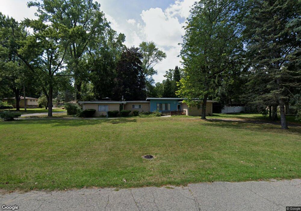
23929 Philip Dr Southfield, MI 48075
Estimated Value: $246,870 - $272,000
3
Beds
2
Baths
1,622
Sq Ft
$160/Sq Ft
Est. Value
About This Home
This home is located at 23929 Philip Dr, Southfield, MI 48075 and is currently estimated at $260,218, approximately $160 per square foot. 23929 Philip Dr is a home located in Oakland County with nearby schools including Morris Adler Elementary School, Glenn W. Levey Middle School, and Dr. Joseph F. Pollack Academic Center Of Excellence.
Ownership History
Date
Name
Owned For
Owner Type
Purchase Details
Closed on
Apr 16, 2013
Sold by
First Third Llc
Bought by
Edwards Lorine
Current Estimated Value
Purchase Details
Closed on
Jul 23, 2009
Sold by
Edwards Latrina
Bought by
Edwards Lorine
Purchase Details
Closed on
Jul 8, 2008
Sold by
Rhodes Guy D
Bought by
Federal National Mortgage Association
Purchase Details
Closed on
May 10, 2006
Sold by
Rhodes Guy D and Rhodes Phyllis M
Bought by
Rhodes Guy D
Home Financials for this Owner
Home Financials are based on the most recent Mortgage that was taken out on this home.
Original Mortgage
$129,500
Interest Rate
6.56%
Mortgage Type
Stand Alone Refi Refinance Of Original Loan
Create a Home Valuation Report for This Property
The Home Valuation Report is an in-depth analysis detailing your home's value as well as a comparison with similar homes in the area
Home Values in the Area
Average Home Value in this Area
Purchase History
| Date | Buyer | Sale Price | Title Company |
|---|---|---|---|
| Edwards Lorine | -- | Progressive Title | |
| Edwards Lorine | -- | None Available | |
| Federal National Mortgage Association | $131,769 | None Available | |
| Rhodes Guy D | -- | None Available |
Source: Public Records
Mortgage History
| Date | Status | Borrower | Loan Amount |
|---|---|---|---|
| Previous Owner | Rhodes Guy D | $129,500 |
Source: Public Records
Tax History Compared to Growth
Tax History
| Year | Tax Paid | Tax Assessment Tax Assessment Total Assessment is a certain percentage of the fair market value that is determined by local assessors to be the total taxable value of land and additions on the property. | Land | Improvement |
|---|---|---|---|---|
| 2022 | $3,081 | $82,790 | $16,730 | $66,060 |
| 2021 | $3,775 | $79,820 | $17,600 | $62,220 |
| 2020 | $2,560 | $65,950 | $15,090 | $50,860 |
| 2018 | $2,872 | $52,180 | $15,090 | $37,090 |
| 2015 | -- | $40,310 | $0 | $0 |
| 2014 | -- | $35,550 | $0 | $0 |
| 2011 | -- | $38,530 | $0 | $0 |
Source: Public Records
Map
Nearby Homes
- 24139 Philip Dr
- 0000 W Nine Mile
- 24153 Evergreen Rd Unit 30
- 24393 Evergreen Rd
- 19633 Mahon St
- 19780 Mahon St
- 19910 Albany Ave
- 19880 Hazelhurst St
- 19171 Hilton Dr
- 18444 Addison Dr
- 17863 Bonstelle Ave
- 19368 Midway Rd
- 19680 Hilton Dr
- 19501 Jeanette St
- 17573 Mount Vernon St
- 19040 Jeanette St
- 19620 Jeanette St
- 24053 Lathrup Blvd
- 18656 Midway Ave
- 19490 Goldwin St
- 23955 Philip Dr
- 23625 Mapleridge Dr
- 23869 Philip Dr
- 23989 Philip Dr
- 23767 Mapleridge Dr
- 23626 Mapleridge Dr
- 23603 Mapleridge Dr
- 23950 Philip Dr
- 23600 Mapleridge Dr
- 24005 Philip Dr
- 23766 Mapleridge Dr
- 23841 Philip Dr
- 23990 Philip Dr
- 23809 Mapleridge Dr
- 23580 Mapleridge Dr
- 23946 Lee Baker Dr
- 24025 Philip Dr
- 23823 Philip Dr
- 24010 Philip Dr
- 23555 Mapleridge Dr