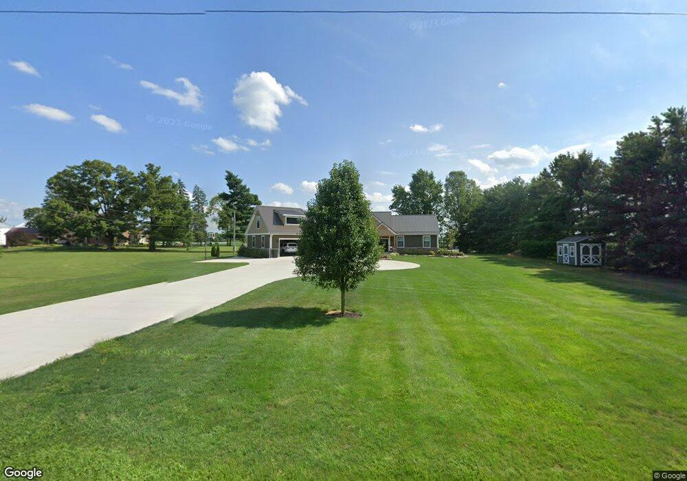
2395 Penry Rd Radnor, OH 43066
Estimated Value: $350,000 - $665,000
3
Beds
3
Baths
1,566
Sq Ft
$343/Sq Ft
Est. Value
About This Home
This home is located at 2395 Penry Rd, Radnor, OH 43066 and is currently estimated at $537,498, approximately $343 per square foot. 2395 Penry Rd is a home located in Delaware County with nearby schools including Buckeye Valley High School.
Ownership History
Date
Name
Owned For
Owner Type
Purchase Details
Closed on
Nov 27, 2013
Sold by
Scharf Patrick E and Scharf Gail E
Bought by
Douce Caleb A and Douce Jaime C
Current Estimated Value
Home Financials for this Owner
Home Financials are based on the most recent Mortgage that was taken out on this home.
Original Mortgage
$171,700
Outstanding Balance
$128,788
Interest Rate
4.3%
Mortgage Type
Future Advance Clause Open End Mortgage
Estimated Equity
$408,710
Purchase Details
Closed on
Aug 15, 2013
Sold by
Cloud Patricia J and Tackett Patricia J
Bought by
Scharf Patrick E and Scharf Gail E
Create a Home Valuation Report for This Property
The Home Valuation Report is an in-depth analysis detailing your home's value as well as a comparison with similar homes in the area
Home Values in the Area
Average Home Value in this Area
Purchase History
| Date | Buyer | Sale Price | Title Company |
|---|---|---|---|
| Douce Caleb A | $86,000 | Chicago Title Of Marion | |
| Scharf Patrick E | $155,000 | None Available |
Source: Public Records
Mortgage History
| Date | Status | Borrower | Loan Amount |
|---|---|---|---|
| Open | Douce Caleb A | $171,700 |
Source: Public Records
Tax History Compared to Growth
Tax History
| Year | Tax Paid | Tax Assessment Tax Assessment Total Assessment is a certain percentage of the fair market value that is determined by local assessors to be the total taxable value of land and additions on the property. | Land | Improvement |
|---|---|---|---|---|
| 2024 | $6,346 | $171,260 | $40,320 | $130,940 |
| 2023 | $5,915 | $171,260 | $40,320 | $130,940 |
| 2022 | $5,319 | $138,390 | $30,380 | $108,010 |
| 2021 | $5,300 | $137,800 | $30,380 | $107,420 |
| 2020 | $5,174 | $133,740 | $30,380 | $103,360 |
| 2019 | $2,830 | $66,820 | $26,430 | $40,390 |
| 2018 | $2,872 | $66,820 | $26,430 | $40,390 |
| 2017 | $2,635 | $61,290 | $17,960 | $43,330 |
| 2016 | $2,464 | $61,290 | $17,960 | $43,330 |
| 2015 | $2,596 | $61,290 | $17,960 | $43,330 |
| 2014 | $2,447 | $61,290 | $17,960 | $43,330 |
| 2013 | $2,461 | $61,290 | $17,960 | $43,330 |
Source: Public Records
Map
Nearby Homes
- 2390 Penry Rd
- 3935 N Section Line Rd
- 2217 Radnor Rd
- 1859 State Route 257 N
- 541 Willey Rd
- 2310 Troy Rd
- 4093 State Route 257
- 1258 Hills Miller Rd
- 159 Marblewood Dr
- 3665 State Route 37 W
- 210 Glemsbury Dr
- 4518 State Route 257
- 2484 State Route 37 W
- 6412 Troy Rd
- 315 Timbersmith Dr
- 518 Lamplight Dr
- 82 Lantern Chase Dr
- 389 Garnet Ranch Dr
- 395 Garnet Ranch Dr
- 224 Overtrick Dr
- 1824 Penry Rd
- 2040 Penry Rd
- 2456 Penry Rd
- 2313 Penry Rd
- 2241 Penry Rd
- 2333 Penry Rd
- 3997 Penry Rd
- 3368 State Route 203
- 3414 State Route 203
- 3510 State Route 203
- 3499 State Route 203
- 3459 State Route 203
- 3547 State Route 203
- 4166 Dildine Rd
- 3601 State Route 203
- 3425 State Route 203
- 2920 State Route 203
- 2818 State Route 203
- 3866 State Route 203
- 2770 State Route 203