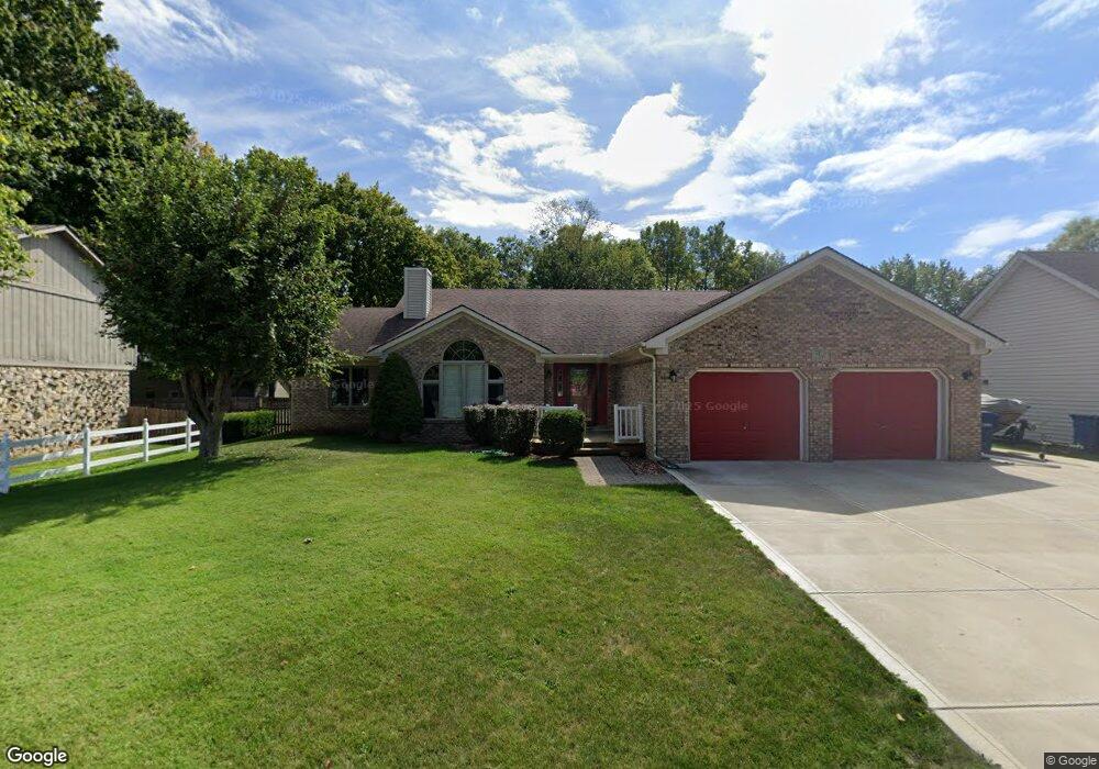
2397 Stringtown Pike Cicero, IN 46034
Estimated Value: $339,000 - $371,000
3
Beds
2
Baths
1,696
Sq Ft
$207/Sq Ft
Est. Value
About This Home
This home is located at 2397 Stringtown Pike, Cicero, IN 46034 and is currently estimated at $350,541, approximately $206 per square foot. 2397 Stringtown Pike is a home located in Hamilton County with nearby schools including Hamilton Heights Primary School, Hamilton Heights Elementary School, and Hamilton Heights Middle School.
Ownership History
Date
Name
Owned For
Owner Type
Purchase Details
Closed on
Jul 19, 2022
Sold by
Lawson Robert M and Lawson Jill A
Bought by
Robert M And Jill A Lawson Keystone Trust
Current Estimated Value
Purchase Details
Closed on
Jul 13, 2009
Sold by
Luczywo Jacqueline
Bought by
Lawson Robert M and Lawson Jill A
Home Financials for this Owner
Home Financials are based on the most recent Mortgage that was taken out on this home.
Original Mortgage
$32,000
Interest Rate
5.43%
Mortgage Type
Purchase Money Mortgage
Purchase Details
Closed on
May 15, 2007
Sold by
Luczywo Douglas and Luczywo Jacqueline
Bought by
Luczywo Jacqueline
Purchase Details
Closed on
Apr 12, 2005
Sold by
Shoemaker James D and Shoemaker Pollyanna
Bought by
Luczywo Douglas and Luczywo Jacqueline
Create a Home Valuation Report for This Property
The Home Valuation Report is an in-depth analysis detailing your home's value as well as a comparison with similar homes in the area
Home Values in the Area
Average Home Value in this Area
Purchase History
| Date | Buyer | Sale Price | Title Company |
|---|---|---|---|
| Robert M And Jill A Lawson Keystone Trust | -- | None Listed On Document | |
| Lawson Robert M | -- | Pinnacle Land Title Co Inc | |
| Luczywo Jacqueline | -- | None Available | |
| Luczywo Douglas | -- | -- |
Source: Public Records
Mortgage History
| Date | Status | Borrower | Loan Amount |
|---|---|---|---|
| Previous Owner | Lawson Robert M | $32,000 |
Source: Public Records
Tax History Compared to Growth
Tax History
| Year | Tax Paid | Tax Assessment Tax Assessment Total Assessment is a certain percentage of the fair market value that is determined by local assessors to be the total taxable value of land and additions on the property. | Land | Improvement |
|---|---|---|---|---|
| 2024 | $1,649 | $269,700 | $96,900 | $172,800 |
| 2023 | $1,649 | $256,600 | $96,900 | $159,700 |
| 2022 | $2,071 | $269,200 | $57,600 | $211,600 |
| 2021 | $1,486 | $219,200 | $57,600 | $161,600 |
| 2020 | $1,172 | $194,400 | $57,600 | $136,800 |
| 2019 | $1,287 | $180,500 | $25,100 | $155,400 |
| 2018 | $1,053 | $180,500 | $25,100 | $155,400 |
| 2017 | $768 | $163,500 | $25,100 | $138,400 |
| 2016 | $900 | $154,800 | $25,100 | $129,700 |
| 2014 | $712 | $139,400 | $27,100 | $112,300 |
| 2013 | $712 | $139,500 | $27,100 | $112,400 |
Source: Public Records
Map
Nearby Homes
- 2390 Lincoln Dr
- 2340 Lincoln Dr
- 1367 Sherman Cir
- 2628 Inlet Dr
- 1628 W Port Ct
- 73 Forest Hollow Dr
- 1940 Stringtown Pike
- 1209 Half Moon Ln
- 949 Nantucket Dr
- 1306 N Catamaran Cir
- 21529 Shorevista Ln
- 88 Cedar Ln
- 815 Morse Landing Dr
- 221 Common Loon Blvd
- 21450 Oakview Dr
- 826 N Lanyard Dr
- 130 Overston Ct
- 100 Confidential Dr
- 1180 Shoreline Cir
- 7161 Oakview Cir
- 2393 Stringtown Pike
- 2401 Stringtown Pike
- 1169 Grant Cir
- 1170 Grant Cir
- 2389 Stringtown Pike
- 2520 Lincoln Dr
- 2510 Lincoln Dr
- 1349 Gull Ct
- 2500 Lincoln Dr
- 2385 Stringtown Park
- 2385 Stringtown Pike
- 1147 Grant Cir
- 1150 Grant Cir
- 2490 Lincoln Dr
- 1369 Gull Ct
- 2480 Lincoln Dr
- 2373 Stringtown Pike
- 2420 Stringtown Pike
- 2470 Lincoln Dr
- 1389 Gull Ct