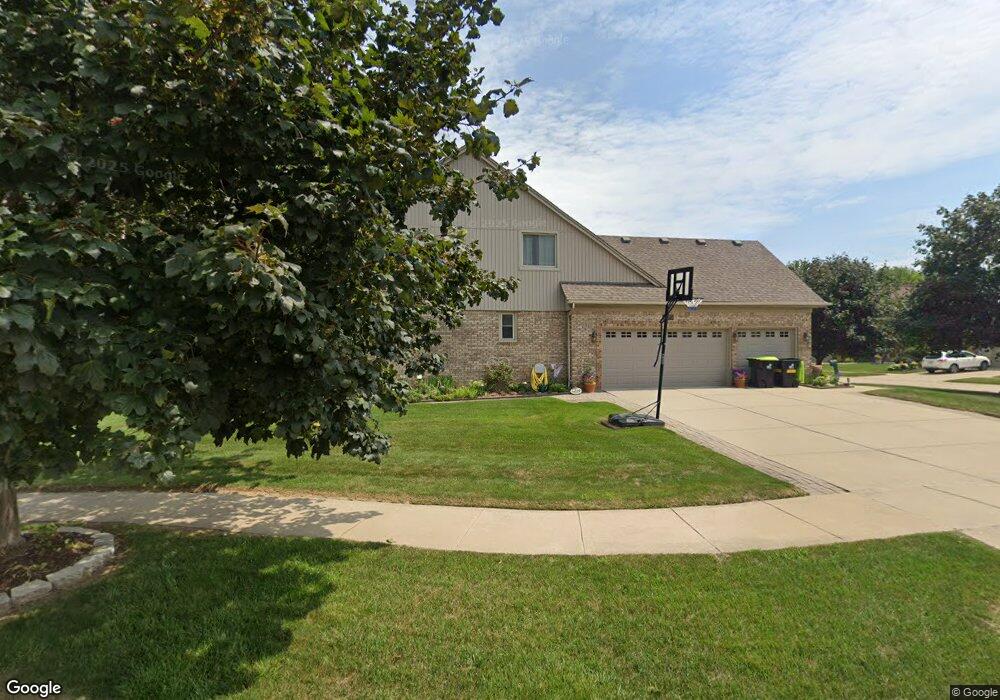
23975 Pointe Dr Macomb, MI 48042
Estimated Value: $398,000 - $426,000
Studio
1
Bath
2,106
Sq Ft
$193/Sq Ft
Est. Value
About This Home
This home is located at 23975 Pointe Dr, Macomb, MI 48042 and is currently estimated at $407,319, approximately $193 per square foot. 23975 Pointe Dr is a home located in Macomb County with nearby schools including Atwood Elementary School, L'Anse Creuse Middle School - North, and L'Anse Creuse High School - North.
Ownership History
Date
Name
Owned For
Owner Type
Purchase Details
Closed on
Sep 28, 2015
Sold by
Albert Walter B and Albert Susan M
Bought by
Albert Walter B and Revo Susan
Current Estimated Value
Purchase Details
Closed on
Oct 25, 2001
Sold by
Hurley Michael T
Bought by
Albert Walter B
Home Financials for this Owner
Home Financials are based on the most recent Mortgage that was taken out on this home.
Original Mortgage
$197,600
Outstanding Balance
$76,776
Interest Rate
6.64%
Mortgage Type
Purchase Money Mortgage
Estimated Equity
$330,543
Create a Home Valuation Report for This Property
The Home Valuation Report is an in-depth analysis detailing your home's value as well as a comparison with similar homes in the area
Home Values in the Area
Average Home Value in this Area
Purchase History
| Date | Buyer | Sale Price | Title Company |
|---|---|---|---|
| Albert Walter B | -- | Attorney | |
| Albert Walter B | $247,000 | -- |
Source: Public Records
Mortgage History
| Date | Status | Borrower | Loan Amount |
|---|---|---|---|
| Open | Albert Walter B | $197,600 |
Source: Public Records
Tax History
| Year | Tax Paid | Tax Assessment Tax Assessment Total Assessment is a certain percentage of the fair market value that is determined by local assessors to be the total taxable value of land and additions on the property. | Land | Improvement |
|---|---|---|---|---|
| 2025 | $2,884 | $191,300 | $0 | $0 |
| 2024 | $28 | $181,000 | $0 | $0 |
| 2023 | $2,659 | $173,000 | $0 | $0 |
| 2022 | $3,357 | $154,900 | $0 | $0 |
| 2021 | $3,267 | $144,600 | $0 | $0 |
| 2020 | $2,441 | $139,200 | $0 | $0 |
| 2019 | $3,015 | $131,000 | $0 | $0 |
| 2018 | $2,937 | $126,700 | $0 | $0 |
| 2017 | $2,892 | $121,530 | $34,500 | $87,030 |
| 2016 | $2,736 | $121,500 | $0 | $0 |
| 2015 | $2,701 | $117,540 | $0 | $0 |
| 2014 | $2,701 | $95,080 | $23,500 | $71,580 |
| 2013 | $4,101 | $95,080 | $0 | $0 |
Source: Public Records
Map
Nearby Homes
- 23856 Keyway Dr
- 24374 21 Mile Rd
- 46828 Scotch Pine Ln
- 47338 Hunters Chase Dr
- 23206 21 Mile Rd
- 23330 Duprey St
- 46290 Brentwood St
- 23944 Harrellson St
- 47846 North Ave
- 45945 N Gratiot Ave
- 6009 Gratiot Ave
- 0 Gratiot Ave
- 45729 N Gratiot Ave
- 23346 Spring Creek Dr
- 23075 Shepherd Ln
- 45215 Fairchild Rd
- 23424 Urban St
- 25591 Lord Dr
- 48736 Carnegie Way
- 45937 Duke Dr
- 23997 Pointe Dr
- 23953 Pointe Dr
- 24019 Pointe Dr
- 23930 21 Mile Rd
- 23896 Pointe Dr
- 0 Bay Point Ct Unit 213082815
- 0 Bay Point Ct Unit 214064297
- 23984 Pointe Dr
- 23931 Pointe Dr
- 23918 Pointe Dr
- 23962 Pointe Dr
- 24006 Pointe Dr
- 24041 Pointe Dr
- 23909 Pointe Dr
- 24028 Pointe Dr
- 23940 Pointe Dr
- 23887 Pointe Dr
- 46886 Ridgepointe Dr
- 24063 Pointe Dr
- 24050 Pointe Dr
Your Personal Tour Guide
Ask me questions while you tour the home.