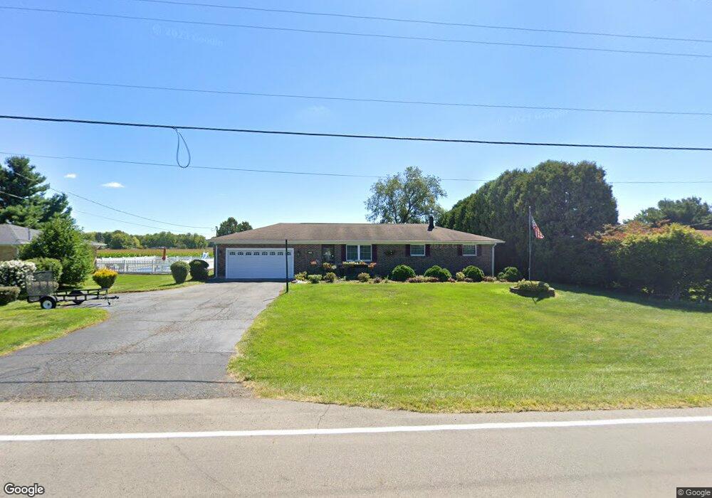
2399 Moorefield Rd Springfield, OH 45502
Estimated Value: $245,086 - $327,000
4
Beds
2
Baths
1,344
Sq Ft
$207/Sq Ft
Est. Value
About This Home
This home is located at 2399 Moorefield Rd, Springfield, OH 45502 and is currently estimated at $278,772, approximately $207 per square foot. 2399 Moorefield Rd is a home located in Clark County with nearby schools including Northridge Elementary School, Kenton Ridge Middle & High School, and Emmanuel Christian Academy.
Ownership History
Date
Name
Owned For
Owner Type
Purchase Details
Closed on
Aug 14, 1995
Sold by
Meehan Michael J
Bought by
Nicholson Herbert and Nicholson Gale
Current Estimated Value
Home Financials for this Owner
Home Financials are based on the most recent Mortgage that was taken out on this home.
Original Mortgage
$102,250
Interest Rate
8.25%
Mortgage Type
VA
Purchase Details
Closed on
Feb 21, 1991
Create a Home Valuation Report for This Property
The Home Valuation Report is an in-depth analysis detailing your home's value as well as a comparison with similar homes in the area
Home Values in the Area
Average Home Value in this Area
Purchase History
| Date | Buyer | Sale Price | Title Company |
|---|---|---|---|
| Nicholson Herbert | $100,275 | -- | |
| -- | $77,900 | -- |
Source: Public Records
Mortgage History
| Date | Status | Borrower | Loan Amount |
|---|---|---|---|
| Closed | Nicholson Herbert | $102,250 |
Source: Public Records
Tax History
| Year | Tax Paid | Tax Assessment Tax Assessment Total Assessment is a certain percentage of the fair market value that is determined by local assessors to be the total taxable value of land and additions on the property. | Land | Improvement |
|---|---|---|---|---|
| 2025 | $2,414 | $76,740 | $13,780 | $62,960 |
| 2024 | $2,334 | $55,200 | $11,450 | $43,750 |
| 2023 | $2,334 | $55,200 | $11,450 | $43,750 |
| 2022 | $2,343 | $55,200 | $11,450 | $43,750 |
| 2021 | $2,445 | $48,820 | $9,460 | $39,360 |
| 2020 | $2,447 | $48,820 | $9,460 | $39,360 |
| 2019 | $2,494 | $48,820 | $9,460 | $39,360 |
| 2018 | $2,227 | $41,840 | $8,710 | $33,130 |
| 2017 | $1,908 | $48,773 | $8,708 | $40,065 |
| 2016 | $1,895 | $48,773 | $8,708 | $40,065 |
| 2015 | $2,194 | $49,529 | $9,464 | $40,065 |
| 2014 | $2,194 | $49,529 | $9,464 | $40,065 |
| 2013 | $2,143 | $49,529 | $9,464 | $40,065 |
Source: Public Records
Map
Nearby Homes
- 4890 Brannan Dr W Unit 4890
- 4500 Bosart Rd
- 4732 Lehigh Dr
- 4652 Reno Ln Unit 15
- 4577 Reno Ln Unit 2
- 1977 Willoughby Ave
- 1521 Erika Dr
- 4446 Ridgewood Rd E Unit 3
- 4028 Ryland Dr Unit 4028
- 1309 Richmoor Rd
- 5235 W Ridgewood Rd
- 4322 Midfield St Unit 15
- 4256 Midfield St Unit 9
- 4802 Willowbrook Dr
- 1644 Delmar Dr
- 5060 Morris Rd
- 1398 Elizabeth Ct Unit 66
- 1341 Student Ave
- 1470 Oldham Dr Unit 12
- 4741 Cullen Ave
- 2375 Moorefield Rd
- 2411 Moorefield Rd
- 2357 Moorefield Rd
- 2433 Moorefield Rd
- 2339 Moorefield Rd
- 2321 Moorefield Rd
- 4953 Bosart Rd
- 2301 Moorefield Rd
- 2497 Moorefield Rd
- 4931 Bosart Rd
- 2494 Moorefield Rd
- 4911 Bosart Rd
- 2283 Moorefield Rd
- 4885 Bosart Rd
- 4960 Bosart Rd
- 2536 Moorefield Rd
- 4928 Bosart Rd
- 4922 Bosart Rd
- 4914 Bosart Rd
- 4906 Bosart Rd
Your Personal Tour Guide
Ask me questions while you tour the home.