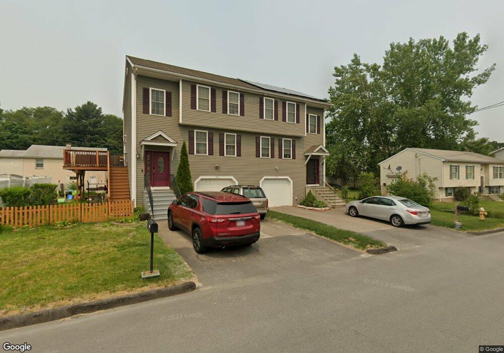
23A Bangor St Worcester, MA 01604
Grafton Hill NeighborhoodEstimated Value: $423,672 - $504,000
3
Beds
2
Baths
1,700
Sq Ft
$271/Sq Ft
Est. Value
About This Home
This home is located at 23A Bangor St, Worcester, MA 01604 and is currently estimated at $460,418, approximately $270 per square foot. 23A Bangor St is a home located in Worcester County with nearby schools including Roosevelt Elementary School, Jacob Hiatt Magnet School, and Chandler Magnet.
Ownership History
Date
Name
Owned For
Owner Type
Purchase Details
Closed on
Apr 20, 2023
Sold by
Camiso Jered A and Yap-Camiso Mila D
Bought by
Undag Marvellous C
Current Estimated Value
Home Financials for this Owner
Home Financials are based on the most recent Mortgage that was taken out on this home.
Original Mortgage
$266,000
Outstanding Balance
$257,966
Interest Rate
6.73%
Mortgage Type
Purchase Money Mortgage
Estimated Equity
$202,452
Purchase Details
Closed on
Mar 31, 2010
Sold by
Black Angela
Bought by
Camiso Jered A
Home Financials for this Owner
Home Financials are based on the most recent Mortgage that was taken out on this home.
Original Mortgage
$212,087
Interest Rate
4.94%
Mortgage Type
Purchase Money Mortgage
Create a Home Valuation Report for This Property
The Home Valuation Report is an in-depth analysis detailing your home's value as well as a comparison with similar homes in the area
Home Values in the Area
Average Home Value in this Area
Purchase History
| Date | Buyer | Sale Price | Title Company |
|---|---|---|---|
| Undag Marvellous C | $280,000 | None Available | |
| Camiso Jered A | $216,000 | -- | |
| Camiso Jered A | $216,000 | -- | |
| Camiso Jered A | $216,000 | -- |
Source: Public Records
Mortgage History
| Date | Status | Borrower | Loan Amount |
|---|---|---|---|
| Open | Undag Marvellous C | $266,000 | |
| Previous Owner | Camiso Jered A | $212,087 |
Source: Public Records
Tax History
| Year | Tax Paid | Tax Assessment Tax Assessment Total Assessment is a certain percentage of the fair market value that is determined by local assessors to be the total taxable value of land and additions on the property. | Land | Improvement |
|---|---|---|---|---|
| 2025 | $5,408 | $410,000 | $83,800 | $326,200 |
| 2024 | $5,155 | $374,900 | $83,800 | $291,100 |
| 2023 | $4,960 | $345,900 | $72,900 | $273,000 |
| 2022 | $4,536 | $298,200 | $58,300 | $239,900 |
| 2021 | $4,381 | $269,100 | $46,600 | $222,500 |
| 2020 | $4,308 | $253,400 | $46,700 | $206,700 |
| 2019 | $4,320 | $240,000 | $42,000 | $198,000 |
| 2018 | $4,311 | $228,000 | $42,000 | $186,000 |
| 2017 | $4,073 | $211,900 | $42,000 | $169,900 |
| 2016 | $4,085 | $198,200 | $31,800 | $166,400 |
| 2015 | -- | $198,200 | $31,800 | $166,400 |
| 2014 | $3,873 | $198,200 | $31,800 | $166,400 |
Source: Public Records
Map
Nearby Homes
- 143 Commonwealth Ave
- Lot B Crawford St
- 19 Middlesex Ave
- 41 Modoc St
- 360 Hamilton St
- 143 Dorcester
- 496 Hamilton St
- 53 Denver Terrace
- 80 Delmont Ave
- 83 Massasoit Rd
- 62 Allston Ave
- 155 Hamilton St Unit 4
- 25 Stoneham Rd
- 20 Brightwood Ave
- 61 Cohasset St
- 81 Pilgrim Ave
- 340 Sunderland Rd Unit 28
- 259 Massasoit Rd
- 330 Sunderland Rd Unit 80
- 330 Sunderland Rd Unit 69
- 23 Bangor St
- 23 Bangor St
- 23B Bangor St
- 19A Bangor St
- 19B Bangor St Unit B
- 25 Marjorie St
- 19 Bangor St
- 19 Bangor St Unit A
- 27 Marjorie St
- 27 Marjorie St Unit B
- 27 Marjorie St Unit A
- 27 Marjorie St Unit 2
- 27 Marjorie St Unit 1
- 18B Bangor St
- 18A Bangor St
- 21 Bangor St
- 20 Bangor St
- 13 Marjorie St
- 17 Bangor St
- 16 Bangor St
Your Personal Tour Guide
Ask me questions while you tour the home.