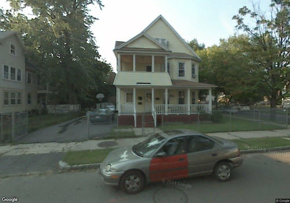
24 Acorn St Unit 26 Springfield, MA 01109
Bay NeighborhoodEstimated Value: $280,435 - $419,000
8
Beds
3
Baths
3,719
Sq Ft
$95/Sq Ft
Est. Value
About This Home
This home is located at 24 Acorn St Unit 26, Springfield, MA 01109 and is currently estimated at $353,609, approximately $95 per square foot. 24 Acorn St Unit 26 is a home located in Hampden County with nearby schools including Rebecca M Johnson School, John F. Kennedy Academy, and Roger L. Putnam Vocational Technical Academy.
Ownership History
Date
Name
Owned For
Owner Type
Purchase Details
Closed on
May 19, 2021
Sold by
Ward Edes M
Bought by
Mccray Edwin
Current Estimated Value
Purchase Details
Closed on
Jan 10, 1997
Sold by
Springfield Nghbrhd Hs
Bought by
Ward Edes M
Home Financials for this Owner
Home Financials are based on the most recent Mortgage that was taken out on this home.
Original Mortgage
$76,000
Interest Rate
7.46%
Mortgage Type
Purchase Money Mortgage
Create a Home Valuation Report for This Property
The Home Valuation Report is an in-depth analysis detailing your home's value as well as a comparison with similar homes in the area
Home Values in the Area
Average Home Value in this Area
Purchase History
| Date | Buyer | Sale Price | Title Company |
|---|---|---|---|
| Mccray Edwin | -- | None Available | |
| Ward Edes M | $80,000 | -- |
Source: Public Records
Mortgage History
| Date | Status | Borrower | Loan Amount |
|---|---|---|---|
| Previous Owner | Ward Edes M | $76,000 | |
| Previous Owner | Ward Edes M | $50,300 | |
| Closed | Ward Edes M | $6,827 |
Source: Public Records
Tax History
| Year | Tax Paid | Tax Assessment Tax Assessment Total Assessment is a certain percentage of the fair market value that is determined by local assessors to be the total taxable value of land and additions on the property. | Land | Improvement |
|---|---|---|---|---|
| 2025 | $5,058 | $322,600 | $31,200 | $291,400 |
| 2024 | $4,514 | $281,100 | $31,200 | $249,900 |
| 2023 | $4,056 | $237,900 | $28,400 | $209,500 |
| 2022 | $4,101 | $217,900 | $26,500 | $191,400 |
| 2021 | $3,941 | $208,500 | $24,100 | $184,400 |
| 2020 | $3,482 | $178,300 | $24,100 | $154,200 |
| 2019 | $2,856 | $157,500 | $24,100 | $133,400 |
| 2018 | $3,050 | $155,000 | $24,100 | $130,900 |
| 2017 | $2,945 | $149,800 | $24,100 | $125,700 |
| 2016 | $2,843 | $144,600 | $24,100 | $120,500 |
| 2015 | $2,451 | $124,600 | $24,100 | $100,500 |
Source: Public Records
Map
Nearby Homes
- 15-17 Sycamore St
- 16 Cambridge St
- 21 Clifford St
- 15 Kenyon St
- 145 Cambridge St
- 163 Marion St
- 65 Montrose St
- 52-54 Aster St
- 46 Mapledell St
- 106 Amherst St
- 52-56 Andrew St
- 158 Bowles St
- 16 Amherst St
- 393 Saint James Ave
- 25 Dresden St
- 107 Dartmouth St
- 48-50 Dresden St
- 19 Westford Ave
- 283 Wilbraham Rd
- 31-33 Suffolk St
- 18 Acorn St Unit 20
- 82 Sycamore St Unit 84
- 82-84 Sycamore St
- 36 Acorn St Unit 38
- 78 Sycamore St Unit 80
- 102 Kenyon St Unit 104
- 102 Kenyon St Unit 2
- 102-104 Kenyon St
- 81 Sycamore St
- 205 Oak Grove Ave Unit 207
- 215 Oak Grove Ave
- 40-42 Acorn St
- 40 Acorn St Unit 42
- 72 Sycamore St Unit 74
- 35 Acorn St Unit 37
- 209 Oak Grove Ave Unit 3
- 209 Oak Grove Ave Unit 1
- 209 Oak Grove Ave
- 77 Sycamore St
- 96 Kenyon St Unit 98
Your Personal Tour Guide
Ask me questions while you tour the home.