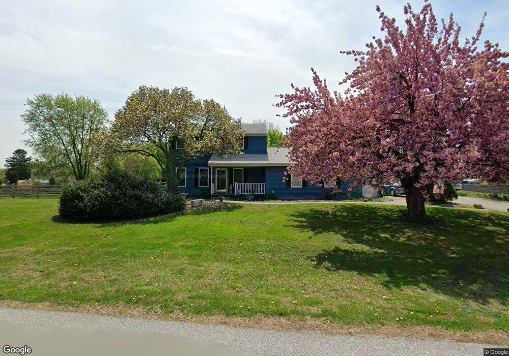
24 Andrew Dr Coatesville, PA 19320
Estimated Value: $386,000 - $461,000
3
Beds
2
Baths
1,632
Sq Ft
$255/Sq Ft
Est. Value
About This Home
This home is located at 24 Andrew Dr, Coatesville, PA 19320 and is currently estimated at $415,359, approximately $254 per square foot. 24 Andrew Dr is a home located in Chester County with nearby schools including Coatesville Intermediate High School, Coatesville Area Senior High School, and Valley Christian School.
Ownership History
Date
Name
Owned For
Owner Type
Purchase Details
Closed on
Apr 13, 1999
Sold by
United Guranty Residential Insurance Co
Bought by
Longacre Scott and Chambers Patricia Lynn
Current Estimated Value
Home Financials for this Owner
Home Financials are based on the most recent Mortgage that was taken out on this home.
Original Mortgage
$92,000
Outstanding Balance
$32,080
Interest Rate
11.55%
Estimated Equity
$383,279
Purchase Details
Closed on
Feb 24, 1999
Sold by
Federal National Mortgage Association
Bought by
United Guaranty Residential Insurance Co
Home Financials for this Owner
Home Financials are based on the most recent Mortgage that was taken out on this home.
Original Mortgage
$92,000
Outstanding Balance
$32,080
Interest Rate
11.55%
Estimated Equity
$383,279
Purchase Details
Closed on
Feb 8, 1999
Sold by
Smith Timothy E and Smith Sue Ann Carter
Bought by
Federal National Mortgage Association
Purchase Details
Closed on
Sep 1, 1996
Sold by
Michnuk Michael B and Michnuk Mary Ann
Bought by
Smith Timothy E and Carter Smith Sue Anne
Home Financials for this Owner
Home Financials are based on the most recent Mortgage that was taken out on this home.
Original Mortgage
$104,750
Interest Rate
7.9%
Create a Home Valuation Report for This Property
The Home Valuation Report is an in-depth analysis detailing your home's value as well as a comparison with similar homes in the area
Home Values in the Area
Average Home Value in this Area
Purchase History
| Date | Buyer | Sale Price | Title Company |
|---|---|---|---|
| Longacre Scott | $115,000 | -- | |
| United Guaranty Residential Insurance Co | $110,980 | -- | |
| Federal National Mortgage Association | -- | -- | |
| Smith Timothy E | $108,000 | -- |
Source: Public Records
Mortgage History
| Date | Status | Borrower | Loan Amount |
|---|---|---|---|
| Open | Longacre Scott | $92,000 | |
| Previous Owner | Smith Timothy E | $104,750 |
Source: Public Records
Tax History Compared to Growth
Tax History
| Year | Tax Paid | Tax Assessment Tax Assessment Total Assessment is a certain percentage of the fair market value that is determined by local assessors to be the total taxable value of land and additions on the property. | Land | Improvement |
|---|---|---|---|---|
| 2025 | $5,490 | $110,980 | $23,130 | $87,850 |
| 2024 | $5,490 | $110,980 | $23,130 | $87,850 |
| 2023 | $5,424 | $110,980 | $23,130 | $87,850 |
| 2022 | $5,143 | $110,980 | $23,130 | $87,850 |
| 2021 | $4,978 | $110,980 | $23,130 | $87,850 |
| 2020 | $4,958 | $110,980 | $23,130 | $87,850 |
| 2019 | $4,797 | $110,980 | $23,130 | $87,850 |
| 2018 | $4,615 | $110,980 | $23,130 | $87,850 |
| 2017 | $4,343 | $110,980 | $23,130 | $87,850 |
| 2016 | $3,465 | $110,980 | $23,130 | $87,850 |
| 2015 | $3,465 | $110,980 | $23,130 | $87,850 |
| 2014 | $3,465 | $110,980 | $23,130 | $87,850 |
Source: Public Records
Map
Nearby Homes
- 14 Frederick Rd
- 205 Jamie Ln
- 215 Jamie Ln
- 114 Wendy Cir
- 408 Green Hill Rd Unit D22
- 132 N Harner Blvd
- 471 Ash Rd
- 221 Folin St
- 320 Trego Ave
- 364 Trego Ave
- 284 Old Mill Rd
- 415 Anderson St
- 20 Peacemaker Dr
- 189 Octorara Rd
- 233 Sloan Dr
- 213 Sloan Dr
- 389 Larose Dr Unit 389
- 240 S Bonsall Rd
- 28 Lincoln Ave
- 231 Flagstone Cir
- 59 Frederick Rd
- 10 Andrew Dr
- 35 Andrew Dr
- 17 Frederick Rd
- 41 Andrew Dr
- 29 Andrew Dr
- 76 Frederick Rd
- 47 Andrew Dr
- 70 Frederick Rd
- 12141 Anderlea Dr
- 11120 Anderlea Dr
- 11100 Anderlea Dr
- 11080 Anderlea Dr
- 11060 Anderlea Dr
- 11040 Anderlea Dr
- 11020 Anderlea Dr
- 31 Frederick Rd
- 64 Frederick Rd
- 53 Andrew Dr
- 52 Frederick Rd