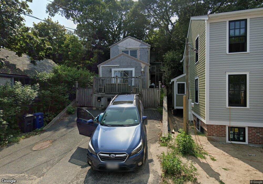
24 Bangs St Unit 2 Provincetown, MA 02657
Estimated Value: $808,000 - $875,000
1
Bed
1
Bath
620
Sq Ft
$1,337/Sq Ft
Est. Value
About This Home
This home is located at 24 Bangs St Unit 2, Provincetown, MA 02657 and is currently estimated at $829,154, approximately $1,337 per square foot. 24 Bangs St Unit 2 is a home located in Barnstable County with nearby schools including Provincetown Schools.
Ownership History
Date
Name
Owned For
Owner Type
Purchase Details
Closed on
Sep 14, 2024
Sold by
Daniels Robert A and Feeley Mary T
Bought by
Daniels Ft and Daniels
Current Estimated Value
Purchase Details
Closed on
Dec 2, 2008
Sold by
Kirby Margaret A and Ives Nancy K
Bought by
Feeley Mary T and Daniels Robert A
Purchase Details
Closed on
May 20, 1996
Sold by
Penn Scott D
Bought by
Kirby Margaret A and Ives Nancy K
Home Financials for this Owner
Home Financials are based on the most recent Mortgage that was taken out on this home.
Original Mortgage
$84,000
Interest Rate
7.77%
Mortgage Type
Purchase Money Mortgage
Create a Home Valuation Report for This Property
The Home Valuation Report is an in-depth analysis detailing your home's value as well as a comparison with similar homes in the area
Home Values in the Area
Average Home Value in this Area
Purchase History
| Date | Buyer | Sale Price | Title Company |
|---|---|---|---|
| Daniels Ft | -- | None Available | |
| Daniels Ft | -- | None Available | |
| Daniels Ft | -- | None Available | |
| Feeley Mary T | $305,000 | -- | |
| Feeley Mary T | $305,000 | -- | |
| Kirby Margaret A | $105,000 | -- | |
| Kirby Margaret A | $105,000 | -- |
Source: Public Records
Mortgage History
| Date | Status | Borrower | Loan Amount |
|---|---|---|---|
| Previous Owner | Kirby Margaret A | $81,000 | |
| Previous Owner | Kirby Margaret A | $84,000 |
Source: Public Records
Tax History
| Year | Tax Paid | Tax Assessment Tax Assessment Total Assessment is a certain percentage of the fair market value that is determined by local assessors to be the total taxable value of land and additions on the property. | Land | Improvement |
|---|---|---|---|---|
| 2025 | $3,553 | $634,400 | $0 | $634,400 |
| 2024 | $3,340 | $598,600 | $0 | $598,600 |
| 2023 | $2,765 | $462,400 | $0 | $462,400 |
| 2022 | $2,903 | $435,900 | $0 | $435,900 |
| 2021 | $2,744 | $387,500 | $0 | $387,500 |
| 2020 | $2,490 | $376,100 | $0 | $376,100 |
| 2019 | $2,561 | $362,700 | $0 | $362,700 |
| 2018 | $2,347 | $315,100 | $0 | $315,100 |
| 2017 | $2,336 | $303,000 | $0 | $303,000 |
| 2016 | $2,284 | $292,800 | $0 | $292,800 |
| 2015 | $2,058 | $278,800 | $0 | $278,800 |
Source: Public Records
Map
Nearby Homes
- 184 Bradford St Unit 1
- 441 Commercial St Unit B
- 208 Bradford St Unit 7
- 488 Commercial St Unit 14
- 37 Pearl St
- 495 Commercial St Unit 9
- 495 Commercial St Unit 11
- 405 Commercial St Unit 5
- 9A Conwell St Unit 4
- 86 Harry Kemp Way Unit B
- 16 Conwell St Unit 3
- 16 Off Conwell St
- 361b Commercial St Unit U3
- 286A Bradford St Unit 5
- 33 Conwell St Unit 5B
- 535 Commercial St Unit 2
- 535 Commercial St Unit 2
- 539 Commercial St Unit 1
- 539 Commercial St Unit 3
- 333 Commercial St Unit 9
- 24 Bangs St Unit 3
- 24 Bangs St Unit 1
- 26 Bangs St
- 22 Bangs St
- 22 Bangs St Unit 1 & 2
- 26-A Bangs St
- 20 Bangs St
- 25 Bangs St Unit 2
- 25 Bangs St Unit 1
- 25 Bangs St
- 6 Upper Miller Hill Rd
- 21-A Bangs St
- 30 Bangs St Unit E
- 30 Bangs St Unit D
- 30 Bangs St Unit C
- 30 Bangs St Unit B
- 30 Bangs St Unit F
- 30 Bangs St Unit A
- 30 Bangs St Unit UF
- 30 Bangs St Unit G
Your Personal Tour Guide
Ask me questions while you tour the home.