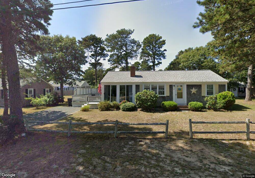
24 Blueberry Ln Dennis Port, MA 02639
Dennis Port NeighborhoodEstimated Value: $600,000 - $663,000
4
Beds
2
Baths
1,246
Sq Ft
$499/Sq Ft
Est. Value
About This Home
This home is located at 24 Blueberry Ln, Dennis Port, MA 02639 and is currently estimated at $622,179, approximately $499 per square foot. 24 Blueberry Ln is a home located in Barnstable County with nearby schools including Dennis-Yarmouth Regional High School and St. Pius X. School.
Ownership History
Date
Name
Owned For
Owner Type
Purchase Details
Closed on
Mar 5, 2010
Sold by
Dwyer 4Th Walter J and Dwyer Patti Ann M
Bought by
Zhitomi Paul G and Zhitomi Penny K
Current Estimated Value
Home Financials for this Owner
Home Financials are based on the most recent Mortgage that was taken out on this home.
Original Mortgage
$240,000
Outstanding Balance
$159,226
Interest Rate
5%
Mortgage Type
Purchase Money Mortgage
Estimated Equity
$462,953
Purchase Details
Closed on
Oct 24, 2003
Sold by
Cornell Kim J
Bought by
Dwyer Walter J and Dwyer Patti Ann W
Home Financials for this Owner
Home Financials are based on the most recent Mortgage that was taken out on this home.
Original Mortgage
$283,500
Interest Rate
6.15%
Mortgage Type
Purchase Money Mortgage
Purchase Details
Closed on
Apr 2, 2001
Sold by
Daly Claire A Est
Bought by
Cornell Thomas P and Cornell Kim J
Home Financials for this Owner
Home Financials are based on the most recent Mortgage that was taken out on this home.
Original Mortgage
$147,000
Interest Rate
6.96%
Mortgage Type
Purchase Money Mortgage
Create a Home Valuation Report for This Property
The Home Valuation Report is an in-depth analysis detailing your home's value as well as a comparison with similar homes in the area
Home Values in the Area
Average Home Value in this Area
Purchase History
| Date | Buyer | Sale Price | Title Company |
|---|---|---|---|
| Zhitomi Paul G | $300,000 | -- | |
| Dwyer Walter J | $315,000 | -- | |
| Cornell Thomas P | $163,750 | -- |
Source: Public Records
Mortgage History
| Date | Status | Borrower | Loan Amount |
|---|---|---|---|
| Open | Zhitomi Paul G | $240,000 | |
| Previous Owner | Cornell Thomas P | $283,500 | |
| Previous Owner | Cornell Thomas P | $238,000 | |
| Previous Owner | Cornell Thomas P | $147,000 |
Source: Public Records
Tax History Compared to Growth
Tax History
| Year | Tax Paid | Tax Assessment Tax Assessment Total Assessment is a certain percentage of the fair market value that is determined by local assessors to be the total taxable value of land and additions on the property. | Land | Improvement |
|---|---|---|---|---|
| 2025 | $2,003 | $462,700 | $182,900 | $279,800 |
| 2024 | $2,008 | $457,300 | $175,900 | $281,400 |
| 2023 | $1,947 | $417,000 | $159,900 | $257,100 |
| 2022 | $1,875 | $334,800 | $144,100 | $190,700 |
| 2021 | $1,813 | $300,600 | $141,200 | $159,400 |
| 2020 | $1,668 | $273,400 | $130,400 | $143,000 |
| 2019 | $1,649 | $267,300 | $127,800 | $139,500 |
| 2018 | $6,254 | $251,800 | $131,800 | $120,000 |
| 2017 | $1,486 | $241,700 | $121,700 | $120,000 |
| 2016 | $1,487 | $227,700 | $126,800 | $100,900 |
| 2015 | $1,457 | $227,700 | $126,800 | $100,900 |
| 2014 | $1,393 | $219,400 | $111,500 | $107,900 |
Source: Public Records
Map
Nearby Homes
- 31 Easy St
- 22 Wixon Rd
- 22 Ferncliff Rd
- 72 Bassett Ln
- 102 Sea St
- 37-A Beach Hills Rd
- 37 Beach Hills Rd
- 19 Standish Way
- 268 Main St
- 262 Old Wharf Rd Unit 67
- 262 Old Wharf Rd Unit 5
- 262 Old Wharf Rd Unit 5
- 262 Old Wharf Rd Unit 20
- 262 Old Wharf Rd Unit 87
- 4 Coffey Ln
- 12 Cross St
- 125 Main St Unit 3
- 80 Michaels Ave
- 241 Old Wharf Rd Unit 127
- 28 Blueberry Ln
- 27 Beach Plum Ln
- 27 Beachplum Ln
- 3 Blueberry Ln
- 19 Blueberry Ln
- 31 Beach Plum Ln
- 20 Blueberry Ln
- 15 Blueberry Ln
- 25 Beach Plum Ln
- 25 Beachplum Ln
- 32 Blueberry Ln
- 25 Blueberry Ln
- 19 Beach Plum Ln
- 11 Blueberry Ln
- 33 Beach Plum Ln
- 10 Huckleberry Ln
- 34 Beach Plum Ln
- 14 Huckleberry Ln
- 18 Huckleberry Ln
- 38 Beach Plum Ln