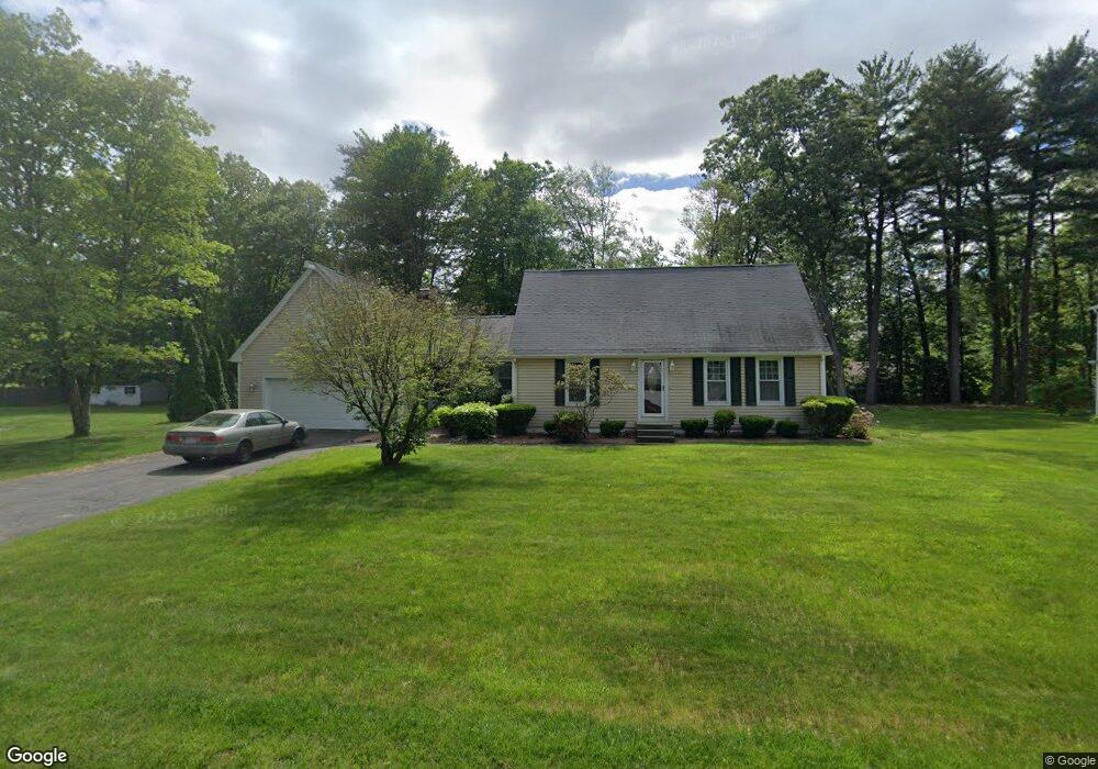
24 Briarcliff Dr Westfield, MA 01085
Estimated Value: $440,000 - $449,000
4
Beds
2
Baths
1,722
Sq Ft
$258/Sq Ft
Est. Value
About This Home
This home is located at 24 Briarcliff Dr, Westfield, MA 01085 and is currently estimated at $444,861, approximately $258 per square foot. 24 Briarcliff Dr is a home located in Hampden County with nearby schools including Westfield High School and St Thomas The Apostle School.
Ownership History
Date
Name
Owned For
Owner Type
Purchase Details
Closed on
Mar 19, 2014
Sold by
Flynn Janina L
Bought by
Flynn David M
Current Estimated Value
Home Financials for this Owner
Home Financials are based on the most recent Mortgage that was taken out on this home.
Original Mortgage
$170,000
Outstanding Balance
$128,031
Interest Rate
4.25%
Mortgage Type
New Conventional
Estimated Equity
$316,830
Purchase Details
Closed on
Mar 2, 1995
Sold by
Wells Greg A and Wells Mary E
Bought by
Flynn David M
Purchase Details
Closed on
Apr 25, 1991
Sold by
Bannish Daniel M and Bannish Pamela F
Bought by
Wells Greg A and Wells Mary E
Purchase Details
Closed on
Nov 13, 1987
Sold by
Clemons Ralph
Bought by
Bannish Daniel M
Create a Home Valuation Report for This Property
The Home Valuation Report is an in-depth analysis detailing your home's value as well as a comparison with similar homes in the area
Home Values in the Area
Average Home Value in this Area
Purchase History
| Date | Buyer | Sale Price | Title Company |
|---|---|---|---|
| Flynn David M | -- | -- | |
| Flynn David M | -- | -- | |
| Flynn David M | -- | -- | |
| Flynn David M | $139,925 | -- | |
| Flynn David M | $139,925 | -- | |
| Wells Greg A | $165,500 | -- | |
| Wells Greg A | $165,500 | -- | |
| Bannish Daniel M | $157,500 | -- |
Source: Public Records
Mortgage History
| Date | Status | Borrower | Loan Amount |
|---|---|---|---|
| Open | Flynn David M | $170,000 | |
| Closed | Bannish Daniel M | $170,000 |
Source: Public Records
Tax History Compared to Growth
Tax History
| Year | Tax Paid | Tax Assessment Tax Assessment Total Assessment is a certain percentage of the fair market value that is determined by local assessors to be the total taxable value of land and additions on the property. | Land | Improvement |
|---|---|---|---|---|
| 2025 | $5,371 | $353,800 | $128,500 | $225,300 |
| 2024 | $5,369 | $336,200 | $117,000 | $219,200 |
| 2023 | $4,976 | $304,000 | $111,300 | $192,700 |
| 2022 | $4,976 | $269,100 | $99,100 | $170,000 |
| 2021 | $4,818 | $255,200 | $93,400 | $161,800 |
| 2020 | $4,678 | $243,000 | $93,400 | $149,600 |
| 2019 | $4,575 | $232,600 | $89,100 | $143,500 |
| 2018 | $4,503 | $232,600 | $89,100 | $143,500 |
| 2017 | $4,424 | $227,800 | $90,400 | $137,400 |
| 2016 | $4,428 | $227,800 | $90,400 | $137,400 |
| 2015 | $4,368 | $235,600 | $90,400 | $145,200 |
| 2014 | $3,267 | $235,600 | $90,400 | $145,200 |
Source: Public Records
Map
Nearby Homes
- 242 Eastwood Dr
- 120 Woodcliff Dr
- 162 Joseph Ave
- 0 E Mountain Rd
- 846 E Mountain Rd
- 0 Holyoke Rd
- 189 Springfield Rd Unit 23
- 315 Holyoke Rd
- 119 Union St Unit 4
- 243 Holyoke Rd
- 0 Feeding Hills Rd
- 103 Feeding Hills Rd
- 10 Mckinley Terrace
- 13 William St
- 99 Woodmont St
- 76 Shaker Rd
- 16 Locust St
- 30 Cross St
- 25 White St
- 28 Union St
- 20 Briarcliff Dr
- 28 Briarcliff Dr
- 41 Woodcliff Dr
- 37 Woodcliff Dr
- 25 Briarcliff Dr
- 45 Woodcliff Dr
- 21 Briarcliff Dr
- 16 Briarcliff Dr
- 32 Briarcliff Dr
- 29 Briarcliff Dr
- 33 Woodcliff Dr
- 15 Briarcliff Dr
- 49 Woodcliff Dr
- 12 Briarcliff Dr
- 36 Briarcliff Dr
- 27 Woodcliff Dr
- 42 Woodcliff Dr
- 38 Woodcliff Dr
- 46 Woodcliff Dr
- 53 Woodcliff Dr