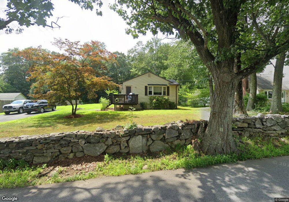
24 Brigham St Northborough, MA 01532
Estimated Value: $449,000 - $511,000
3
Beds
1
Bath
888
Sq Ft
$541/Sq Ft
Est. Value
About This Home
This home is located at 24 Brigham St, Northborough, MA 01532 and is currently estimated at $480,210, approximately $540 per square foot. 24 Brigham St is a home located in Worcester County with nearby schools including Marguerite E. Peaslee Elementary School, Robert E. Melican Middle School, and Algonquin Regional High School.
Ownership History
Date
Name
Owned For
Owner Type
Purchase Details
Closed on
Feb 15, 2001
Sold by
Maroni Mark L and Peel-Maroni Ann
Bought by
Roy Core P and Warren Elizabeth A
Current Estimated Value
Home Financials for this Owner
Home Financials are based on the most recent Mortgage that was taken out on this home.
Original Mortgage
$164,698
Interest Rate
7.08%
Mortgage Type
Purchase Money Mortgage
Purchase Details
Closed on
Dec 30, 1997
Sold by
Larocque Albert and Larocque Leo
Bought by
Maroni Mark L and Maroni Ann P
Create a Home Valuation Report for This Property
The Home Valuation Report is an in-depth analysis detailing your home's value as well as a comparison with similar homes in the area
Home Values in the Area
Average Home Value in this Area
Purchase History
| Date | Buyer | Sale Price | Title Company |
|---|---|---|---|
| Roy Core P | $166,000 | -- | |
| Maroni Mark L | $130,000 | -- |
Source: Public Records
Mortgage History
| Date | Status | Borrower | Loan Amount |
|---|---|---|---|
| Open | Maroni Mark L | $188,000 | |
| Closed | Maroni Mark L | $185,000 | |
| Closed | Maroni Mark L | $20,000 | |
| Closed | Maroni Mark L | $164,698 |
Source: Public Records
Tax History Compared to Growth
Tax History
| Year | Tax Paid | Tax Assessment Tax Assessment Total Assessment is a certain percentage of the fair market value that is determined by local assessors to be the total taxable value of land and additions on the property. | Land | Improvement |
|---|---|---|---|---|
| 2025 | $5,716 | $401,100 | $230,800 | $170,300 |
| 2024 | $4,945 | $346,300 | $186,900 | $159,400 |
| 2023 | $5,051 | $341,500 | $176,200 | $165,300 |
| 2022 | $4,972 | $301,500 | $167,800 | $133,700 |
| 2021 | $4,751 | $277,500 | $152,400 | $125,100 |
| 2020 | $4,799 | $278,200 | $152,400 | $125,800 |
| 2019 | $4,644 | $270,800 | $152,400 | $118,400 |
| 2018 | $4,412 | $253,700 | $149,400 | $104,300 |
| 2017 | $4,285 | $246,400 | $149,400 | $97,000 |
| 2016 | $4,140 | $241,100 | $146,100 | $95,000 |
| 2015 | $3,895 | $232,800 | $153,500 | $79,300 |
| 2014 | $3,769 | $227,200 | $153,500 | $73,700 |
Source: Public Records
Map
Nearby Homes
- 26 Maple St
- 59 School St Unit A-14
- 85 Hudson St Unit 85
- 6 Silas Dr
- 6 Vanessa Dr
- 14 Vanessa Dr
- 5 Swan View Common Dr
- 71 Summer St
- 86 Whitney St
- 13 Deacon St
- 90 W Main St
- 89 W Main St
- 129 Bartlett St
- 39 Pleasant St Unit B19
- 39 Pleasant St Unit C5
- 132 W Main St
- 19 Crestwood Dr Unit 19
- 185-187 South St
- 198 South St
- 223 South St
- 20 Brigham St
- 28 Brigham St
- 23 Brigham St
- 19 Brigham St
- 130 Main St
- 27 Brigham St
- 15 Brigham St
- 9 Rodney Terrace
- 11 Brigham St
- 6 Maple St Unit 205
- 6 Maple St Unit 103
- 6 Maple St Unit 2 B
- 6 Maple St Unit 2
- 6 Maple St Unit 203
- 6 Maple St
- 6 Maple St Unit 204
- 124 Main St
- 1 Leland Dr
- 40 Brigham St
- 5 Leland Dr