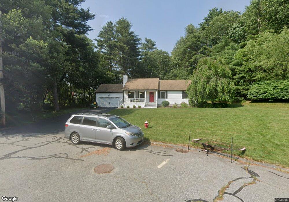
24 Britton Ct Raynham, MA 02767
Estimated Value: $624,651 - $730,000
3
Beds
1
Bath
1,196
Sq Ft
$556/Sq Ft
Est. Value
About This Home
This home is located at 24 Britton Ct, Raynham, MA 02767 and is currently estimated at $664,413, approximately $555 per square foot. 24 Britton Ct is a home located in Bristol County with nearby schools including Merrill Elementary School, LaLiberte Elementary School, and Williams Intermediate School.
Ownership History
Date
Name
Owned For
Owner Type
Purchase Details
Closed on
Aug 9, 2011
Sold by
24 Britton Court T and Latham Steven D
Bought by
Leonard Brandon D and Bostrom Heather L
Current Estimated Value
Purchase Details
Closed on
Aug 26, 2010
Sold by
Latham Sally A
Bought by
Henderson Tr Lynda A and Latham Steven D
Create a Home Valuation Report for This Property
The Home Valuation Report is an in-depth analysis detailing your home's value as well as a comparison with similar homes in the area
Home Values in the Area
Average Home Value in this Area
Purchase History
| Date | Buyer | Sale Price | Title Company |
|---|---|---|---|
| Leonard Brandon D | $285,000 | -- | |
| Henderson Tr Lynda A | -- | -- |
Source: Public Records
Tax History
| Year | Tax Paid | Tax Assessment Tax Assessment Total Assessment is a certain percentage of the fair market value that is determined by local assessors to be the total taxable value of land and additions on the property. | Land | Improvement |
|---|---|---|---|---|
| 2025 | $6,459 | $533,800 | $205,700 | $328,100 |
| 2024 | $6,326 | $509,300 | $197,800 | $311,500 |
| 2023 | $6,134 | $451,000 | $178,000 | $273,000 |
| 2022 | $5,855 | $394,800 | $158,200 | $236,600 |
| 2021 | $5,562 | $378,600 | $150,300 | $228,300 |
| 2020 | $5,320 | $369,200 | $150,300 | $218,900 |
| 2019 | $5,254 | $369,200 | $150,300 | $218,900 |
| 2018 | $5,146 | $345,400 | $150,300 | $195,100 |
| 2017 | $4,802 | $319,500 | $142,400 | $177,100 |
| 2016 | $4,738 | $316,300 | $139,200 | $177,100 |
| 2015 | $4,267 | $280,000 | $139,700 | $140,300 |
Source: Public Records
Map
Nearby Homes
- 634 Broadway
- 646 Broadway
- 314 Britton St
- 123 Center St
- 4-B High Ridge Dr
- 13 Daisy Ave
- 2 Maplewood Ln Unit 21-1
- 0 Maplewood Unit 21.3 73426136
- 138 Carver St
- 19 Abbey Ln
- 9 Valley Forge Rd
- 191 Red Oak Terrace
- 658 Broadway
- 11 Settlers Rd
- 41 Scadding St
- 84 Diniz Dr
- 930 Bay St
- 68 Sabbatia Ln
- 170 Lake Ridge Dr
- 33 White St
Your Personal Tour Guide
Ask me questions while you tour the home.