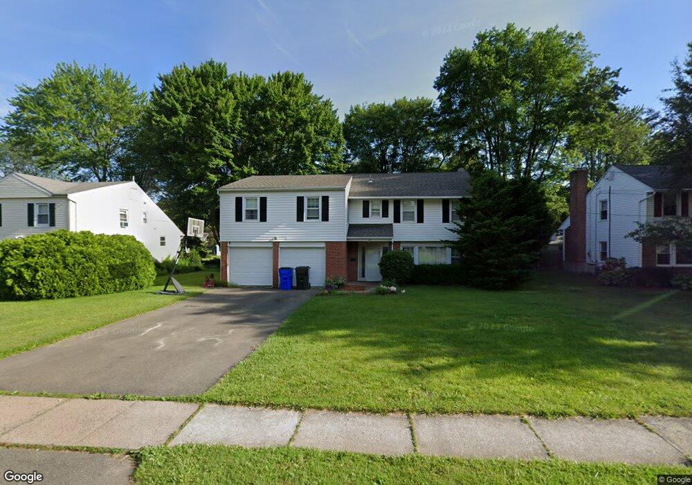
24 Brownleigh Rd West Hartford, CT 06117
Estimated Value: $481,000 - $577,999
4
Beds
3
Baths
2,058
Sq Ft
$260/Sq Ft
Est. Value
About This Home
This home is located at 24 Brownleigh Rd, West Hartford, CT 06117 and is currently estimated at $534,500, approximately $259 per square foot. 24 Brownleigh Rd is a home located in Hartford County with nearby schools including Aiken School, King Philip Middle School, and Hall High School.
Ownership History
Date
Name
Owned For
Owner Type
Purchase Details
Closed on
Aug 11, 2006
Sold by
Weinberg Daniel A and Weinberg Michelle L
Bought by
Geoghegan Joseph R and Geoghegan Jennifer R
Current Estimated Value
Home Financials for this Owner
Home Financials are based on the most recent Mortgage that was taken out on this home.
Original Mortgage
$277,900
Interest Rate
6.8%
Purchase Details
Closed on
Dec 17, 1999
Sold by
Zaken Yair and Zaken Idit
Bought by
Weinberg Daniel A and Weinberg Michelle L
Purchase Details
Closed on
Apr 16, 1997
Sold by
Monarch Savings Bank
Bought by
Zaken Yair and Zaken Idit
Create a Home Valuation Report for This Property
The Home Valuation Report is an in-depth analysis detailing your home's value as well as a comparison with similar homes in the area
Home Values in the Area
Average Home Value in this Area
Purchase History
| Date | Buyer | Sale Price | Title Company |
|---|---|---|---|
| Geoghegan Joseph R | $309,900 | -- | |
| Weinberg Daniel A | $200,000 | -- | |
| Zaken Yair | $120,000 | -- |
Source: Public Records
Mortgage History
| Date | Status | Borrower | Loan Amount |
|---|---|---|---|
| Open | Zaken Yair | $2,725,000 | |
| Closed | Zaken Yair | $277,900 | |
| Previous Owner | Zaken Yair | $178,000 |
Source: Public Records
Tax History Compared to Growth
Tax History
| Year | Tax Paid | Tax Assessment Tax Assessment Total Assessment is a certain percentage of the fair market value that is determined by local assessors to be the total taxable value of land and additions on the property. | Land | Improvement |
|---|---|---|---|---|
| 2025 | $11,225 | $250,670 | $77,490 | $173,180 |
| 2024 | $10,616 | $250,670 | $77,490 | $173,180 |
| 2023 | $10,257 | $250,670 | $77,490 | $173,180 |
| 2022 | $10,197 | $250,670 | $77,490 | $173,180 |
| 2021 | $8,130 | $191,660 | $69,790 | $121,870 |
| 2020 | $7,572 | $181,160 | $62,160 | $119,000 |
| 2019 | $7,572 | $181,160 | $62,160 | $119,000 |
| 2018 | $7,428 | $181,160 | $62,160 | $119,000 |
| 2017 | $7,435 | $181,160 | $62,160 | $119,000 |
| 2016 | $6,649 | $168,280 | $56,280 | $112,000 |
| 2015 | $6,447 | $168,280 | $56,280 | $112,000 |
| 2014 | $6,289 | $168,280 | $56,280 | $112,000 |
Source: Public Records
Map
Nearby Homes
- 6 Lyman Rd
- 11 Westbrook Rd
- 2 Croydon Dr
- 645 Bloomfield Ave
- 55 Kenwood Cir
- 1 King Philip Dr Unit 207
- 7 Sequin Rd
- 94 Richmond Ln
- 3 Pilgrim Rd
- 30 Farmstead Ln
- 11 Rye Ridge Pkwy
- 11 Lawler Rd
- 320 N Steele Rd
- 2581 Albany Ave
- 21 Barksdale Rd
- 165 Bloomfield Ave
- 62 Blue Ridge Ln
- 111 Bloomfield Ave
- 5 Northmoor Rd
- 5 Coolidge Rd
- 28 Brownleigh Rd
- 22 Brownleigh Rd
- 30 Brownleigh Rd
- 205 Simsbury Rd
- 201 Simsbury Rd
- 5 King Edward Rd
- 14 Brownleigh Rd
- 25 Brownleigh Rd
- 29 Brownleigh Rd
- 34 Brownleigh Rd
- 199 Simsbury Rd
- 23 Brownleigh Rd
- 3 King Edward Rd
- 31 Brownleigh Rd
- 7 King Edward Rd
- 195 Simsbury Rd
- 19 Brownleigh Rd
- 36 Brownleigh Rd
- 35 Brownleigh Rd
- 193 Simsbury Rd