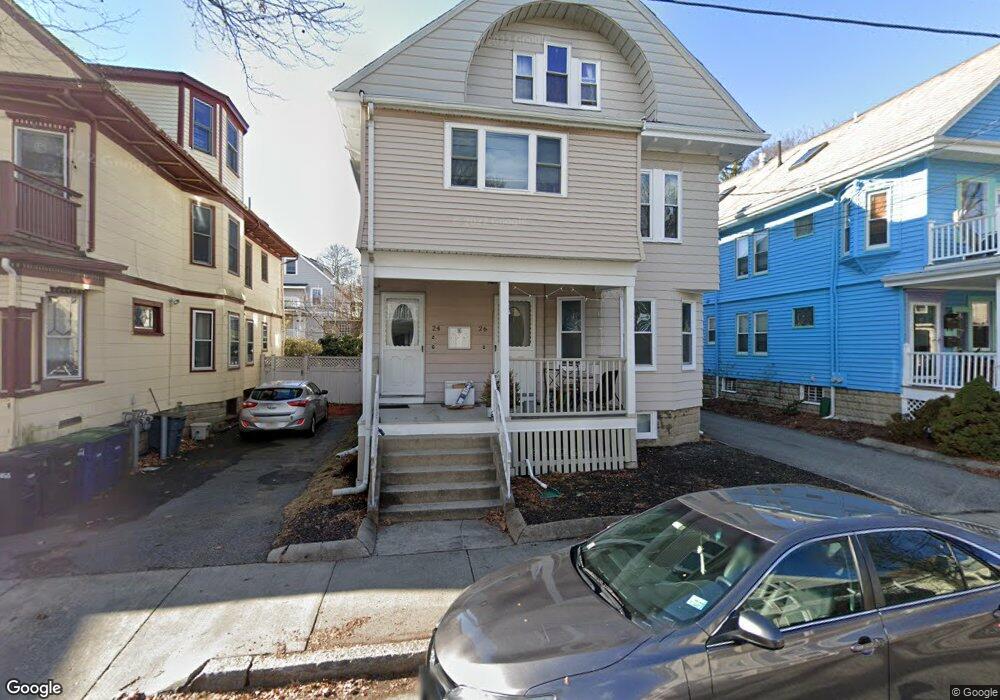
24 Burnham St Unit 1 Somerville, MA 02144
Davis Square NeighborhoodEstimated Value: $1,662,000 - $1,893,000
2
Beds
3
Baths
1,000
Sq Ft
$1,817/Sq Ft
Est. Value
About This Home
This home is located at 24 Burnham St Unit 1, Somerville, MA 02144 and is currently estimated at $1,817,061, approximately $1,817 per square foot. 24 Burnham St Unit 1 is a home located in Middlesex County with nearby schools including Carstens Academy of Aquatic Science, Somerville High School, and St. Clement Elementary School.
Ownership History
Date
Name
Owned For
Owner Type
Purchase Details
Closed on
Jun 14, 2018
Sold by
Braga Malinda C
Bought by
24-26 Burham Llc
Current Estimated Value
Purchase Details
Closed on
Oct 1, 2010
Sold by
Powers Stephen J
Bought by
Braga Malinda C
Home Financials for this Owner
Home Financials are based on the most recent Mortgage that was taken out on this home.
Original Mortgage
$599,975
Interest Rate
4.44%
Mortgage Type
Purchase Money Mortgage
Create a Home Valuation Report for This Property
The Home Valuation Report is an in-depth analysis detailing your home's value as well as a comparison with similar homes in the area
Home Values in the Area
Average Home Value in this Area
Purchase History
| Date | Buyer | Sale Price | Title Company |
|---|---|---|---|
| 24-26 Burham Llc | -- | -- | |
| Braga Malinda C | $801,225 | -- |
Source: Public Records
Mortgage History
| Date | Status | Borrower | Loan Amount |
|---|---|---|---|
| Previous Owner | Braga Malinda C | $599,975 |
Source: Public Records
Tax History Compared to Growth
Tax History
| Year | Tax Paid | Tax Assessment Tax Assessment Total Assessment is a certain percentage of the fair market value that is determined by local assessors to be the total taxable value of land and additions on the property. | Land | Improvement |
|---|---|---|---|---|
| 2025 | $17,748 | $1,626,800 | $754,500 | $872,300 |
| 2024 | $16,723 | $1,589,600 | $754,500 | $835,100 |
| 2023 | $16,359 | $1,582,100 | $754,500 | $827,600 |
| 2022 | $15,589 | $1,531,300 | $718,500 | $812,800 |
| 2021 | $14,753 | $1,447,800 | $713,200 | $734,600 |
| 2020 | $14,125 | $1,399,900 | $713,700 | $686,200 |
| 2019 | $13,375 | $1,243,000 | $649,800 | $593,200 |
| 2018 | $12,338 | $1,090,900 | $590,700 | $500,200 |
| 2017 | $12,167 | $1,042,600 | $557,300 | $485,300 |
| 2016 | $11,974 | $955,600 | $497,700 | $457,900 |
| 2015 | $11,430 | $906,400 | $459,600 | $446,800 |
Source: Public Records
Map
Nearby Homes
- 20 Electric Ave Unit 2
- 22 Ossipee Rd Unit 2
- 23 Ossipee Rd
- 29 Packard Ave
- 55 Packard Ave Unit 1
- 26 Warner St
- 50 Howard St Unit 5
- 11 Watson St Unit 1
- 11 Watson St Unit 2
- 67-69 Cameron Ave
- 15 Colby St
- 69 Clarendon Ave Unit A
- 202 Powder House Blvd Unit 2
- 33 Conwell Ave
- 39 Seven Pines Ave
- 32 Cameron Ave
- 24 Washburn Ave Unit 1
- 34 Day St
- 34 Belknap St
- 17 Shea Rd
- 24 Burnham St
- 26 Burnham St Unit 3
- 24 Burnham St Unit 3
- 26 Burnham St Unit 2
- 24 Burnham St Unit 2
- 26 Burnham St
- 24 Burnham St
- 26 Burnham St Unit 3A
- 20 Burnham St
- 22 Burnham St
- 28 Burnham St
- 16 Burnham St
- 34 Burnham St Unit 2
- 34 Burnham St Unit 1
- 34 Burham St Unit 1
- 27 Mason St
- 31 Mason St
- 27 Burnham St
- 23 Burnham St
- 23 Burnham St Unit 1