Estimated Value: $292,492 - $301,000
3
Beds
1
Bath
1,468
Sq Ft
$202/Sq Ft
Est. Value
About This Home
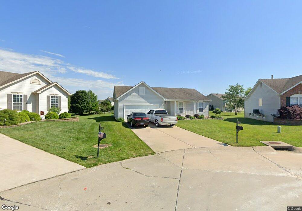
This home is located at 24 Cambridge Ct, Troy, MO 63379 and is currently estimated at $295,873, approximately $201 per square foot. 24 Cambridge Ct is a home located in Lincoln County with nearby schools including Lincoln Elementary School, Troy South Middle School, and Troy Buchanan High School.
Ownership History
Date
Name
Owned For
Owner Type
Purchase Details
Closed on
Dec 13, 2021
Sold by
Wright Margie and Wright Trust
Bought by
Glaus Cynthia M and Glaus Rodger E
Current Estimated Value
Purchase Details
Closed on
Nov 1, 2021
Sold by
Wright Margie
Bought by
Glaus Cynthia M and Glaus Rodger E
Purchase Details
Closed on
Nov 5, 2010
Sold by
Wright Billy D and Wright Margie
Bought by
Wright Margie M and Billy D Wright And Margie M Wright Livin
Purchase Details
Closed on
Jul 25, 2008
Sold by
Co Wingate Development Group Llc
Bought by
Wright Billy D and Wright Margie
Create a Home Valuation Report for This Property
The Home Valuation Report is an in-depth analysis detailing your home's value as well as a comparison with similar homes in the area
Home Values in the Area
Average Home Value in this Area
Purchase History
| Date | Buyer | Sale Price | Title Company |
|---|---|---|---|
| Glaus Cynthia M | -- | None Available | |
| Glaus Cynthia M | -- | None Available | |
| Wright Margie M | -- | None Available | |
| Wright Billy D | -- | None Available |
Source: Public Records
Tax History
| Year | Tax Paid | Tax Assessment Tax Assessment Total Assessment is a certain percentage of the fair market value that is determined by local assessors to be the total taxable value of land and additions on the property. | Land | Improvement |
|---|---|---|---|---|
| 2025 | $2,147 | $34,177 | $4,512 | $29,665 |
| 2024 | $1,999 | $31,227 | $3,819 | $27,408 |
| 2023 | $1,987 | $31,227 | $3,819 | $27,408 |
| 2022 | $1,896 | $29,653 | $3,819 | $25,834 |
| 2021 | $1,906 | $156,070 | $0 | $0 |
| 2020 | $1,689 | $138,040 | $0 | $0 |
| 2019 | $1,690 | $137,940 | $0 | $0 |
| 2018 | $1,725 | $26,442 | $0 | $0 |
| 2017 | $1,730 | $26,442 | $0 | $0 |
| 2016 | $1,566 | $23,302 | $0 | $0 |
| 2015 | $1,570 | $23,302 | $0 | $0 |
| 2014 | $1,587 | $23,503 | $0 | $0 |
| 2013 | -- | $23,503 | $0 | $0 |
Source: Public Records
Map
Nearby Homes
- 157 Sweetgum Dr
- 310 Red Wing Ct
- 408 Westridge Dr
- 0 Westridge Dr
- 42 + - Acres Snyder Rd
- 459 Westridge Dr
- 456 Westridge Dr
- 996 Huntington Dr
- 101 Kensington Palace Dr
- 381 Linns Mill Rd
- 2489 Oak Forest Dr
- 1091 Boone St
- 971 Boone St
- 28 Bittersweet Dr
- 191 Gardenia Dr
- 23 Oakview Ct - Lot 6
- 27 Oakview Ct - Lot 7
- 12 Oakview Ct - Lot 15
- 31 Oakview Ct - Lot 8
- 35 Oakview Ct - Lot 9
- 24 Cambridge Ct
- 20 Cambridge Ct
- 28 Cambridge Ct
- 28 Cambridge Ct
- 35 Oxford Place
- 31 Oxford Place
- 16 Cambridge Ct
- 319 Waterford Ct
- 30 Cambridge Ct
- 319 Waterford Ct
- 19 Cambridge Ct
- 39 Oxford Place
- 23 Cambridge Ct
- 325 Waterford Ct
- 313 Waterford Ct
- 18 Eddington Ct
- 15 Cambridge Ct
- 12 Cambridge Ct
- 27 Oxford Place
- 8 Cambridge Ct
Your Personal Tour Guide
Ask me questions while you tour the home.