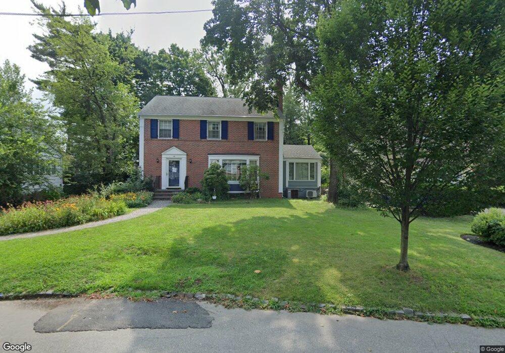
24 Carter Rd West Orange, NJ 07052
Estimated Value: $809,128 - $863,000
--
Bed
--
Bath
2,372
Sq Ft
$350/Sq Ft
Est. Value
About This Home
This home is located at 24 Carter Rd, West Orange, NJ 07052 and is currently estimated at $829,782, approximately $349 per square foot. 24 Carter Rd is a home located in Essex County with nearby schools including West Orange High School and Golda Och Academy Lower School.
Ownership History
Date
Name
Owned For
Owner Type
Purchase Details
Closed on
Jun 6, 2002
Sold by
Ehrenkrantz Dan
Bought by
Sampson Collin and Kim Karyn
Current Estimated Value
Home Financials for this Owner
Home Financials are based on the most recent Mortgage that was taken out on this home.
Original Mortgage
$276,000
Outstanding Balance
$117,606
Interest Rate
6.92%
Estimated Equity
$712,176
Purchase Details
Closed on
Aug 26, 1993
Sold by
Moradian Lesley
Bought by
Ehrenkrantz Dan and Ehrenkratz Kay
Home Financials for this Owner
Home Financials are based on the most recent Mortgage that was taken out on this home.
Original Mortgage
$147,000
Interest Rate
7.21%
Purchase Details
Closed on
Jul 29, 1993
Sold by
Moradian Khosrow
Bought by
Moradian Lesley A
Home Financials for this Owner
Home Financials are based on the most recent Mortgage that was taken out on this home.
Original Mortgage
$147,000
Interest Rate
7.21%
Create a Home Valuation Report for This Property
The Home Valuation Report is an in-depth analysis detailing your home's value as well as a comparison with similar homes in the area
Home Values in the Area
Average Home Value in this Area
Purchase History
| Date | Buyer | Sale Price | Title Company |
|---|---|---|---|
| Sampson Collin | $345,000 | -- | |
| Ehrenkrantz Dan | $210,000 | -- | |
| Moradian Lesley A | -- | -- |
Source: Public Records
Mortgage History
| Date | Status | Borrower | Loan Amount |
|---|---|---|---|
| Open | Sampson Collin | $276,000 | |
| Previous Owner | Ehrenkrantz Dan | $147,000 |
Source: Public Records
Tax History Compared to Growth
Tax History
| Year | Tax Paid | Tax Assessment Tax Assessment Total Assessment is a certain percentage of the fair market value that is determined by local assessors to be the total taxable value of land and additions on the property. | Land | Improvement |
|---|---|---|---|---|
| 2025 | $19,840 | $734,600 | $319,700 | $414,900 |
| 2024 | $19,840 | $431,500 | $178,200 | $253,300 |
| 2022 | $19,146 | $431,500 | $178,200 | $253,300 |
| 2021 | $18,788 | $431,500 | $178,200 | $253,300 |
| 2020 | $18,485 | $431,500 | $178,200 | $253,300 |
| 2019 | $17,955 | $431,500 | $178,200 | $253,300 |
| 2018 | $17,424 | $431,500 | $178,200 | $253,300 |
| 2017 | $17,200 | $431,500 | $178,200 | $253,300 |
| 2016 | $16,785 | $431,500 | $178,200 | $253,300 |
| 2015 | $16,470 | $431,500 | $178,200 | $253,300 |
| 2014 | $16,147 | $431,500 | $178,200 | $253,300 |
Source: Public Records
Map
Nearby Homes
- 8 Colony Dr E
- 152 Mitchell St
- 2 Linden Ave
- 21 Glen Rd
- 45 Oakridge Rd
- 47 Quinby Place
- 19 Cobane Terrace
- 92 Riggs Place
- 88 Riggs Place
- 59 Oakridge Rd
- 76 Mitchell St
- 54 Mitchell St
- 37 Kingsley St
- 84 Gregory Ave
- 17 Mountain Dr
- 31 Mitchell St
- 412 S Valley Rd
- 9 Joyce St
- 31 Collamore Terrace
- 33 Lafayette St