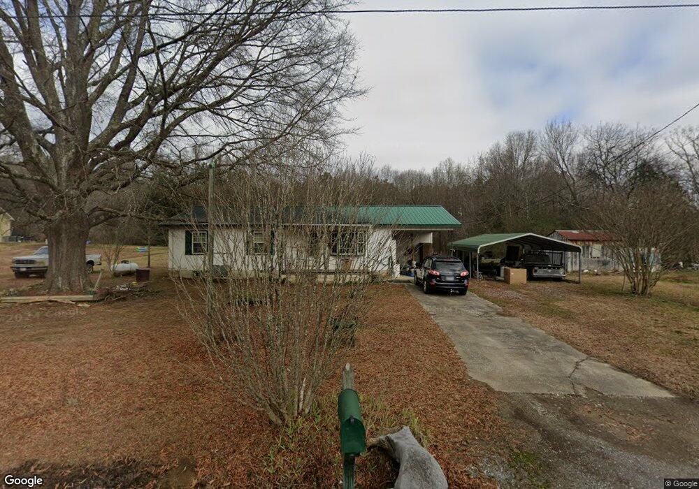
24 Corn Rd Cedartown, GA 30125
Estimated Value: $174,448 - $206,000
3
Beds
2
Baths
1,232
Sq Ft
$154/Sq Ft
Est. Value
About This Home
This home is located at 24 Corn Rd, Cedartown, GA 30125 and is currently estimated at $190,112, approximately $154 per square foot. 24 Corn Rd is a home located in Polk County with nearby schools including Cedar Christian School.
Ownership History
Date
Name
Owned For
Owner Type
Purchase Details
Closed on
Dec 14, 1993
Sold by
Kight Edward Eugene and Dingler Wylene Mar
Bought by
Dollar William H and Dollar Deborah S
Current Estimated Value
Purchase Details
Closed on
Nov 18, 1993
Sold by
Kight Edward E and Kight *
Bought by
Kight Edward E and Wykene Mary K Ding
Purchase Details
Closed on
Jun 8, 1982
Sold by
1St Fed Savings&Loan
Bought by
Kight Thomas E
Purchase Details
Closed on
May 4, 1982
Sold by
Pierce Larry
Bought by
1St Fed Savings&Loan
Purchase Details
Closed on
Dec 20, 1979
Sold by
Thomas Joseph U
Bought by
Pierce Larry P
Purchase Details
Closed on
Aug 20, 1979
Sold by
Milam Rufus
Bought by
Thomas Joseph U
Purchase Details
Closed on
Jul 1, 1979
Bought by
Milam Rufus
Purchase Details
Closed on
Mar 15, 1973
Bought by
Milam Rufus
Create a Home Valuation Report for This Property
The Home Valuation Report is an in-depth analysis detailing your home's value as well as a comparison with similar homes in the area
Home Values in the Area
Average Home Value in this Area
Purchase History
| Date | Buyer | Sale Price | Title Company |
|---|---|---|---|
| Dollar William H | $20,000 | -- | |
| Kight Edward E | -- | -- | |
| Kight Thomas E | -- | -- | |
| 1St Fed Savings&Loan | -- | -- | |
| Pierce Larry P | -- | -- | |
| Thomas Joseph U | -- | -- | |
| Milam Rufus | -- | -- | |
| Milam Rufus | -- | -- |
Source: Public Records
Tax History Compared to Growth
Tax History
| Year | Tax Paid | Tax Assessment Tax Assessment Total Assessment is a certain percentage of the fair market value that is determined by local assessors to be the total taxable value of land and additions on the property. | Land | Improvement |
|---|---|---|---|---|
| 2024 | $859 | $43,101 | $2,879 | $40,222 |
| 2023 | $619 | $28,075 | $2,879 | $25,196 |
| 2022 | $507 | $23,354 | $1,920 | $21,434 |
| 2021 | $513 | $23,354 | $1,920 | $21,434 |
| 2020 | $514 | $23,354 | $1,920 | $21,434 |
| 2019 | $603 | $24,451 | $1,920 | $22,531 |
| 2018 | $599 | $23,754 | $1,920 | $21,834 |
| 2017 | $592 | $23,754 | $1,920 | $21,834 |
| 2016 | $588 | $23,591 | $1,757 | $21,834 |
| 2015 | $594 | $23,752 | $1,757 | $21,995 |
| 2014 | $598 | $23,752 | $1,757 | $21,995 |
Source: Public Records
Map
Nearby Homes
- 497 Judkin Mill Rd
- 0 Old Esom Hill Loop Unit 7654342
- 0 Old Esom Hill Loop Unit 10611077
- 0 Judkin Mill Rd Unit LotWP001 19369404
- 966 Judkin Mill Rd
- 1987 Buchanan Hwy
- 00 Buchanan Hwy
- 35 Old Mill Rd
- 142 Acres On Judkin Mill Rd
- 0 Wieuca Way Unit 10614129
- 000 Wieuca Way
- 0 Cornelius Rd Unit 7646589
- 95 Wieuca Way
- 325 Fairview Ave
- 203 Cason Rd
- 1106 Frances St
- 149 Irwin St
- 117 Cason Rd
- 2460 Hidden Creek Rd
- 151 W Ellawood Ave