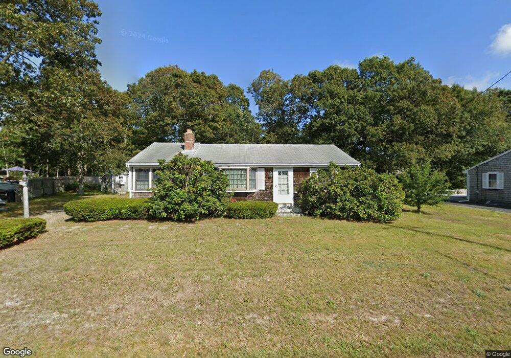
24 Dartmouth Rd West Dennis, MA 02670
West Dennis NeighborhoodEstimated Value: $579,000 - $686,000
3
Beds
1
Bath
1,001
Sq Ft
$633/Sq Ft
Est. Value
About This Home
This home is located at 24 Dartmouth Rd, West Dennis, MA 02670 and is currently estimated at $633,659, approximately $633 per square foot. 24 Dartmouth Rd is a home located in Barnstable County with nearby schools including Dennis-Yarmouth Regional High School and St. Pius X. School.
Ownership History
Date
Name
Owned For
Owner Type
Purchase Details
Closed on
Jan 27, 2003
Sold by
Zak Edward W and Zak Blanche B
Bought by
Zak Mary Ellen
Current Estimated Value
Purchase Details
Closed on
Aug 9, 1996
Sold by
Mary M Kearney Lt and Kearney Joseph M
Bought by
Zak Edward W and Zak Blanche B
Home Financials for this Owner
Home Financials are based on the most recent Mortgage that was taken out on this home.
Original Mortgage
$60,000
Interest Rate
8.24%
Mortgage Type
Purchase Money Mortgage
Create a Home Valuation Report for This Property
The Home Valuation Report is an in-depth analysis detailing your home's value as well as a comparison with similar homes in the area
Home Values in the Area
Average Home Value in this Area
Purchase History
| Date | Buyer | Sale Price | Title Company |
|---|---|---|---|
| Zak Mary Ellen | $100,000 | -- | |
| Zak Edward W | $95,000 | -- |
Source: Public Records
Mortgage History
| Date | Status | Borrower | Loan Amount |
|---|---|---|---|
| Previous Owner | Zak Edward W | $60,000 |
Source: Public Records
Tax History Compared to Growth
Tax History
| Year | Tax Paid | Tax Assessment Tax Assessment Total Assessment is a certain percentage of the fair market value that is determined by local assessors to be the total taxable value of land and additions on the property. | Land | Improvement |
|---|---|---|---|---|
| 2025 | $2,524 | $582,800 | $220,400 | $362,400 |
| 2024 | $2,357 | $536,800 | $211,900 | $324,900 |
| 2023 | $2,280 | $488,200 | $192,700 | $295,500 |
| 2022 | $2,068 | $369,200 | $150,400 | $218,800 |
| 2021 | $3,589 | $327,500 | $147,500 | $180,000 |
| 2020 | $1,950 | $319,700 | $158,800 | $160,900 |
| 2019 | $1,912 | $309,900 | $166,800 | $143,100 |
| 2018 | $3,255 | $276,700 | $148,200 | $128,500 |
| 2017 | $3,431 | $272,600 | $148,200 | $124,400 |
| 2016 | $1,689 | $258,600 | $153,500 | $105,100 |
| 2015 | $1,655 | $258,600 | $153,500 | $105,100 |
| 2014 | $1,642 | $258,600 | $153,500 | $105,100 |
Source: Public Records
Map
Nearby Homes
- 15 Woodside Park Rd
- 12 Spoonbill Rd
- 26 Center St
- 61 Trotters Ln
- 3 Pinefield Ln
- 80 Michaels Ave
- 71 Main St
- 95 Center St
- 19 Standish Way
- 4 Coffey Ln
- 125 Main St Unit 3
- 467 Main St
- 22 Wixon Rd
- 401 Main St Unit 201
- 401 Main St Unit 101
- 31 Easy St
- 72 Bassett Ln
- 268 Main St
- 37 Ocean Dr Unit 2
- 20 Aunt Debbys Rd
- 20 Dartmouth Rd
- 28 Dartmouth Rd
- 28 Teal Cir
- 27 Dartmouth Rd
- 63 Princeton Cir
- 32 Teal Cir
- 26 Teal Cir
- 14 Dartmouth Rd
- 34 Dartmouth Rd
- 8 Dartmouth Rd
- 21 Dartmouth Rd
- 59 Princeton Cir
- 28 Woodside Park
- 39 Dartmouth Rd
- 2 Dartmouth Rd
- 36 Teal Cir
- 24 Woodside Park
- 24 Woodside Park Rd
- 12 Dartmouth Rd
- 45 Tower Rd