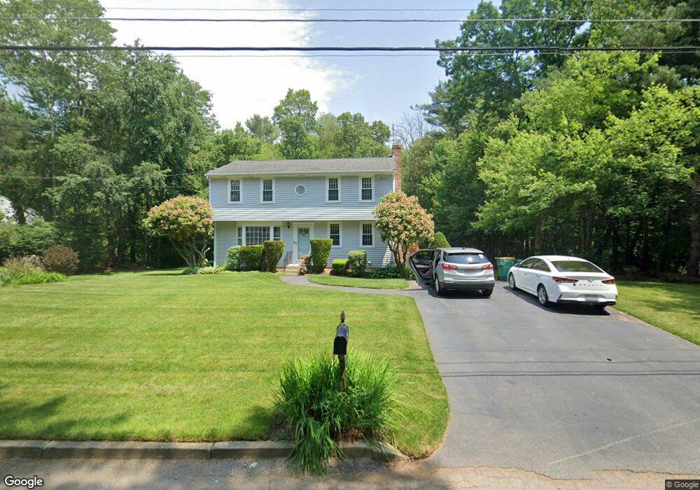
24 Deborah Lee Ln North Easton, MA 02356
Estimated Value: $683,000 - $737,000
4
Beds
2
Baths
1,700
Sq Ft
$419/Sq Ft
Est. Value
About This Home
This home is located at 24 Deborah Lee Ln, North Easton, MA 02356 and is currently estimated at $712,332, approximately $419 per square foot. 24 Deborah Lee Ln is a home located in Bristol County with nearby schools including Easton Middle School and Oliver Ames High School.
Ownership History
Date
Name
Owned For
Owner Type
Purchase Details
Closed on
Jul 26, 1983
Bought by
Crosby Bruce D and Crosby Peggy A
Current Estimated Value
Create a Home Valuation Report for This Property
The Home Valuation Report is an in-depth analysis detailing your home's value as well as a comparison with similar homes in the area
Home Values in the Area
Average Home Value in this Area
Purchase History
| Date | Buyer | Sale Price | Title Company |
|---|---|---|---|
| Crosby Bruce D | $85,500 | -- |
Source: Public Records
Mortgage History
| Date | Status | Borrower | Loan Amount |
|---|---|---|---|
| Open | Crosby Bruce D | $25,000 | |
| Open | Crosby Bruce D | $164,500 | |
| Closed | Crosby Bruce D | $66,000 | |
| Closed | Crosby Bruce D | $66,000 |
Source: Public Records
Tax History Compared to Growth
Tax History
| Year | Tax Paid | Tax Assessment Tax Assessment Total Assessment is a certain percentage of the fair market value that is determined by local assessors to be the total taxable value of land and additions on the property. | Land | Improvement |
|---|---|---|---|---|
| 2025 | $7,750 | $621,000 | $408,600 | $212,400 |
| 2024 | $7,134 | $534,400 | $322,900 | $211,500 |
| 2023 | $6,927 | $474,800 | $314,300 | $160,500 |
| 2022 | $6,598 | $428,700 | $274,100 | $154,600 |
| 2021 | $6,421 | $414,800 | $260,200 | $154,600 |
| 2020 | $6,235 | $405,400 | $255,300 | $150,100 |
| 2019 | $6,237 | $390,800 | $237,000 | $153,800 |
| 2018 | $6,178 | $381,100 | $237,000 | $144,100 |
| 2017 | $6,024 | $371,400 | $237,000 | $134,400 |
| 2016 | $5,796 | $358,000 | $237,000 | $121,000 |
| 2015 | $5,410 | $322,400 | $201,400 | $121,000 |
| 2014 | $5,341 | $320,800 | $201,400 | $119,400 |
Source: Public Records
Map
Nearby Homes
- 32 Heritage Dr
- 15 Randall Farm Dr
- 25 Andrews Farm Rd
- 114 Summer St
- 20 Quarry Ln
- 81 Rockland St
- 45 Randall St
- 79 Summer St
- 89 Massapoag Ave
- 73 Summer St
- 321 Bay Rd
- 9 Oak Ridge Dr
- 295 Lincoln St
- 47 Guinevere Rd
- 30 King Arthur Rd
- 22 Pammys Path
- 98 Massapoag Ave
- 29 Owl Ridge Rd
- 43 Matthew Cir
- 120 Sheridan St