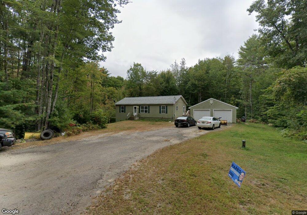
24 Della Mill Rd New Gloucester, ME 04260
Estimated Value: $432,603 - $909,000
3
Beds
3
Baths
1,248
Sq Ft
$453/Sq Ft
Est. Value
About This Home
This home is located at 24 Della Mill Rd, New Gloucester, ME 04260 and is currently estimated at $565,901, approximately $453 per square foot. 24 Della Mill Rd is a home with nearby schools including Gray-New Gloucester High School.
Ownership History
Date
Name
Owned For
Owner Type
Purchase Details
Closed on
Apr 17, 2015
Sold by
Wohltjen Amy C and Wohltjen Fryer R
Bought by
Ljm Properties Llc
Current Estimated Value
Home Financials for this Owner
Home Financials are based on the most recent Mortgage that was taken out on this home.
Original Mortgage
$165,299
Outstanding Balance
$126,419
Interest Rate
3.72%
Mortgage Type
New Conventional
Estimated Equity
$439,482
Purchase Details
Closed on
Nov 5, 2008
Sold by
Fryer Robert B Sr Est
Bought by
Fryer Ann A
Create a Home Valuation Report for This Property
The Home Valuation Report is an in-depth analysis detailing your home's value as well as a comparison with similar homes in the area
Home Values in the Area
Average Home Value in this Area
Purchase History
| Date | Buyer | Sale Price | Title Company |
|---|---|---|---|
| Ljm Properties Llc | -- | -- | |
| Fryer Ann A | -- | -- |
Source: Public Records
Mortgage History
| Date | Status | Borrower | Loan Amount |
|---|---|---|---|
| Open | Ljm Properties Llc | $165,299 |
Source: Public Records
Tax History
| Year | Tax Paid | Tax Assessment Tax Assessment Total Assessment is a certain percentage of the fair market value that is determined by local assessors to be the total taxable value of land and additions on the property. | Land | Improvement |
|---|---|---|---|---|
| 2025 | $3,533 | $228,388 | $67,000 | $161,388 |
| 2024 | $3,401 | $228,388 | $67,000 | $161,388 |
| 2023 | $3,264 | $228,388 | $67,000 | $161,388 |
| 2022 | $3,152 | $228,388 | $67,000 | $161,388 |
| 2021 | $3,152 | $228,388 | $67,000 | $161,388 |
| 2020 | $3,117 | $228,388 | $67,000 | $161,388 |
| 2019 | $3,473 | $205,500 | $61,400 | $144,100 |
| 2018 | $3,247 | $205,500 | $61,400 | $144,100 |
| 2017 | $3,206 | $205,500 | $61,400 | $144,100 |
| 2016 | $3,021 | $205,500 | $61,400 | $144,100 |
| 2015 | $3,011 | $205,500 | $61,400 | $144,100 |
| 2014 | $812 | $56,000 | $56,000 | $0 |
| 2013 | $753 | $56,000 | $56,000 | $0 |
Source: Public Records
Map
Nearby Homes
- 71A Black Point Rd
- 14 Golden Way
- TBD Emmaus Rd
- 0 Ginger Way Unit 1656391
- 0 Ginger Way Unit 1656392
- 163 Valley Rd
- 80 Spiller Hill Rd
- 46-47D Hines Rd & Main St
- Lot 47C Hines Rd
- 65 Blueberry Ln
- 0 Gladstone Dr Unit 1642697
- 0 Mountain Rd
- 4 Chelsey Ln
- 53 Westview Dr
- 192 Mountain Rd
- 86 Skips Way
- 21 Bald Hill Rd
- M20/21/311 Shaw Brook Ln
- Lot 21-29 Weymouth Rd
- 155 & 151 Gloucester Hill Rd
- 50 Macdonald Dr
- 26 Della Mill Rd
- 8 Della Mill Rd
- 8 Della Mill Rd
- 10 Della Mill Rd
- 38 Della Mill Rd
- 21 Della Mill Rd
- LOT 36/4 Della Mill Rd
- 11 Della Mill Rd
- lot 36-4 Della Mill Rd
- Lot #1 Della Mill Rd
- 569 Shaker Rd
- 542 Maine St
- 553 Maine St
- 561 Maine St
- 575 Shaker Rd
- 534 Maine St
- 585 Shaker Rd
- 600 Shaker Rd
- 604 Shaker Rd
Your Personal Tour Guide
Ask me questions while you tour the home.