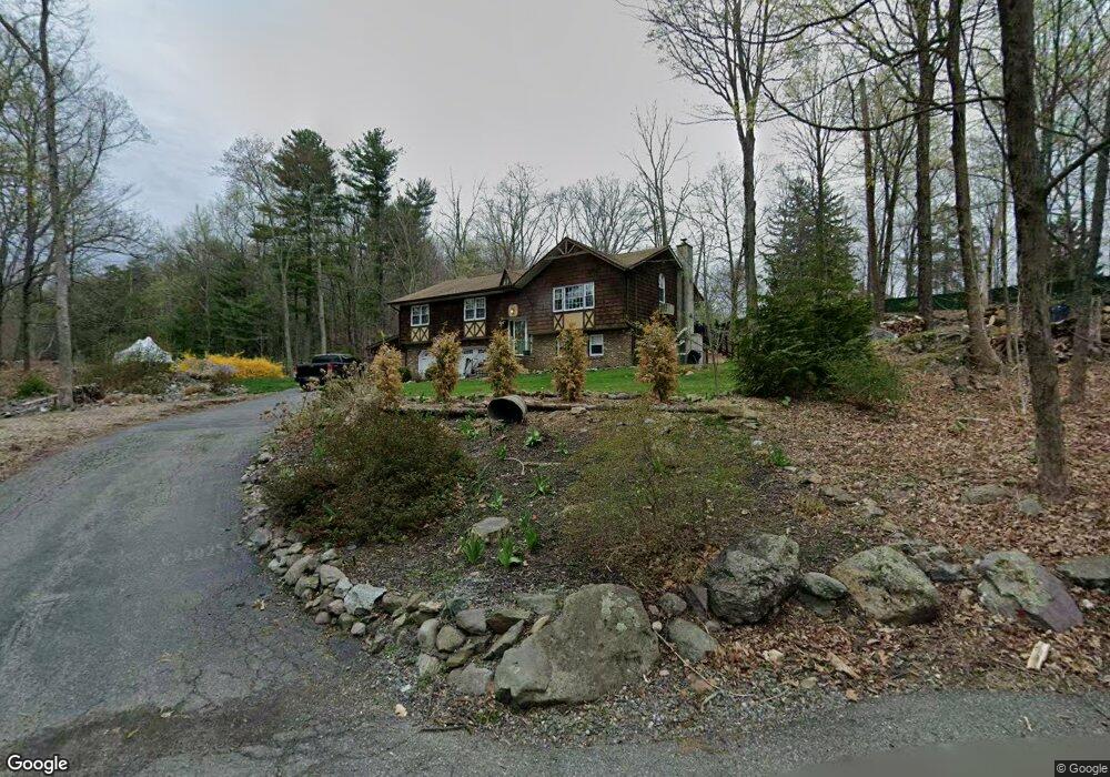
24 Dockerty Hollow Rd West Milford, NJ 07480
Estimated Value: $584,000 - $639,049
--
Bed
--
Bath
2,336
Sq Ft
$260/Sq Ft
Est. Value
About This Home
This home is located at 24 Dockerty Hollow Rd, West Milford, NJ 07480 and is currently estimated at $606,762, approximately $259 per square foot. 24 Dockerty Hollow Rd is a home located in Passaic County with nearby schools including Macopin Middle School and West Milford High School.
Ownership History
Date
Name
Owned For
Owner Type
Purchase Details
Closed on
Mar 27, 2015
Sold by
Nespolini Robyn and Kildune Robyn A
Bought by
Taylor Marisa and Mcdonald Scott
Current Estimated Value
Home Financials for this Owner
Home Financials are based on the most recent Mortgage that was taken out on this home.
Original Mortgage
$247,000
Outstanding Balance
$190,283
Interest Rate
3.76%
Mortgage Type
New Conventional
Estimated Equity
$416,479
Purchase Details
Closed on
Dec 5, 2000
Sold by
Timothy John
Bought by
Kildune Joe and Kildune Robyn
Home Financials for this Owner
Home Financials are based on the most recent Mortgage that was taken out on this home.
Original Mortgage
$210,762
Interest Rate
7.52%
Mortgage Type
FHA
Create a Home Valuation Report for This Property
The Home Valuation Report is an in-depth analysis detailing your home's value as well as a comparison with similar homes in the area
Home Values in the Area
Average Home Value in this Area
Purchase History
| Date | Buyer | Sale Price | Title Company |
|---|---|---|---|
| Taylor Marisa | $262,000 | Multiple | |
| Kildune Joe | $242,500 | -- |
Source: Public Records
Mortgage History
| Date | Status | Borrower | Loan Amount |
|---|---|---|---|
| Open | Taylor Marisa | $247,000 | |
| Previous Owner | Kildune Joe | $210,762 |
Source: Public Records
Tax History Compared to Growth
Tax History
| Year | Tax Paid | Tax Assessment Tax Assessment Total Assessment is a certain percentage of the fair market value that is determined by local assessors to be the total taxable value of land and additions on the property. | Land | Improvement |
|---|---|---|---|---|
| 2025 | $11,047 | $272,500 | $102,900 | $169,600 |
| 2024 | $11,104 | $272,500 | $102,900 | $169,600 |
| 2022 | $10,540 | $272,500 | $102,900 | $169,600 |
| 2021 | $10,314 | $272,500 | $102,900 | $169,600 |
| 2020 | $10,205 | $272,500 | $102,900 | $169,600 |
| 2019 | $10,069 | $272,500 | $102,900 | $169,600 |
| 2018 | $10,044 | $272,500 | $102,900 | $169,600 |
| 2017 | $10,091 | $272,500 | $102,900 | $169,600 |
| 2016 | $10,107 | $272,500 | $102,900 | $169,600 |
| 2015 | $10,320 | $281,500 | $102,900 | $178,600 |
| 2014 | $10,069 | $281,500 | $102,900 | $178,600 |
Source: Public Records
Map
Nearby Homes
- 0 Rock Ledge Rd Unit 25030488
- 0 Rock Ledge Rd Unit 3983243
- 11 Eagles Nest Terrace
- 2 Iron Hill
- 33 Eagles Nest Terrace
- 24 Eagles Nest Terrace
- 45 Heritage Dr
- 1731 MacOpin Rd
- 95 Morris Ave
- 60 Eagles Nest Terrace
- 68 Heritage Dr
- 91 Heritage Dr
- 82 Heritage Dr
- 17 Camelot Dr
- 1772 MacOpin Rd
- 9 Somerset Place
- 43 Bisset Dr
- 54 Nosenzo Pond Rd
- 7 New Bedford Rd Unit H
- 16 Quincy Ln
- 1565 MacOpin Rd
- 1577 MacOpin Rd
- 32 Dockerty Hollow Rd
- 1561 MacOpin Rd
- 1571 MacOpin Rd
- 1585 MacOpin Rd
- 1578 MacOpin Rd
- 1 Arundel Rd
- 1584 MacOpin Rd
- 1588 MacOpin Rd
- 2 Arundel Rd
- 1591 MacOpin Rd
- 1555 MacOpin Rd
- 8 Tom Ln
- 6 Macgregor Rd
- 5 Bradrick Ln
- 9 Bradrick Ln
- 6 Arundel Rd
- 1596 MacOpin Rd
- 1547 MacOpin Rd