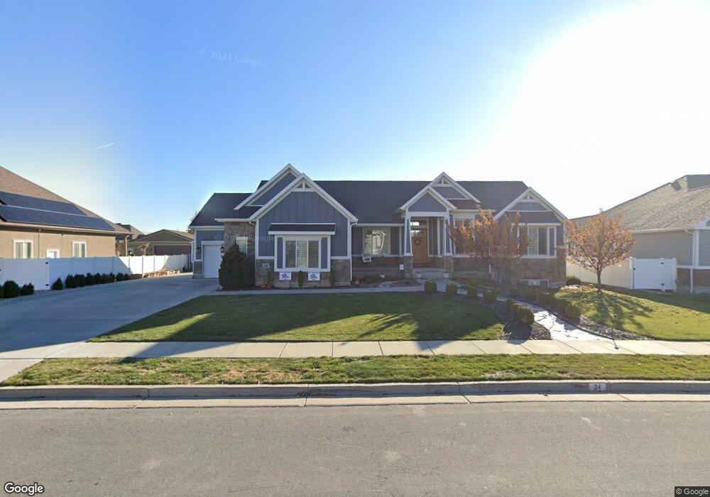
24 E 1900 S Kaysville, UT 84037
West Kaysville NeighborhoodEstimated Value: $1,052,000 - $1,478,676
--
Bed
5
Baths
2,383
Sq Ft
$547/Sq Ft
Est. Value
About This Home
This home is located at 24 E 1900 S, Kaysville, UT 84037 and is currently estimated at $1,302,419, approximately $546 per square foot. 24 E 1900 S is a home with nearby schools including Endeavour Elementary School, Farmington High, and Centennial Junior High School.
Ownership History
Date
Name
Owned For
Owner Type
Purchase Details
Closed on
May 2, 2024
Sold by
Warby David and Warby Karene
Bought by
David And Karene Warby Family Trust and Warby
Current Estimated Value
Purchase Details
Closed on
Aug 7, 2013
Sold by
Warby David H and Warby Karene
Bought by
Warby David and Warby Karene
Home Financials for this Owner
Home Financials are based on the most recent Mortgage that was taken out on this home.
Original Mortgage
$335,000
Interest Rate
3.5%
Mortgage Type
New Conventional
Purchase Details
Closed on
Feb 13, 2013
Sold by
Terraventrue Development Ltd
Bought by
Warby David H and Warby Karene
Home Financials for this Owner
Home Financials are based on the most recent Mortgage that was taken out on this home.
Original Mortgage
$350,000
Interest Rate
3.29%
Mortgage Type
Construction
Create a Home Valuation Report for This Property
The Home Valuation Report is an in-depth analysis detailing your home's value as well as a comparison with similar homes in the area
Home Values in the Area
Average Home Value in this Area
Purchase History
| Date | Buyer | Sale Price | Title Company |
|---|---|---|---|
| David And Karene Warby Family Trust | -- | None Listed On Document | |
| Warby David | -- | Dep Ecash Recd For Mountain | |
| Warby David H | -- | Backman Title Services Ltd |
Source: Public Records
Mortgage History
| Date | Status | Borrower | Loan Amount |
|---|---|---|---|
| Previous Owner | Warby David | $335,000 | |
| Previous Owner | Warby David H | $350,000 |
Source: Public Records
Tax History
| Year | Tax Paid | Tax Assessment Tax Assessment Total Assessment is a certain percentage of the fair market value that is determined by local assessors to be the total taxable value of land and additions on the property. | Land | Improvement |
|---|---|---|---|---|
| 2025 | $7,098 | $715,550 | $219,464 | $496,086 |
| 2024 | $6,848 | $700,700 | $207,456 | $493,244 |
| 2023 | $6,223 | $1,127,000 | $366,923 | $760,077 |
| 2022 | $5,827 | $596,750 | $200,243 | $396,507 |
| 2021 | $5,264 | $807,000 | $239,482 | $567,518 |
| 2020 | $4,948 | $737,000 | $204,947 | $532,053 |
| 2019 | $4,813 | $704,000 | $204,260 | $499,740 |
| 2018 | $5,009 | $729,000 | $173,117 | $555,883 |
| 2016 | $4,499 | $342,925 | $88,255 | $254,670 |
| 2015 | $4,672 | $338,140 | $88,255 | $249,885 |
| 2014 | $4,479 | $329,912 | $88,255 | $241,657 |
| 2013 | -- | $104,047 | $104,047 | $0 |
Source: Public Records
Map
Nearby Homes
- 2195 S Betsy's Way
- 1104 N 1880 Loop W
- 163 E 1400 S
- 1647 W 1410 N
- 629 Mare Dr
- 1316 S 150 E
- 1317 S 150 E
- 1308 S 150 E
- 461 W Summit Ln
- 2172 Rifleman Dr
- 479 W Summit Ln
- 1181 Set Ct Unit 2
- 771 Mare Cir
- 1883 Moss Ln Unit 236
- 75 E Monticello Dr
- 1303 Appaloosa Ave
- 1572 Stayner Dr
- 1467 Brown Ln
- 1843 W Burke Ln Unit 103
- 1406 Swinton Ln
- 3 W 1900 S
- 38 E 1900 S
- 21 E 1900 S Unit 803
- 15 W 1900 S
- 52 E 1900 S
- 5 E 1950 S
- 6 W 1900 S Unit 802
- 6 W 1900 S
- 27 E 1950 S Unit 113
- 49 E 1950 S
- 14 W 1950 S
- 1870 Kerrybrook Dr
- 1838 Kerrybrook Dr
- 18 W 1900 S
- 1902 Kerrybrook Dr
- 1838 Kerrybrook Dr Unit 704
- 71 E 1950 S
- 1820 Kerrybrook Dr
- 12 E 1950 S
- 1916 Kerrybrook Dr
Your Personal Tour Guide
Ask me questions while you tour the home.